Payne, A New and Complete System of Universal Geography; Describing Asia, Africa
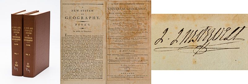
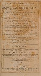
A New and Complete System of Universal Geography [Complete with all 20 maps / illustrations] ; Describing Asia, Africa, Europe and America; with their Subdivisions of Republics, States, Empires and Kingdoms : The Extent, Boundaries and Remarkable Appearances of each Country; Cities, Towns and Curiosities of Nature and Art. Also giving a general account of The Fossil and Vegetable Productions [with hand-coloured plates] of the Earth. The History of Man, In all Climates, Regions and Conditions; Customs, Manners, Laws, Governments and Religions: The State of Arts, Sciences, Commerce, Manufactures and Knowledge. Sketches of the Ancient and Modern History of each Nation and People to the present time. To which is added, A View of Astronomy, As connected with Geography; Of the Planetary System to which the Earth belongs; And of the Universe in General. With a copious Index annexed to each Volume. Being a Large and Comprehensive Abridgement of Universal Geography. By John Payne. With additions, corrections and Improvements from the latest and best authors by James Hardie – Author of “The Principles of Latin Grammar”, “The American Remembrancer” and “Universal Tablet of Memory” &c. In Four Volumes.
First Abridged Edition. Volumes I [Asia] and II [Africa] (of IV). New York, Printed for and Sold by John Low, Book-Seller at The Shakespeare – Head, No.332 Water-Street, 1798 – 1799. Octavo – Edition. Pagination: Volume I [Asia]: Folded Frontispiece (Map of the World), XLVIII, 518 pages plus 10 unnumbered pages of an Index and one additional page with Directions for the Bookbinder for placing the maps and illustrations as well as Errata. Volume I includes all 10 Maps / Engravings as called for / Volume II [Africa]: Folded Frontispiece (Map of Africa), 578 pages plus 12 unnumbered pages of an Index plus one additional page with Directions for the Bookbinder for placing the maps and illustrations as well as Errata. Volume II includes all 10 Maps / Engravings as called for. Hardcover / Modern Library – Binding with the original 18th century – work bound in. Former library copy of Bergen County Historical Society (cancelled) and Johnson Free Public Library in Hackensack, New Jersey, with a very boring, modern library binding and library cards applied to the endpapers only, leaving the bookblock with text and maps and illustrations entirely untouched from any library-signs. Very good condition with some signs of external wear.
The Illustrations in this work are profound and include important maps, handcoloured-engravings of botanical illustrations.
Volume I includes the following 10 maps and illustrations (as called for):
1. Fold-out Map of the World (Frontispiece): “The World from the best Authorities” – Engraved for Payne’s Geography and published by Low & Willis, New York.
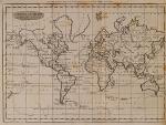
2. “General Chart on Mercator’s Projection” – Engraved for Payne’s Geography and published by Low & Willis, New York.
3. “Artificial Sphere and a diagram of “The Copernican System” showing also two Comets (including the Comet of 1661), Saturn and his Moon, Jupiter and his Moon, Mars, Earth and its Moon.
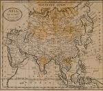
4. Fold-out map “Asia from the latest Authorities” Engraved for Payne’s Geography and published by Low & Willis, New York.
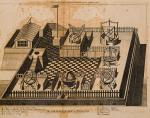
5. Fold-out Engraving of “The Observatory at Peking” showing in detail the setup of the Observatory with 18th century Astronomical Equipment: “Equinoctial Sphere”, Celestial Globe, Zodical Sphere, Azimuthal Horizon, Quadrant, Sextant etc.
6. Engraving with “Ornaments worn on the Dress of the Chinese” [ornament, Signets, Allegorical Illustrations, Characters, Animals, Dragons etc. as examples of ornaments on Dresses and possibly war-garments in China and Asia in general [the engraving shows for example: Vases used in the Hall of Ancestors, White Rice, Sign for “The Stars”, The “Character Fo”, Battle Axe, A Pheasant, Aquatic Herb, Signs for Fire, Dragons, Animal Creatures standing for “The Sun” and “The Moon”]
7. Engraving showing “Warlike Instruments” [Shields, Helmets, Quiver with Arrows, Chinese Bow]
8. Illustration No. 8: Large, Hand-coloured fold-out-illustration of 18th-century Plants which were part of the international Trade of 18th-century “Vegetable Production constitution important Articles of Commerce or suited for such”.
Plants include:
a. The Olive Tree
b. Rice in Ear
c. The Sugar Cane
d. The Indigo Plant
e. The New Zealand Flax Plant
f. Ginseng in Flower
g. Bread Fruit Tree
h. Black Pepper Vine
i. Root of the Ginseng
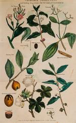
9. Illustration No.9: Large, Hand-coloured fold-out-illustration of 18th-century Plants which were part of the international Trade of 18th-century “Vegetable Production constitution important Articles of Commerce or suited for such”.
This plate includes hand-coloured specimen of:
a. The Tobacco Plant
b. Coffee Tree
c. Cinnamon
d. Coffee Pistil
e. Sramen of Coffee
f. Coffee Berry burnt [Pre-stage of Coffee-roasting]
g. Nutmeg Tree
h. Bark of the Cinnamon
i. Bohea Tree Plant
j. The Cotton Shrub
k. The Nutmeg enclosed in the Mace
l. Nutmeg Kernel
m. Flower of tea
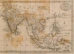
10. Fold-out Map of the “East Indies from the Best Authorities” [showing the Philippines, Borneo, Moguls Empire, Gulf of Tonquin, Ceylon etc.] – Engraved for Payne’s Geography and published by Low & Willis, New York
Volume II includes the following 10 maps and illustrations (as called for):
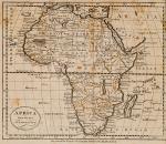
1. Fold-out Map of “Africa from the Best Authorities” – Engraved for Payne’s Geography and published by Low & Willis, New York
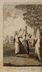
2. Engraving of “Dancing Girls in Eqypt″
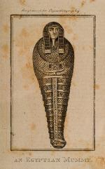
3. Engraving of “An Eqyptian Mummy″
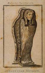
4. Engraving of “An[other] Equptian Mummy″
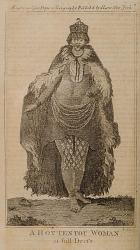
5. Engraving of “A Hottentot Woman in full Dress″
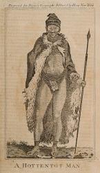
6. Engraving of “A Hottentot Man″
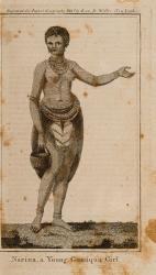
7. Engraving of “Narina, a Young Conaqua Girl″
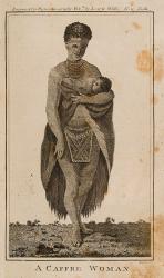
8. Engraving of “A Caffre Woman″
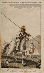
9. Engraving of “An Arab on Horseback″
10. Larger fold-out Map: “A Correct map of the Mediterranean Sea with the Countries Adjacent” [showing the “Barbary” (today’s Algeria and Morocco), “Land of Dates”, Tripoli (today’s Libya), Eqypt, Holy Land, Syria, Cyprus, Sicily, Greece, Spain, Sardinia] – Engraved for Payne’s Geography and published by Low & Willis, New York.
- Keywords: Africa – Rare · African History · African Travel · Asia – Rare · Asian History – Rare · Books with vintage Maps · Botany · Botany – Rare · Illustrated Books Natural History · Natural History – Rare · Travel · Travel & Expedition – Rare · Travel Africa – Rare · Travel Asia – Rare · Travel China – Rare · Travel Egypt – Rare
- Language: English
- Inventory Number: 31409AB
EUR 680,--
© 2026 Inanna Rare Books Ltd. | Powered by HESCOM-Software


