

![Richard Ligon, A True and Exact History of the Island of Barbadoes [sic].](/images/thumbnails/31260AB.jpg)
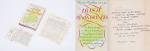
A True and Exact History of the Island of Barbadoes [sic] / [Barbados]. Illustrated with a Map of the Island [missing], as also the Principal Trees and Plants there, set forth in their due Proportions and Shapes, drawn out by their several and respective Scales. Together with the Ingenio that makes the Sugar, with the Plots of the several Houses, Rooms, and other places, that are used in the whole process of Sugar-making; viz. the Grinding-house, Still-house, and Furnaces; All cut in Copper.
[Second Edition]. London, Printed, and are to be sold by Peter Parker, at his Shop at the Leg and Star over against the Royal Exchange, and Thomas Guy at the corner Shop of Little Lumbard-street and Cornhill, 1673. Small-Folio (19 cm x 29 cm). [II], 122 pages plus an unnumbered Index-page (bound, according to instructions for the bookbinder after page 84), lacking the Fold-out-Map of Barbados but including all six illustrations of Plants, as well as the three diagrams of Houses and Production-Rooms for Sugar. 19th-century Hardcover (half-leather with gilt lettering on spine). Condition of Binding: Very good condition with only minor signs of wear to the binding / Condition of bookblock: Original, front free endpaper was preserved and bound in. Rear endpaper missing. The original endpaper includes two historical ownership-signatures in ink (c.17th or early 18th century) as well as several annotations in ink and pencil. The previous owners seem to have been one Richard Gardner and there is an additional notation verso which reads: “E[x] Libris Richmondi Garnays [or Garneys]”. Some ink-annotations or corrections throughout the book. Signs of old bookworm – damage and very few abrasions due to fire-sparks (few pages effected only). Some plates with professional repairs, some tears. Some professional paper-repairs and re-enforcements to title-page and Content-Page. All the described flaws sound worse than they really appear. All plant-plates in strong impresion. A scarce publication ! From the library of Rev. William Andrew Lamb, Kilcoleman Park, County Cork.
EUR 2.800,--
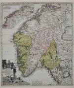

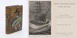
![Jean-Denis Barbié du Bocage - Tableau de la Grande-Bretagne, De L'Irlande et des Possessions Angloises dans les quatre parties du Monde. [Large Paper Copy / Better Paper Copy / Exemplaire de Luxe]](/images/thumbnails/28935AB.jpg)
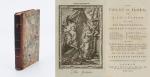
![[Trevor, Edward / Kilmainhaim Gaol (Jail)] / [Anonymous (attributed to Sanders, Robert) - THE ROMAN HISTORY IN A SERIES OF LETTERS FROM A NOBLEMAN TO HIS SON](/images/thumbnails/31237AB.jpg)