6. Hodges, Rev. Richard J. / Pike, W.T.
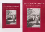
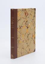
Cork and County Cork in the Twentieth Century / Contemporary Biographies. / [History of Big Houses, Town Houses and Country Estates in Cork, County Cork, North Cork, East Cork & West Cork with original Photographs of Houses and Portraits as well as Biographies of the Men and their Families who lived in these Houses] / [Half-Leather-Version – Limited Edition Reprint]. Edited by W. T. Pike.
Limited Edition Reprint of the First and only Edition by Pike in 1911. [Skibbereen (County Cork)], Inanna Rare Books / Inanna Reprint Series, 2022. 4° (24,5 cm wide x 33,5 cm high). 319 pages with hundreds of photographs and including an Index to Biographies and Illustrations. Hardcover / Half-Leather with marbled-paper-covered boards in protective Collector’s Mylar. [Important Information: This special limited edition has a special feature which makes each volume of this reprint unique: Each version of the book is bound by hand by a craft-bookbindery and the colour of the leather and endpapers, as well as the marbled-paper-covered boards, are always different / This means the interior is always the same while the look of the binding can differ from the image attached to this description]. One of 350 copies of the Half-Leather-version of a limited edition, republished by Inanna Rare Books Ltd. / This high-quality reprint, hand-bound and hand-numbered, includes hundreds of photographs of grand houses in the irish countryside from South Cork to North Cork, from East Cork to West Cork. The stories of the houses are not only accompanied by photographs of now mostly vanished or derelict homes, the images also show the original state of homes which are now restructured etc. The second part of the publication offers an abundance of historical biographies of local irish Nobility (Meade family, O’Callaghan, Browne, Kelly etc.), Gentry and Clergy and general owners of Country Houses etc. [Pike’s New Century Series].


![[Anonymous]. Guide to Killarney and Glengariff. With a Map and Six Plates.](/images/thumbnails/29433AB.jpg)
![[Eason & Son Ltd.]. Souvenir of Cork & Killarney](/images/thumbnails/28568AB.jpg)
![[Eason & Son Ltd.]. Souvenir of Cork & Killarney](/images/thumbnails/28458AB.jpg)


![[Ireland] The Romantic Scenery of England, Ireland and Scotland.](/images/thumbnails/28636AB.jpg)


