Schenk, Belgii pars Septentrionalis Communi Nomine Vulgo Hollandia Nuncupata con
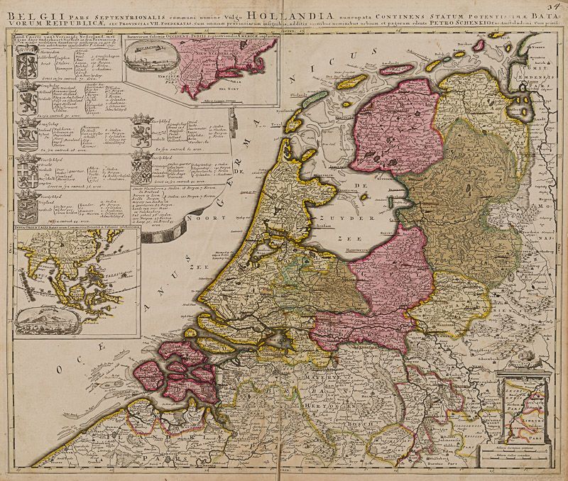
Belgii pars Septentrionalis Communi Nomine Vulgo Hollandia Nuncupata Continens Statum Potentissimae Batavorum Reipublicae seu Provincias VII Foederatas [With an inset box titled ‘Batavorum Coloniae Occident: Indiis Septetrionalis Americae Implantatae’ and shows the Dutch colony of ‘New Neederland’ located on the east coast of America. Virginia Pars, Pennsylvania, Philadelphia, New Jork (New York), New Amsterdam (New York City) , New Jarsey (New Jersey), Manhattan and Nova Angia (New England) are all shown. The inset also includes a vignette scene of the (Hudson) harbour at New Amsterdam (New York City).]
Original hand-coloured engraving. Amsterdam, Schenk, [c.1700]. Plate Size: 58 cm x 46.5 cm. Sheet Size: 60.2 cm x 51.7 cm. Original map. In good- condition. Browning evident as is a tear near lower centre fold. Some inked underlining to place names. Minor inked numeration in margin at top right corner. Slight crease on verso sheet. Discreet duplicate stamp from library in Poland on reverse.
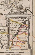
A highly detailed and very interesting map of Holland and its former and current foreign holdings included in inset boxes. The individual provinces Dutch Republic are clearly demarcated. Rivers and hills and forests and marshes are shown pictorially – as are the shallow approaches and sandbanks along the coast. Towns and cities such as Amsterdam, are also included, and many depicted pictorially also. An inset box in the lower right corner shows the most southernly province, Limburg. In the lower left is Flanders while the regions comprising modern-day Luxemburg and Germany fill out the map. A stunning map of the Netherlands at the turn of the century, the little country having enjoyed a ‘Golden Age’ n which Dutch financial and commercial acumen, trade, science, military, maritime-skills and art were among the most acclaimed in the world.
Off-shore in the Oceanus Germanicus is a large decorative cartouche showing armorial coat-of-arms of the seven provinces of United Provinces of the Netherlands with tables listing the administrative structure of each province. Also included are two inset boxes containing maps of the foreign possessions of the far-flung Dutch Empire. The upper inset box titled ‘Batavorum Coloniae Occident: Indiis Septetrionalis Americae Implantatae’ and shows the Dutch colony of ‘New Neederland’ located on the east coast of America. Virginia Pars, Pennsylvania, Philadelphia, New Jork (New York), New Amsterdam (New York City) , New Jarsey (New Jersey), Manhattan and Nova Angia (New England) are all shown. The inset also includes a vignette scene of the (Hudson) harbour at New Amsterdam (New York City).
The lower inset map is titled ‘India Orientalis Batavorum Commerciis Potentia & Coloniis Celeberrima’ and shows China and South-East Asia, including India and Ceylon, Indonesian islands such as Borneo, Java Summatra, ‘Terra des Pappous (Papua New Guinea) and the Philippines. Japan, Formosa and New Hollandia (Australia) can also be seen. The inset also carries a panoramic vignette of the ship-filled port at Batavia (Jakarta).
Petrus/Pieter/Peter Schenck, or Pieter, or Peter Schenk the elder (1660 – 1711) was a German engraver and cartographer active in Amsterdam and Leipzig.
- Keywords: 18th Century · 18th Century Map · America · Amsterdam · Cartography · Catalogue No.19 – American History and Politics · Catalogue No.5 – Maps of the World · Dutch · Dutch Colonialism/Imperialism · Dutch East Indian Company · Europe · Holland · Map · New York · Original Engraving · Original Map · Original Maps · Rare Map – Holland · Rare Map – The Netherlands · Rare Map Europe · South-East Asia · Vintage Map
- Inventory Number: 200032AG
EUR 475,--
© 2026 Inanna Rare Books Ltd. | Powered by HESCOM-Software


