[Naylor, The Geology of the West Mackenzie Coastal Area / The Mackenzie Delta, A
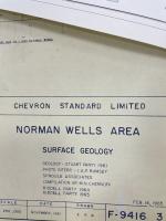
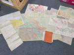
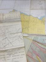
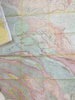
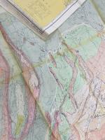
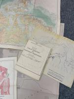
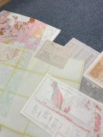
The Geology of the West Mackenzie Coastal Area / The Mackenzie Delta, Arctic Canada Canada / Collection of Manuscript and Typescript Material as well as original proofs and notes for the publication by Naylor and Tebbutt, with handwritten annotations and a large collection of important geological Maps of Canada’s Geology, among which is also the stunning, enormous, hand-coloured Surface Geology-Map of the Norman Wells Area in the Mackenzie River Delta which measures 152 cm (width) x 106 cm (height) and which was published in 1965.
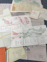
Vintage Maps in Colour-Print, Lithographs, Black-and-white etc. Including a large hand-coloured Map of the Norman Wells Area, accompanying the publication by Naylor and Tebbutt on the Expedition into the West Mackenzie Coastal Area. (Canada), (c.1968). Maps ranging from sizes A4 to Folio to 152 cm x 106 cm. Excellent condition with minor signs of wear. Very rare and special collection of a landmark – excursion into the Mackenzie Delta and Arctic Canada under the leadership of David (Dave) Naylor as Party Chief of the Field Crew, accompanied by Senior Geologists G.E.Tebbutt, D.J.McIntyre, D.Mason as well as Junior Geologists R.Procter, L.S.Eliuk, K.Dahlman, C.M.James, D.R.Ojakangas. The party planned to stay at Camp Sites in Inuvik but moved it to Shingle Point and from there to Norman Wells.
This outstanding collection of original geological surveying material includes the following typescript, manuscript, typed and annotated materials reporting on the Expedition into the Mackenzie Delta of Arctic Canada, led by Geologist David (Dave) Naylor:
Regarding the Exploration – Expedition into the Mackenzie – Delta of Canada
This collection includes a Paper of two pages plus three maps, stapled together and titled:
″Talk prepared for presentation at C.R.C.Exploration Representative’s Meeting, La Habra, California – February 13th to 17th, 1967″
The collection regarding this Expedition include:
1. Original Map of the Norman Wells Area (hand-coloured)
2. Original Typescript of the 1968 Field Report – Project 11-54-098 – Volume 2 – Part 2 “The Geology of the West Mackenzie Coastal Area by D[avid] Naylor and G.E.Tebbutt – September 1968”
3. Sections focusing on the different aspects of the Expedition into the Mackenzie River Delta:
a. “Northern Alaska” (6 pages)
b. 1968 Field Party – Project 11-54-098
General: Gravity Programme – Mackenzie Delta / Naylor Reconnaisance – East Mackenzie operating from Inuvi / Field Party – Shingle Point Coastal Area / Field Party Florence Lake (Mackenzie Mountains) (14 pages)
c. Fish River Composite Section – Section JR-68 (4 pages plus Draft Versions of this text)
d. Age of the explored area from Upper Jurassic to Recent (1 page)
e. Petroleum Prospects in the West Mackenzie Coastal Area – Manuscript Notes by Dave Naylor (2 pages)
f. Structure [of the West Mackenzie Coastal Area] – Manuscript Notes by Dave Naylor (1 page)
g. References – Manuscript Notes by Dave Naylor (1 page)
h. Ladas Creek – Section KH-68 – (5 pages of a Draft Essay on Ladas Creek and the Northwest Region of Hidden Lake)
4. Structure Test Hole Survey for Texaco – Nicholson PrN45
The Canadian Map-Collection which comes with this Expedition-Materials are:
Sheet: “How to Read a Western Canadian Map″
1. Port Brabant Map N.W.68/136 (District of Mackenzie)
2. Arctic Red River N.W. 66/136 (Yukon Territory)
3. Manuscript Map of “Zero Edges of Stratigraphic Units at the Pre-Jurassic Surface of Unconformity around the Vittrekwa River
and the North Vittrekwa River” (Yukon / Northwest Territories in Canada)
4. Manuscript Diagram of “Cross-Section Linking 3 Shell Peel River Wells” highlighting Drill Stem Tests
5. Transportation Facilities Map for Northwestern Canada – produced by the Canadian Mines and Technical Surveys and Mapping Branch (1958) [listing Distances in Miles by Air between main centres along principal flying routes]
The Map details the area northwest of Edmonton with Yukon and Northwest Territories but even Victoria Island (Arctic)
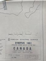
6. XXL Map: Northern Sheet – Map of the Yukon and Northwest Territories and Beaufort Sea showing the Foreign Scouting Services (Synopsis 1981 (Including Activity at the end of 1981). Printed in July 1982 with Well Symbols / Field Symbols etc.
The Map gives great detail of the Rightholders active in this region / prospecting of each company at each location including share-allocation of each company engaged in each drill (for example HUNT Group / Petro Canada / Dome Petroleum / CANPAR / etc.
7. Plat of Map for Foreign Scouting Service in the Yukon (Northern Sheet of the NWT) (Canada / 1982)
8. Plat of Map for Foreign Scouting Service in the Eastern Offshore Area of the Yukon (Canada / 1982)
9. XXL Map: Baffin Bay – Davis Strait – Map of the Foreign Scouting Services (Synopsis 1981). Printed in July 1982 with Well Symbols / Field Symbols etc.
The Map gives great detail with a List of the Rightholders active in this region (for example: Aquitaine Co Canada / BP Exploration Canada / Buttes Resources / Bluewater Oil / Lassiter Kuma Oils Ltd. / Magnorth Petroleum / Panarctic Oils / Shell Canada / Texaco Exploration
10. XXL-Map / Geological Map of the Region North and Northwest of Great Slave Lake, including McLeod Bay and Christie Bay in detail and the Region around Yellowknife marked with fault-lines
11. Bathy-Orography-Map of Northern Canada with great detail of Queen Elizabeth Island – Published by the Canadian Department of Mines and Technical Survey’s
12. Contour-Map of Bathymetry, Mackenzie Delta Region (Canada) – showing the Submarine Contours based on soundings from U.S.Navy & Canadian Reconnaisance Surveys in the years 1956 to 1964 / with conversion table for Fathoms, Feet and Metres
13. XXL-Map / Geological Survey-Map of Canada – Map 30-1963 – “Geology of the Yukon Territory and Northwest Territories″
Published in 1963
14. Herschel Island – Large Geological Map published by Canadian Department of Mines and Technical Surveys (1962) – shwoing Contours, Gravel, Sand or Mud sediments, Glaciers, Marsh, Trading Posts, etc.
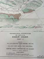
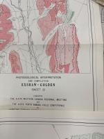
15. Exshaw – Golden [Geological Map-Sheets I and II (2 Maps)] prepared for the A.A.P.G. Western CANADA Regional Meeting and the A.S.P.G. Tenth Annual Field Conference by the Hunting Survey Corporation Ltd. in Calgary (Geology by C.Wright-Broughton) – (Year 1960) – The Maps show Mapped Rock Units
16. Arctic Coast of Alaska – Map produced by the U.S.Dept. of Commerce (Coast & Geodetic Survey) – with annotations by Dave Naylor in the Mackenzie Bay Region, Herschel etc.
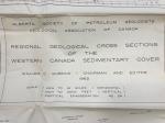
17. Fascinating sheet Map of the “Regional Geological Cross Sections of the Western Canada Sedimentary Cover” by William C. Gussow – Chairman and Editor (1962) (With a detailed section on the Rocky Mountains)
18. Mackenzie Bay Map – World Aeronautical Chart (Sheet 62) (America, 1958)
19. Mackenzie Delta – Map 107 C (Edition 1)(Printed 1962) (Two copies)
20. Aklavik – Map (Sheet 107 B) (Printed 1962) (Two copies)
21. Blow River – Yukon Territory – Map (Printed 1962)
22. Crossley Lakes – District of Mackenzie Map (Printed 1962)
23. Stanton – District of Mackenzie Map (Printed in 1962) (Two copies)
24. Herschel – Island – Yukon Territory (Provisional Map) (Printed 1962)
25. Cape Dalhousie – District of Mackenzie Map (Printed 1962)
The Collection also includes an original offprint-publication by J.R.Mackay and J. Terasmae: “Pollen Diagrams in the Mackenzie Delta Area, North West Territories” (Reprinted from “Arctic” – 1963)
- Keywords: Arctic · Arctic Exploration · Arctic Red River (Canada) · Arctic Regions · Canada · Collection Dave Naylor · Dave Naylor Collection – Arctic Section · Dave Naylor Collection – Canada Section · Dave Naylor Collection – North America Section · Dave Naylor Collection of Drill Sites / Drill Maps and related Materials · Dave Naylor Collection of Geological Maps · Dave Naylor Collection of Middle East / Asian / European / American Surveying · David (Dave) Naylor Collection of Geological Maps & Publications (Oil & Gas) · Expedition Rare · Expeditions – Rare · Geological Expedition into Canada / Arctic · Geology – Rare · Library & Collection Building · Mackenzie River Delta (Canada) · Oil · Port Brabant (Canada) · Prospecting · Shell Peel River Wells · Travel & Expedition – Rare · Travel and Exploration · Travel Canada – Rare · Yukon
- Language: English
- Inventory Number: 900109AG
© 2025 Inanna Rare Books Ltd. | Powered by HESCOM-Software


