West Cork Rare BookfairINANNA MODERNWest Cork Reading Holidays
We ship per DHL Express

We ship per DHL Express

Books with vintage Maps (54 items)

Philip Luckombe, The Compleat Irish Traveller [Luxury Reprint with all of Charles Smith's Illustrations of 18th century Ireland (Munster / Kerry / Waterford) in separate Folder for Framing]

33. [Luckombe, Philip / Smith, Charles].

Luxury Reprint of “The Compleat Irish Traveller” [With high quality Reproductions of the 31 original Plates of detailed Maps of County Cork in the 18th century, County Kerry in the 18th century and Waterford in the 18th century, as well as some of the earliest engravings of Irish Towns here for the first time reproduced as beautiful Artworks for framing and housed in a special, handmade Folder. The publication was just recently enlarged with a detailed, Topographical Index (July 2023)]. Complete Title: “The Compleat Irish Traveller, containing A general Description of the most Noted Cities, Towns, Seats, Buildings, Loughs &c. in the Kingdom of Ireland, Interspersed with Observations on the Manners, Customs, Antiquities, Curiosities and Natural History of that Country. With Elegant Copper Plates”. [With 31 original Plates after Charles Smith, including Frontispiece, this Reprint / Facsimile is the result of 10 years of research and purchase of three (3) original versions of the First Edition from the year 1788. The first Editions known to Inanna Rare Books all had different quantities of Plates and Maps included. This Reprint by Inanna Rare Books has been produced from an extremely clean version of the original and shows the most complete set of illustrations and XL-Size Maps and Artworks we could find in any of the original editions. The publication shows not only Maps of County Cork, County Kerry and County Waterford but also Views of Irish Cities and Towns in these Counties of the Province of Munster and besides the wonderful Historical Plan of Cork City this set also includes the very rare Plan of the “Grand Canal from Dublin to the River Shannon” (see detailed list of all the illustrations present at the end of this description)].

Luxury Limited-Edition-Reprint of the First Edition by Luckombe in 1788. Two Volumes plus extra Folder with 31 Plates reprinted as Artworks for framing. Skibbereen (County Cork), Inanna Rare Books Publishing, 1788. Octavo (13.5 cm x 21 cm). Pagination: Volume I: Frontispiece, engraved Titlepage, XXX, 189 pages plus recently published Index (July, 2023) / Volume II: Engraved Titlepage, 263 pages plus recently published Index (July, 2023). Plus large, bespoke made Folder with thirtyone (31) Reproductions of the Maps, Plans and Illustrations which usually were folded inside this publication and now for the first time have been liberated from the book and were published as the beautiful works of art they are. Textvolume: Volume I and II of the text bound in one beautiful half-leather-volume with gilt lettering on spine, bound in the style of the 18th century / Illustrations-Folder with 31 reprinted illustrations of Towns and Maps of Ireland but mainly of Munster, bound in bespoke made half-cloth with paper-covered boards and pasted Reprint of the original titlepage. Excellent, new condition. One of only 300 printed. [Inanna Rare Books – Reprint & Facsimile – Series].

EUR 2.480,-- 

Show details   Add to cart

Richard Nixon's Cheshire Prophecy / Plus - John Collier - A Collection of Four Local History Pamphlets on Manchester and its History and A Map of Manchester and Salford by J.Pigot

36. [Nixon, Robert] / [Lilly, William] / Collier, John / Bobbin, Tom.

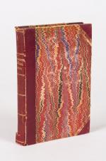
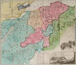
Collection of Four Local History Pamphlets on Manchester and its History, a Map of Manchester and Salford and a rare, early 18th century Prophecy-Pamphlet with William Lilly-Connection. The Collection includes as provisional Frontispiece a rare, folded, original “Map of Manchester and Salford” by J.Pigot, from the year 1811 – (36 cm x 32 cm) / The Map if followed by: Pamphlet I: Anonymous – Short Sketch of the History of Manchester (XII Pages – Manchester, Printed by Sowler and Russell, 1794 (and First published in the Encyclopaedia Britannica)/ Pamphlet II: [John Collier] – Curious Remarks on the History of Manchester. With a judicious Incredulity of Spirit, let us enquire and think for ourselves. By “Muscipula” [that is John Collier alias Tim Bobbin]. (IX, 65 pages – London, Printed for, and sold by the Booksellers in Town and Country, 1771 / Pamphlet III: [Anonymously but most likely also John Collier]″More Fruit from the same Pannier; Or, Additional Remarks on the History of Manchester. (IV, 73, VIII pages) / [Bound together with: NIXON’S Cheshire Prohecy At Large. Published from the Lady Cowper’s Correct Copy. With Historical and Political Remarks and several instances wherein it is Fulfilled. To which is added, THE LIFE OF [ROBERT] NIXON. With an advertising for a “William Lilly – Prophecy” on page 19 of the Nixon-Pamphlet: “Mr.Lilly’s remarkable Prophecy, transcrib’d Verbatim out of his Almanack for the Year 1655, printed under the following Title: “Merlini Anglici Ephemeris”: Astrological Predictions for the Year 1655 by William Lilly – Student in Astrology. [Followed by:] The Prophecy. “….Long’ere that Time poor Merlin sleeps In’s Grave secure; sad England weeps”. ([2], 32 pages – London, Printed for J.Roberts, 1719). //

Manchester / London, J.Roberts and others, 1719-1794. Octavo. Original Hardcover / 19th-century half-leather with gilt lettering to spine. Excellent condition with some minor signs of wear only. Name of preowner on third pamphlet (″Michael North”) / With a manuscript entry by one ‘W.K.’, regarding the “garbled” appearance of the Nixon’s Prophecy in Fielding’s novel, Tom Jones: ‘This was probably the very book which Partridge read out of… This shows Fielding’s attention to minutiae I think – such a jumbled Head as [barber-surgeon] Partridge wd be likely to mix up those part of the Tale Together’. The Cheshire Prophecy in Chapbook-Style with an advertising bound before the titlepage and “Price Six-Pence” on cover.

EUR 1.800,-- 

Show details   Add to cart

Daniel Paterson & Edward Mogg - Paterson's Roads [1831/1832 Edition (18th Edition) with 12 Maps]

39. [Paterson, Daniel] Mogg, Edward.

Paterson’s Roads [1831/1832 Edition (18th Edition)] – Being an entirely original and accurate Description of all the direct and Principal Cross Roads in England and Wales, with part of the roads of Scotland. [Including an “Appendix to the Eighteenth Edition of Paterson’s Roads; being An Accurate Description of the Direct and Principal Cross roads communicating with the Improved Old Passage Ferry, across the River Severn, between Aust and Beachley, near Chepstow. Accompanied by a Map of the Banks of the Wye. To which are added, Course of the Chepstow Steam Packets; and An arranged Tour through Wales, with References to the pages in the Body of the Work, where connection with various lines of Road takes place.”]. The Eighteenth Edition. To which are added Topographical Sketches of the several Cities, Market Towns and remarkable Villages and descriptive accounts of the principal seats of the Nobility and Gentry, the Antiquities, Natural Curiosities and other Remarkable Objects throughout the Kingdom. The whole Remodelled, Augmented and Improved by the Addition of Numerous New Roads and New Admeasurements, and Arranged upon A Plan at once Novel, clear and intelligible, is deduced from the latest and best Authorities: Including a Table of the Heights of Mountains from the Grand Trigonometrical Survey of the Kingdom; Also a Table of the Population, From the Census of 1831; To which is annexed the Arrival and Departure of the Mail, together with the Rates of Postage and An Entirely New Set of Maps.

London, Printed for Longman, Rees, Orme, Brown, Green and Longman, 1831/1832. Octavo (15 cm x 21,5 cm). Fontispiece – Fold-out-Map, 715 pages plus 44 pages of an Appendix. With twelve (12) Maps, including the frontipiece-map and full-page maps throughout the publication. Hardcover / Private half-leather of the early 20th century with gilt lettering on the spine. Some of the maps with visible reapirs but complete. Very good condition with only minor signs of wear. This being the so-called “Best Edition”.

EUR 750,-- 

Show details   Add to cart

Payne, A New and Complete System of Universal Geography; Describing Asia, Africa

40. Payne, John / Hardie, James / Provenance I: Signature of J.J. Westervelt [Jacobus James Westervelt (1755 – 1826) – Schraalenberg and Provenance II: Charles Sydney Clark (1925) presented this set to Johnson Free Public Library at Hackensack, New Jersey].

A New and Complete System of Universal Geography [Complete with all 20 maps / illustrations] ; Describing Asia, Africa, Europe and America; with their Subdivisions of Republics, States, Empires and Kingdoms : The Extent, Boundaries and Remarkable Appearances of each Country; Cities, Towns and Curiosities of Nature and Art. Also giving a general account of The Fossil and Vegetable Productions [with hand-coloured plates] of the Earth. The History of Man, In all Climates, Regions and Conditions; Customs, Manners, Laws, Governments and Religions: The State of Arts, Sciences, Commerce, Manufactures and Knowledge. Sketches of the Ancient and Modern History of each Nation and People to the present time. To which is added, A View of Astronomy, As connected with Geography; Of the Planetary System to which the Earth belongs; And of the Universe in General. With a copious Index annexed to each Volume. Being a Large and Comprehensive Abridgement of Universal Geography. By John Payne. With additions, corrections and Improvements from the latest and best authors by James Hardie – Author of “The Principles of Latin Grammar”, “The American Remembrancer” and “Universal Tablet of Memory” &c. In Four Volumes.

First Abridged Edition. Volumes I [Asia] and II [Africa] (of IV). New York, Printed for and Sold by John Low, Book-Seller at The Shakespeare – Head, No.332 Water-Street, 1798 – 1799. Octavo – Edition. Pagination: Volume I [Asia]: Folded Frontispiece (Map of the World), XLVIII, 518 pages plus 10 unnumbered pages of an Index and one additional page with Directions for the Bookbinder for placing the maps and illustrations as well as Errata. Volume I includes all 10 Maps / Engravings as called for / Volume II [Africa]: Folded Frontispiece (Map of Africa), 578 pages plus 12 unnumbered pages of an Index plus one additional page with Directions for the Bookbinder for placing the maps and illustrations as well as Errata. Volume II includes all 10 Maps / Engravings as called for. Hardcover / Modern Library – Binding with the original 18th century – work bound in. Former library copy of Bergen County Historical Society (cancelled) and Johnson Free Public Library in Hackensack, New Jersey, with a very boring, modern library binding and library cards applied to the endpapers only, leaving the bookblock with text and maps and illustrations entirely untouched from any library-signs. Very good condition with some signs of external wear.

EUR 2.480,-- 

Show details   Add to cart

Page: 1 2 3 4 5 6
: