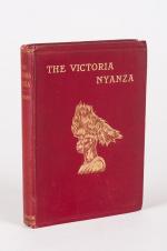
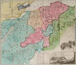
Books with vintage Maps (65 items)

Johannes Justus Rein, Japan nach Reisen und Studien im Auftrage der Königlich Preussischen Regierung dargestellt

41. Rein, J.J. [Johannes Justus] / [Provenienz / Provenance: Max von Baden / Bibliothek Schloss Salem].

Japan nach Reisen und Studien im Auftrage der Königlich Preussischen Regierung dargestellt von J.J. Rein [Johannes Justus Rein], Professor der Geographie in Marburg [an der Lahn]. Erster Band: Natur und Volk des Mikadoreiches. Mit 5 Lichtdruckbildern [Photographien], 12 Holzschnitten, 3 Lithographischen Tafeln und 2 Karten. / Zweiter Band: Land- und Forstwirthschaft, Industrie und Handel. Mit zum Theil farbigen Tafeln, 20 Holzschnitten im Text und 3 Kaertchen.

Erste Ausgabe [First Edition]. Two Volumes. Leipzig, Verlag von Wilhelm Engelmann, 1881 – 1886. Gross-Oktav. Band I: XII, [1], 630 Seiten mit allen Abbildungen und insbesondere der Original-Photographie von Nagasaki aber ohne die “Orographish-hydrographische Karte [Japans]” am Schluss des Bandes. / Band II: XII, 678 Seiten mit den drei Falt-Karten von Japan am Schluss des Bandes . Hardcover / Original 19th century half-leather with gilt lettering and ornament to spine. / Originale Verlags-Leinenbaende. Ehemalige Exemplare der “Bibliothek Salem” und ehemaliges “Eigenthum des Prinzen Wilhelm”, mit zwei dezenten Bibliotheksschildchen der Bibliothek Salem im Innendeckel und dem Stempel des Prinzen Max von Baden [″MB” mit Krone] auf den Titelseiten. Very good condition with only minor signs of wear and only the two folded Maps missing / Sehr guter Zustand des seltenen Werks und mit nur wenigen Stockfleckchen, wie ueblich auf den Rueckseiten des Photo-papiers und Abklatsch auf den Seiten verso. Aus dem Vorwort: “Saemtliche Illustrationen dieses Buchs sind Originale – Bonn, im September 1886 – Der Verfasser”.

EUR 2.480,-- 

Show details   Add to cart

Payne, A New and Complete System of Universal Geography; Describing Asia, Africa

42. Payne, John / Hardie, James / Provenance I: Signature of J.J. Westervelt [Jacobus James Westervelt (1755 – 1826) – Schraalenberg and Provenance II: Charles Sydney Clark (1925) presented this set to Johnson Free Public Library at Hackensack, New Jersey].

A New and Complete System of Universal Geography [Complete with all 20 maps / illustrations] ; Describing Asia, Africa, Europe and America; with their Subdivisions of Republics, States, Empires and Kingdoms : The Extent, Boundaries and Remarkable Appearances of each Country; Cities, Towns and Curiosities of Nature and Art. Also giving a general account of The Fossil and Vegetable Productions [with hand-coloured plates] of the Earth. The History of Man, In all Climates, Regions and Conditions; Customs, Manners, Laws, Governments and Religions: The State of Arts, Sciences, Commerce, Manufactures and Knowledge. Sketches of the Ancient and Modern History of each Nation and People to the present time. To which is added, A View of Astronomy, As connected with Geography; Of the Planetary System to which the Earth belongs; And of the Universe in General. With a copious Index annexed to each Volume. Being a Large and Comprehensive Abridgement of Universal Geography. By John Payne. With additions, corrections and Improvements from the latest and best authors by James Hardie – Author of “The Principles of Latin Grammar”, “The American Remembrancer” and “Universal Tablet of Memory” &c. In Four Volumes.

First Abridged Edition. Volumes I [Asia] and II [Africa] (of IV). New York, Printed for and Sold by John Low, Book-Seller at The Shakespeare – Head, No.332 Water-Street, 1798 – 1799. Octavo – Edition. Pagination: Volume I [Asia]: Folded Frontispiece (Map of the World), XLVIII, 518 pages plus 10 unnumbered pages of an Index and one additional page with Directions for the Bookbinder for placing the maps and illustrations as well as Errata. Volume I includes all 10 Maps / Engravings as called for / Volume II [Africa]: Folded Frontispiece (Map of Africa), 578 pages plus 12 unnumbered pages of an Index plus one additional page with Directions for the Bookbinder for placing the maps and illustrations as well as Errata. Volume II includes all 10 Maps / Engravings as called for. Hardcover / Modern Library – Binding with the original 18th century – work bound in. Former library copy of Bergen County Historical Society (cancelled) and Johnson Free Public Library in Hackensack, New Jersey, with a very boring, modern library binding and library cards applied to the endpapers only, leaving the bookblock with text and maps and illustrations entirely untouched from any library-signs. Very good condition with some signs of external wear.

EUR 1.480,-- 

Show details   Add to cart

Daniel Paterson & Edward Mogg - Paterson's Roads [1831/1832 Edition (18th Edition) with 12 Maps]

43. [Paterson, Daniel] Mogg, Edward.

Paterson’s Roads [1831/1832 Edition (18th Edition)] – Being an entirely original and accurate Description of all the direct and Principal Cross Roads in England and Wales, with part of the roads of Scotland. [Including an “Appendix to the Eighteenth Edition of Paterson’s Roads; being An Accurate Description of the Direct and Principal Cross roads communicating with the Improved Old Passage Ferry, across the River Severn, between Aust and Beachley, near Chepstow. Accompanied by a Map of the Banks of the Wye. To which are added, Course of the Chepstow Steam Packets; and An arranged Tour through Wales, with References to the pages in the Body of the Work, where connection with various lines of Road takes place.”]. The Eighteenth Edition. To which are added Topographical Sketches of the several Cities, Market Towns and remarkable Villages and descriptive accounts of the principal seats of the Nobility and Gentry, the Antiquities, Natural Curiosities and other Remarkable Objects throughout the Kingdom. The whole Remodelled, Augmented and Improved by the Addition of Numerous New Roads and New Admeasurements, and Arranged upon A Plan at once Novel, clear and intelligible, is deduced from the latest and best Authorities: Including a Table of the Heights of Mountains from the Grand Trigonometrical Survey of the Kingdom; Also a Table of the Population, From the Census of 1831; To which is annexed the Arrival and Departure of the Mail, together with the Rates of Postage and An Entirely New Set of Maps.

London, Printed for Longman, Rees, Orme, Brown, Green and Longman, 1831/1832. Octavo (15 cm x 21,5 cm). Fontispiece – Fold-out-Map, 715 pages plus 44 pages of an Appendix. With twelve (12) Maps, including the frontipiece-map and full-page maps throughout the publication. Hardcover / Private half-leather of the early 20th century with gilt lettering on the spine. Some of the maps with visible reapirs but complete. Very good condition with only minor signs of wear. This being the so-called “Best Edition”.

EUR 750,-- 

Show details   Add to cart

Nathaniel Hooke - The Roman History, From the Building of Rome to the Ruin of the Commonwealth

48. Hooke, Nathaniel.

The Roman History, From the Building of Rome to the Ruin of the Commonwealth [with the printed Dedication to Alexander Pope]. Illustrated with 17 folding Maps, 4 Fontispieces and 11 other Plates [32 copper-engravings in total].

The Fourth Edition. Four Volumes (complete set with all maps and plates). London, Printed for J. and R. Tonson; Hawkins and T.Longman, 1766 – 1771. Quarto (27 cm x 22 cm). Collation: Volume I: Frontispiece, XLVI, XLVI, 634 pages with 10 plates and 3 maps / Volume II: Frontispiece, XXXII, XXXII, 668 pages with 8 maps / Volume III: Frontispiece, VI, 694 pages with 5 maps / Volume IV: Frontispiece, VII, 464 pages plus 76 unnumbered pages of a General Index and 1 plate and 1 map. Hardcover / Original 18th-century leather with gilt lettering and labels on spine. Interior of this set with all maps and illustrations in excellent, very clean condition. The boards of the bindings with abrasions and some bumping but overall very firm. Some stronger peeling of the leather on board of Volume I, Only three pages with minor tears. The large map of Northern Africa (Palestine, Egypt and Libya) with a minor tear. The stunning maps and plates in timeless beauty. Highly underestimated work, in the shadow of Gibbon but with meticulous detail in presenting the geographical impact of the Roman Conquest. From the library of Daniel Conner (Connerville / Manch House), with his Exlibris / Bookplate to pastedown.

EUR 3.500,-- 

Show details   Add to cart

Derham, Astro-Theology: or, a Demonstration of the Being and Attributes of God,

50. Derham, William [Philosopher and Scientist] / [John Senex (Cartographer)].

Astro-Theology: or, a Demonstration of the Being and Attributes of God, From a Survey of the Heavens [Including a Chapter on the “Attraction of Gravity”].

Sixth Edition. London, W. Innys, 1731. Octavo. [16], LVI, [8], 246 pages,[10 pages of Index], [with 3 astronomical foldout engravings by english Cartographer and Explorer John Senex / The Engravings show the Ptolemaic Geocentric System with the Earth as centre of the Universe and discuss other models as well by pointing to pages within the text that reflect on the illustrations / Two of the Engravings are showing the Stars and Constellations over Europe, the Mediterranean, Asia Minor, Asia etc.]. ]. Original Hardcover / bound in contemporary panelled calf. The book has been sympathetically rebacked to style. Besides a spot of hard green adhesive to the front board in very good condition. The armorial 18th century bookplate of one Dr. Blackett appears on the first pastedown [″A coat of arms divided into three portions, with three stars and three scallop shells throughout. At the helm is the head of an eagle, and elaborate mantling, flowers, and leaves surround the crest. Below is the motto ‘Nous Travailler ons dans L’Esperance’”] / The text of this rare and notoriously underrated book is complete and clean with the three foldout engravings of the cosmos to the rear with only a small archival paper restoration to one of the engravings.

EUR 980,-- 

Show details   Add to cart

Page: 1 2 3 4 5 6 7
: