3. Shaw, Rev. Stebbing.
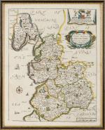
The History and Antiquities of Staffordshire. Complete Set of two Volumes (all published/fully restored). With an original Plan of Wolverhampton, A large map of Staffordshire, Engravings of Boscobel House, The Pedigree of Turton, Etchings of Kings Bromley, Pipe Ridware House, Lichfield, Site of Blythbury Priory, Mavesyn Ridware, Cathedral of Lichfield, View of Freeford, etc. etc. Volume I – Containing the Ancient and Modern History of Thirty Parishes in the Hundred of Offlow, arranged Geographically, with an Appendix of the most curious Charters &c. Illustrated with sixty-two copper plates and a copious Index / Volume II – Part1 (all published) – Containing the Prefatory Introduction, commencing with a Series of Original Letters from Plot’s time to the present; General and Natural History &c. Ancient and Modern History of the remaining Parishes in the Hundred of Offlow and the Whole of Seisdon, arranged Geographically with an Appendix of curious Charters and other additions and Corrections &c. Illustrated with fifty copper plates and a copious Index. Compiled from the Manuscripts of Huntbach, Loxdale, Bishop Lyttelton, and other Collections of Dr.Wilkes, the Rev. T.Reilde. Including Erdeswicke’s Survey of the County and the approved parts of Dr. Plot’s Natural History. The whole brought down to the present time. Interspersed with Pedigrees and Anecdotes of Families, Observations on Agriculture, Commerce, Mines and Manufactories and illustrated with a very full and correct new map of the County, “Agri Staffordiensis Icon” and numerous other plates.
London, J.Nichols and Son, 1798-1801. Large-Folio. Volume I: Folded Map of Staffordshire by W.Faden, Portrait of Rev. Shaw (detached), XXIV, (2), 125, XXXVIII, 434, 38 pages / Volume II, Part I: A Plan of Wolverhampton, XXXII, 290, 20 pages. With a double-page plan, a large, folded county map (coloured), 82 engraved plates, numerous vignettes within the text and 3 folded pedigree – tables. Modern Hardcover. Exceptionally restored. This work is difficult to handle if not in a sturdy binding ! Original Edition in professionally rebound halfleather with gilt lettering on spine and extra-strong boards, suited for this heavy set. This masterpiece of underestimated english local history is of great interest because of its fold out maps and numerous large folio etchings.


![Christoph Weigel - Insulae Britannicae Antiquae [with Ireland and Scotland] ex collatione veterum Geographorum](/images/thumbnails/100077AG.jpg)


