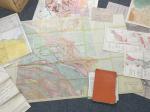
7. Canada – [Naylor, David (Dave) / G.E.Tebbutt].
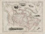
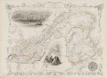
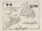
The Geology of the West Mackenzie Coastal Area / The Mackenzie Delta, Arctic Canada Canada / Collection of Manuscript and Typescript Material as well as original proofs and notes for the publication by Naylor and Tebbutt, with handwritten annotations and a large collection of important geological Maps of Canada’s Geology, among which is also the stunning, enormous, hand-coloured Surface Geology-Map of the Norman Wells Area in the Mackenzie River Delta which measures 152 cm (width) x 106 cm (height) and which was published in 1965.
Vintage Maps in Colour-Print, Lithographs, Black-and-white etc. Including a large hand-coloured Map of the Norman Wells Area, accompanying the publication by Naylor and Tebbutt on the Expedition into the West Mackenzie Coastal Area. (Canada), (c.1968). Maps ranging from sizes A4 to Folio to 152 cm x 106 cm. Excellent condition with minor signs of wear. Very rare and special collection of a landmark – excursion into the Mackenzie Delta and Arctic Canada under the leadership of David (Dave) Naylor as Party Chief of the Field Crew, accompanied by Senior Geologists G.E.Tebbutt, D.J.McIntyre, D.Mason as well as Junior Geologists R.Procter, L.S.Eliuk, K.Dahlman, C.M.James, D.R.Ojakangas. The party planned to stay at Camp Sites in Inuvik but moved it to Shingle Point and from there to Norman Wells.