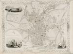
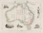
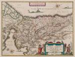
Tallis, John / Rapkin, John. (1817 – 1876)
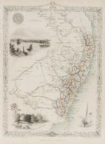
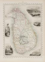
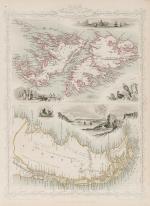
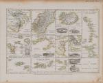
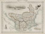
Ceylon (British Ceylon) – with Vignettes and illustrations of the Lake of Kandy, Adam’s Peak from the Lake of Colombo, a beautiful scenery of Colombo, Temple of Buddha , Kalany, Ruins of A Dagora at Toophamaraya. The map is divided in the old regions of British Ceylon: The Eastern Provinces (Kattoe, Colompattoo, Tamblegam, Kottiar, Tambankadewa, Koorle, Eraquer, Mamoene, Karrewitte, Chiam Pature, Erwiel, Nadene, Akkrepattoo, Ghiam Pature, Veddag, Ratte, Nadekadoe, Panowa / The Western Provinces (Anewoelandan, Rajawania, Seram, Sevien Korles, Rajawanny) / Northern Provincec (Wademo Ratchi, Welligammo, Jafnapatam, Leyden, Ponoryn, Manaar, Mantotte, Pomparipo, Moessellie, Neurawanny, Meel-Pattoo, Poedoe, Koe-Dirpo, Moeliawalle, Karie-Kattoe-Molle, Tinne-Mar, Re-waddie, Patchilapelle, Negammo / Central Provinces – Matelle, Doombera, Toompane, Erris Pattoo, Yattenoowere, Dollos Bage, Lower Ouna, Hewahetta, Wellassee / Western Provinces – Hapeti Gam, Pasdum, Caltura, Three Korles, Hewagam Korle, Hina Korle, Saffragam etc. / South Provinces – Wallawitte, Gangebodde, Gangedode, Mahagam, Pattoo, Morva, Talpe, Belligam, Wellerode etc.
Original steel engraving / Vintage map. Drawn and engraved by John Rapkin. Partly hand-coloured. London & New York, J & F. Tallis, 1851. Beautifully Framed. Size of frame with map: 40.5 cm x 50.5 cm. Size of the actual map: 27 cm x 37 cm. Excellent condition.


![Tallis, Channel Islands [Guernsey and Jersey]](/images/thumbnails/200116AG.jpg)
![Christoph Weigel - Insulae Britannicae Antiquae [with Ireland and Scotland] ex collatione veterum Geographorum](/images/thumbnails/100077AG.jpg)
![Fer, Grande Tartarie [Central Asia] with Cazan [Kazan] , Turquestan](/images/thumbnails/398AG.jpg)