


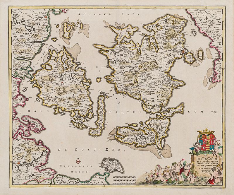
De Wit, Insularum Danicarum ut Zee-Landiae, Fioniae, Langelandiae, Lalandiae, Fa
Insularum Danicarum ut Zee-Landiae, Fioniae, Langelandiae, Lalandiae, Falstriae, Fembriae, Monae, aliquarumque in Mari Balthico Sitarum descriptio
Original hand-coloured engraving. Amsterdam, F. de Wit, [c.1680]. Plate Size: 58.1 cm x 48.8 cm. Sheet Size: 63.8 cm x 53 cm. Original map. In very good condition with only the slightest hints of browning to outer margns only.
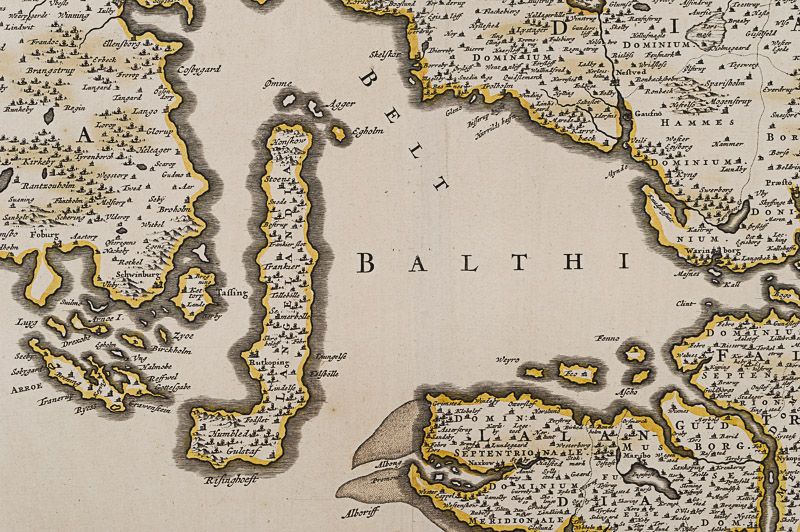
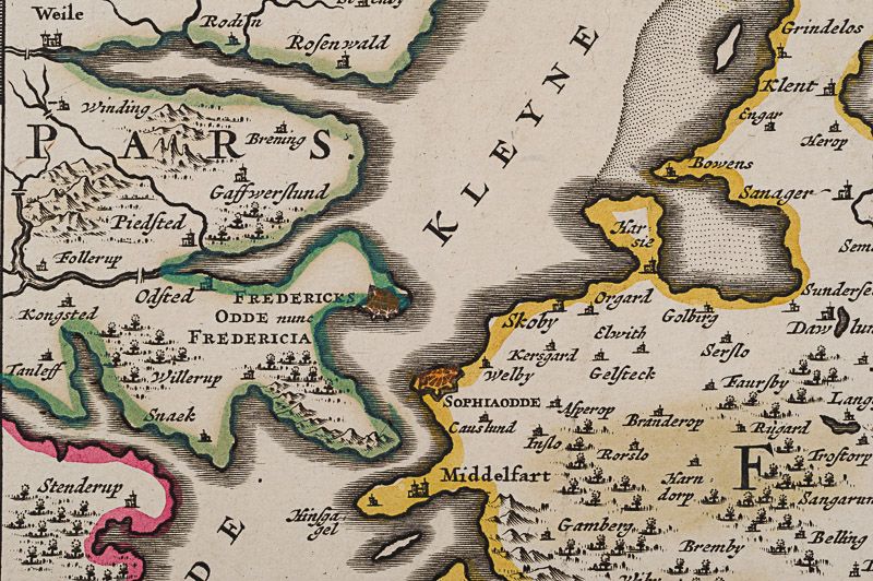
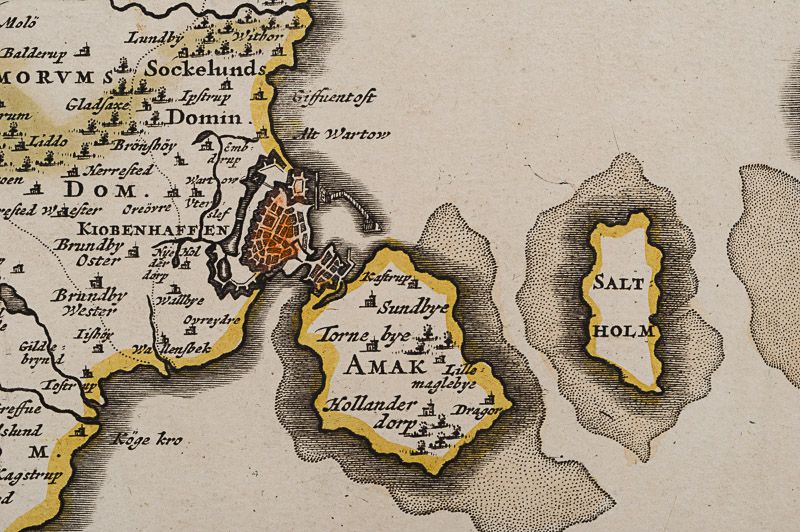
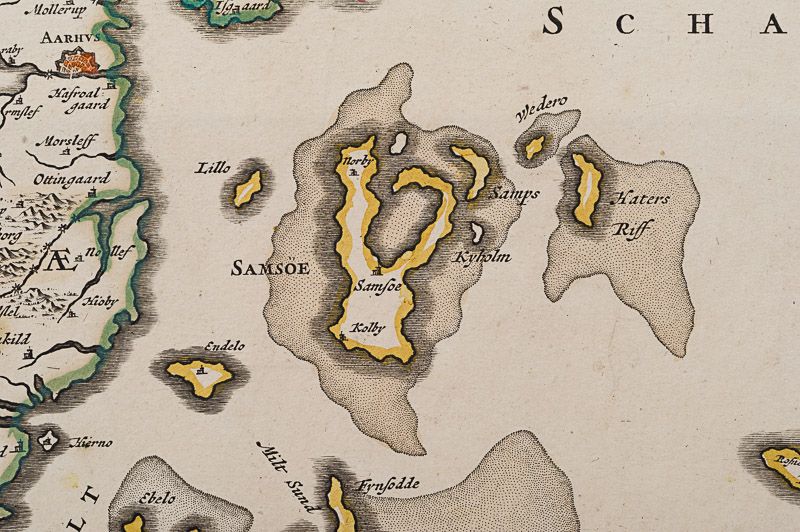
This beautifully engraved chart shows the main Danish islands of Funen and Zealand plus the eastern coastline of the Jutland peninsula and a little of southern Sweden. The major Danish cities like Copenhagen, Aarhus and Odense are shown on the map. The map is filled with minute detail of fortresses, cities, towns and tiny villages. Relief depicted pictorially
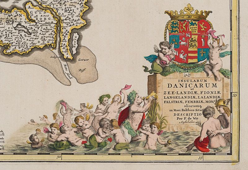
The lower right corner of the map bears a stunningly decorative cartouche featuring the Danish royal coat-of-arms and a Classical scene of putti and merfolk frolicking in the sea with the god Mercury in the foreground. A small compass rose lies off the Schleswig Holstein coast in the Colberger Heide.
Frederick de Wit (1629/1630 – 1706) was a Dutch cartographer and artist who drew, printed and sold maps.
By 1648, during the height of the Dutch Golden Age, De Wit had moved from Gouda to Amsterdam. As early as 1654 he had opened a printing office and shop under the name “De Drie Crabben” (the Three Crabs) which was also the name of his house on the Kalverstraat. In 1655, De Wit changed the name of his shop to the “Witte Pascaert” (the White Chart). Under this name De Wit and his firm became internationally known.
The first cartographic images that De Wit engraved were a plan of Haarlem that has been dated to 1648. The first charts engraved by De Wit were published in 1654 under the “De Drie Crabben” address. The first map that was both engraved and dated by De Wit was that of Denmark: “REGNI DANIÆ Accuratissima delineatio Perfeckte Kaerte van ‘t CONJNCKRYCK DENEMARCKEN” in 1659. His first world maps, “NOVA TOTIUS TERRARUM ORBIS TABULA AUCTORE F. DE WIT” and Nova Totius Terrarum Orbis Tabula appeared around 1660.
His Atlas began to appear around 1662 and by 1671 included anywhere from 17 to 151 maps each. In the 1690s he began to use a new title page “Atlas Maior” but continued to use his old title page. His atlas of the Low Countries first published in 1667, was named Nieuw Kaertboeck van de XVII Nederlandse Provinciën and contained 14 to 25 maps. De Wit quickly expanded upon his first small folio atlas which contained mostly maps printed from plates that he had acquired, to an atlas with 27 maps engraved by or for him. By 1671 he was publishing a large folio atlas with as many as 100 maps.
After Frederick de Wit’s death in 1706 his wife Maria continued the business for four years printing and editing De Wit’s maps until 1710. However, as De Wit’s son Franciscus was already a prosperous merchant by this time and had little interest in his father’s business, he did not take over the publishing house. In 1710 Maria sold the firm at auction. At the auction most of the atlas plates and some of the wall map were sold to Pieter Mortier, whose publishing company grew to become one of the largest cartography publishing houses of the 18th century. The 27 chart plates from his 1675 Sea atlas were sold at the 1710 auction, to the Amsterdam print seller Luis Renard, who published them under his own name in 1715, and then sold them to Rennier and Joshua Ottens who continued to publish them until the mid-1700s. (Wikipedia)
- Keywords: 17th Century · 17th Century Map · Baltic · Cartography · Catalogue No.5 – Maps of the World · Denmark · Europe · Map · Original Engraving · Original Map · Original Maps · Rare Map Denmark · Rare Map Europe · Rare Map Scandinavia · Vintage Map
- Inventory Number: 200040AG
EUR 395,--
We ship per DHL Express


Contact
Inanna Rare Books Ltd.
Woodley House
Castletownshend Road
P81 D262 Skibbereen, County Cork
Ireland
Phone: ++353 - (0) 87 - 102 5412
E-Mail: info@inannararebooks.com
Internet: https://www.inannararebooks.com
Online Bookshop specialized in rare
and secondhand books.
Newsletter and E-Catalogue Sign Up
Payment Options


© 2026 Inanna Rare Books Ltd. | Powered by HESCOM-Software

