


Tallis, Prussia - with Vignettes of Berlin, Brandenburg Gate, The Royal Palace a
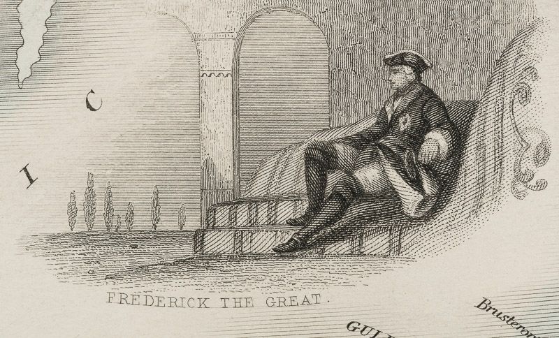
Prussia – with Vignettes of Berlin, Brandenburg Gate, The Royal Palace and French Church Berlin and Frederick the Great.
Original steel engraving / Vintage map. Drawn and engraved by John Rapkin. Partly hand-coloured. Illustrations by J. Salmon and engravings by S. Fisher. London, Edinburgh & Dublin, J & F. Tallis, 1851. Plate Size: 33 cm x 26.5 cm. Sheet Size: 37.4 cm x 27.4 cm. Vintage 19th century map in very good condition.
Published in the Illustrated Atlas, And Modern History Of The World Geographical, Political, Commercial & Statistical, Edited By R. Montgomery Martin.
Beautiful and fascinating map of Prussia from the Victorian Era. Prussia’s boundaries are highlighted and illustrate its
non-contiguous make up. Four De-jure ‘Kleinstaaterei’, or mini-/micro-states can be seen holding within the borders of Prussia – evidence of the fragmented nature of the German lands throughout the existence of the recently expired Holy Roman Empire. But this was changing: In the west lie Prussia’s post-1815 acquisitions in Westphalia and the Rhineland, while in the east ‘Prussian Poland’ and ‘Posen’ remind the viewers of the fate of the erstwhile Polish state. Four additional territorial possessions resemble globules from the main bodies of Prussian land. The more ancient lands of East Prussia and Brandenburg are identified also. Prussia is located in a busy neighbourhood with Denmark, Sweden, Russia, Austria, Saxony, France, Belgium and Holland abutting Berlin’s territory. The islands of the Baltic are also identified. The much-heralded German railway system is shown on the map, linking ports like Hamburg and Stettin to Berlin. The map is littered with the names of famous towns and cities such as Memel, Konigsberg and Warsaw in the East, Cracow, Prague and Dresden in the South to Magdeburg and Dortmund in the west. The region’s rivers, such as the Elbe and Vistula are also identified. Relief is depicted through hachuring. A scale-bar is shown in the lower left corner. A Prussian eagle stands perched upon the highly decorative map border.
John Tallis (7 November 1817 – 3 June 1876) was an English cartographic publisher. His company, John Tallis and Company, published views, maps and atlases in London from roughly 1838 to 1851.
Tallis set up as a publisher with Frederick Tallis in Cripplegate in 1842; the business moved to Smithfield in 1846, and was dissolved in 1849. From 1851 to 1854 Tallis operated as John Tallis and Company. He started The illustrated news of the world and national portrait gallery of eminent personages in 1858, selling it for £1,370 in 1861; it folded in 1863. (Wikipedia)
The most important project John Tallis undertook, was the ‘Illustrated Atlas’ from 1851. The original map we offer here, was part of this exceptional Atlas and all the maps it contained are still today considered as the last reminder of an era of lavish map production. Tallis worked the project together with John Rapkin (1815-1876) and it was Rapkin’s style and talent that we have to thank for when we marvel at these maps today. What makes these maps so special is the detail of engraved vignettes that surround the map and often show indigenous scenes, people in their environment and even more so, historical buildings or historical views of towns and cities, architecture and landscape.
The project of ‘The Illustrated Atlas’ was designed to be finished just in time for the anxiously awaited “Great Exhibition of the Works of Industry of All Nations” or The Great Exhibition, sometimes referred to as the Crystal Palace Exhibition in reference to the temporary structure in which it was held, was an international exhibition that took place in Hyde Park, London, from 1 May to 11 October 1851. It was the first in a series of World’s Fairs, exhibitions of culture and industry that became popular in the 19th century, and it was a much-anticipated event.
The Great Exhibition was organized by Henry Cole and Prince Albert, husband of the reigning monarch, Queen Victoria. It was attended by numerous notable figures of the time, including Charles Darwin, Samuel Colt, members of the Orléanist Royal Family and the writers Charlotte Brontë, Charles Dickens, Lewis Carroll, George Eliot and Alfred Tennyson. Music for the opening was under the direction of Sir George Thomas Smart and the continuous music from the exhibited organs for the Queen’s procession was “under the superintendence of William Sterndale Bennett”. (Wikipedia)
- Keywords: 19.Jahrhundert · 19th Century · 19th Century Map · Cartography · Catalogue No.5 – Maps of the World · Deutschland · Europe · Germany · John Tallis Maps · Map · Original Map · Original Maps · Original Steel Engraving · Ostpreußen · Ostpreussen · Preussen · Preußen · Preussische Geschichte · Prussia · Rare Map – Germany · Travel Germany – Rare · Vintage Map · Vintage Old Map
- Language: English
- Inventory Number: 200103AG
EUR 350,--
We ship per DHL Express


Contact
Inanna Rare Books Ltd.
Woodley House
Castletownshend Road
P81 D262 Skibbereen, County Cork
Ireland
Phone: ++353 - (0) 87 - 102 5412
E-Mail: info@inannararebooks.com
Internet: https://www.inannararebooks.com
Online Bookshop specialized in rare
and secondhand books.
Newsletter and E-Catalogue Sign Up
Payment Options


© 2026 Inanna Rare Books Ltd. | Powered by HESCOM-Software
Follow Us

