


Tallis, Western Hemisphere - With Stunning Vignettes of Indigenous Peoples, Nat
Western Hemisphere – With Stunning Vignettes of Indigenous Peoples, Native Animals.
Original steel engraving / Vintage map. Drawn and engraved by John Rapkin. Partly hand-coloured. Illustrations by H. Warren and Enrgaved by J. Rogers. London, Edinburgh & Dublin, J.& F. Tallis, 1851. Plate Size: 34 cm x 25.5 cm. Sheet Size: 37.4 cm x 27 cm. In very good condition with only faintest traces of browning to outer margins. Very slight paper imperfections along edge. Minor tear near upper left corner. Very minor tear to map above the Arctic Circle.
Published in the Illustrated Atlas, And Modern History Of The World Geographical, Political, Commercial & Statistical, Edited By R. Montgomery Martin.
Beautifully bordered and fascinating map of the western hemisphere, including North and South America. The Azores and Cape Verde islands and the Caribbean islands are included in the Atlantic Ocean. In the south South Shetland Islands and South Victoria populate a blank area where the Antarctic ought to be found. In the Pacific, New Zealand and the Polynesian and Sandwich (Hawaiian) islands. To the north the end of Asia can be seen and, across the Arctic Ocean, Greenland is also included. The political divisions are colourfully delineated. Interestingly, Alaska is described as ‘Russian America’ highlighting that the U.S. had still to purchase “Seward’s Icebox” from the Tsar when the map was published.
John Tallis (7 November 1817 – 3 June 1876) was an English cartographic publisher. His company, John Tallis and Company, published views, maps and atlases in London from roughly 1838 to 1851.
Tallis set up as a publisher with Frederick Tallis in Cripplegate in 1842; the business moved to Smithfield in 1846, and was dissolved in 1849. From 1851 to 1854 Tallis operated as John Tallis and Company. He started The illustrated news of the world and national portrait gallery of eminent personages in 1858, selling it for £1,370 in 1861; it folded in 1863. (Wikipedia)
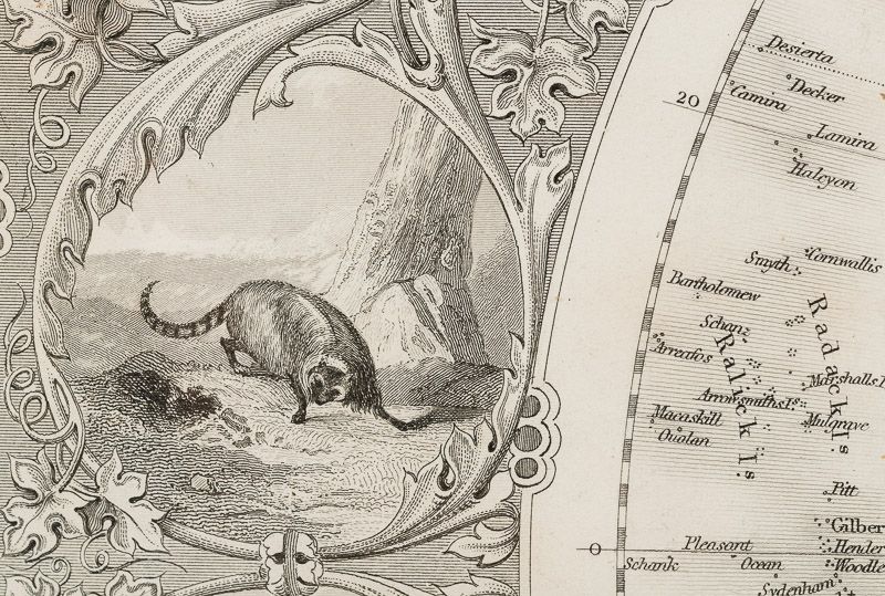
The most important project John Tallis undertook, was the ‘Illustrated Atlas’ from 1851. The original map we offer here, was part of this exceptional Atlas and all the maps it contained are still today considered as the last reminder of an era of lavish map production. Tallis worked the project together with John Rapkin (1815-1876) and it was Rapkin’s style and talent that we have to thank for when we marvel at these maps today. What makes these maps so special is the detail of engraved vignettes that surround the map and often show indigenous scenes, people in their environment and even more so, historical buildings or historical views of towns and cities, architecture and landscape.
The project of ‘The Illustrated Atlas’ was designed to be finished just in time for the anxiously awaited “Great Exhibition of the Works of Industry of All Nations” or The Great Exhibition, sometimes referred to as the Crystal Palace Exhibition in reference to the temporary structure in which it was held, was an international exhibition that took place in Hyde Park, London, from 1 May to 11 October 1851. It was the first in a series of World’s Fairs, exhibitions of culture and industry that became popular in the 19th century, and it was a much-anticipated event.
The Great Exhibition was organized by Henry Cole and Prince Albert, husband of the reigning monarch, Queen Victoria. It was attended by numerous notable figures of the time, including Charles Darwin, Samuel Colt, members of the Orléanist Royal Family and the writers Charlotte Brontë, Charles Dickens, Lewis Carroll, George Eliot and Alfred Tennyson. Music for the opening was under the direction of Sir George Thomas Smart and the continuous music from the exhibited organs for the Queen’s procession was “under the superintendence of William Sterndale Bennett”. (Wikipedia)
- Keywords: 19.Jahrhundert · 19th Century · 19th Century Map · Cartography · Catalogue No.5 – Maps of the World · John Tallis Maps · Map · North America Maps · Original Map · Original Maps · Original Steel Engraving · Pacific · Rare Map – The World · Rare Map South America · Rare Map USA · South America · Travel & Expedition – Rare · Travel America Rare · Travel South America – Rare · Vintage Map · Vintage Old Map · Western Hemisphere
- Language: English
- Inventory Number: 200121AG
EUR 270,--
We ship per DHL Express


Contact
Inanna Rare Books Ltd.
Woodley House
Castletownshend Road
P81 D262 Skibbereen, County Cork
Ireland
Phone: ++353 - (0) 87 - 102 5412
E-Mail: info@inannararebooks.com
Internet: https://www.inannararebooks.com
Online Bookshop specialized in rare
and secondhand books.
Newsletter and E-Catalogue Sign Up
Payment Options


© 2026 Inanna Rare Books Ltd. | Powered by HESCOM-Software
Follow Us

