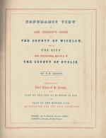
Harvey, Panoramic View of and Tourist's Guide to The County of Wicklow and to Th
Panoramic View of and Tourist’s Guide to The County of Wicklow and to The City and Intervening Scenery of the County of Dublin. Embellished by Select Views of the Scenery ; With Plan of the City as it stood in 1610 and Plan of the Modern City as Engraved for the G.P.O. Directory.
[Second Edition with 11 Illustrations and 2 Maps]. Dublin / London, S.B.Oldham / Seeley’s Fleet Street, no year (c.1850). Quarto (22 cm wide x 28 cm high). Pagination: Halftitle (stating: “Tourist Guide”), Frontispiece, Engraved Titlepage, Titlepage (Decorative in Two colours and two Fonts), “A Plan of Dublin in 1610”, IX, “Dublin – Engraved for The General Post Office Directory”, 24 pages interspersed with an additional eight (8) steelengravings of County Wicklow and surroundings. Original, very decorative cloth with gilt lettering and ornament to front and rear boards. New spine furnished in the 19th century. Corners bumped, pastedown a little rough but interior excellent with all engravings and especially the maps in very good condition. Extremely rare publication !
Illustrations, mainly by William Henry Bartlett, include:
1. “Killiney Bay (County Dublin) – Original Engraving by W.H. Bartlett / Wallis (27 cm wide x 21 cm high)
2. “Phoul a Phuca” [Poulaphouca] – Original Titlepage-Engraving by W.H. Bartlett / Cousen (21 cm wide x 27 cm high)
3. “A Plan of Dublin 1610 as it then stood – with Ostman or Ormontowne to the North” (21 cm wide x 27 cm high)
4. “Killiney Hill (near Dublin)” – Original Engraving by W.H. Bartlett / Brandard (27 cm wide x 21 cm high)
5. “The Dargle” – Original Engraving by Bartlett / Bentley (27 cm wide x 21 cm high)
6. “Powerscourt Fall” – Original Engraving by Bartlett / Cousen (21 cm wide x 27 cm high)
7. “Luggelaw (County Wicklow)” – Original Engraving by Bartlett / Adlard (27 cm wide x 21 cm high)
8. “Glendalough” – Original Engraving by Bartlett / Willmore (27 cm wide x 21 cm high)
9. “Head of Glenmalure (County Wicklow) – Original Engraving by Bartlett / Bentley (27 cm wide x 21 cm high)
10. “The Meeting of the Waters (Vale of Ovoca [sic] / [Avoca]) – Original Engraving by Bartlett / Bentley (27 cm wide x 21 cm high)
11. “Castle Howard, Vale of Avoca” – Original Engraving by Bartlett / Bradshaw (27 cm wide x 21 cm high)
Dimensions of the rare, large fold-out Dublin Map by Kirkwood: “Dublin – Engraved for The General Post Office Directory” – Size: 41.5 cm wide x 34.3 cm high with eminent buildings of Dublin City illustrated in the Margins of this Map and a Legend for “Ward Boundary”.
The Buildings illustrated are: 1. Nelson’s Pillar / 2. Royal Dublin Society / 3. Post Office / 4. St.Patrick’s Cathedral / 5. Custom House / 6. Four Courts / 7. St.George Church / 8. Bank of Ireland / 9. Wellingtons Testimonial /
- Keywords: 19th Century – Rare · Catalogue Irish History One – Ireland in Romantic & Historical Illustration · Catalogue Irish History Three – From Famine to Free State · Ireland in Historical Illustration · Ireland in Romantic Illustration · Irish History of the 19th century · Irish History of Tourism in the 19th century · Tourist Guides · Tourist Industry · Travel & Expedition – Rare · Travel Ireland – Rare
- Inventory Number: 31728AB
EUR 1.800,--
© 2025 Inanna Rare Books Ltd. | Powered by HESCOM-Software


