Inanna Rare Books

Inanna Rare Books

Inanna Rare Books

    • Home
    • About us
    • Shipping Information
    • Search File
    • Contact
    • Cart
    • Rare Book Room
      • Books on Books
      • History - Politics - Law
      • Literature
      • Philosophy & Religion
      • Social Sciences - Education
      • Medicine
      • The Arts
      • Travel & Exploration
      • Mathematics
      • Science & Technology
      • Farming - Fishing - Hunting
      • Natural History
      • Games - Sport
      • Complete Catalogue
    • Art & Map Gallery
      • Art Gallery
      • Rare Maps & Cartography
    • Manuscripts
      • Manuscripts - Literature
      • Manuscripts - History
      • Manuscripts - Travel
      • Manuscripts - Food
      • Manuscripts - Music
      • Manuscripts - Secret Knowledge
      • Manuscript Letters/Autographs
      • Manuscripts - Art
      • Manuscripts - Philosophy
    • Gift Ideas / New Arrivals
      • New Arrivals
      • Gift Ideas for Collectors
      • Gift Wrapping Available
      • Handmade Paper
      • Gift Wrapping Available
    • Inanna Publishing
    • Libraries & Collections
      • Savigny Collection
      • Henry David Aiken - Collection
      • John Minihan Collection
      • Castlefreke - Collection
      • Samuel Beckett - Collection
      • Walter Benjamin - Collection
      • Fly Fishing / Angling Collection
      • David (Dave) Naylor - Collection
      • David Puttnam Collection
      • Vere Foster - Collection
      • Alice Curtayne Collection
      • Alexander Calder Collection
    • Catalogues
    • News / Events
  • Advanced Search
  • List
    • Terms & Conditions
    • Return Policy
    • Privacy Policy
    • Shipping Information
    • Imprint
INANNA MODERNWest Cork Reading Holidays
We ship per DHL Express

We ship per DHL Express

Advanced Search
  • Rare Book Room
    • Books on Books
    • History - Politics - Law
    • Literature
    • Philosophy & Religion
    • Social Sciences - Education
    • Medicine
    • The Arts
    • Travel & Exploration
    • Mathematics
    • Science & Technology
    • Farming - Fishing - Hunting
    • Natural History
    • Games - Sport
    • Complete Catalogue
  • Art & Map Gallery
    • Art Gallery
    • Rare Maps & Cartography
  • Manuscripts
    • Manuscripts - Literature
    • Manuscripts - History
    • Manuscripts - Travel
    • Manuscripts - Food
    • Manuscripts - Music
    • Manuscripts - Secret Knowledge
    • Manuscript Letters/Autographs
    • Manuscripts - Art
    • Manuscripts - Philosophy
  • Gift Ideas / New Arrivals
    • New Arrivals
    • Gift Ideas for Collectors
    • Gift Wrapping Available
    • Handmade Paper
    • Gift Wrapping Available
  • Inanna Publishing
  • Libraries & Collections
    • Savigny Collection
    • Henry David Aiken - Collection
    • John Minihan Collection
    • Castlefreke - Collection
    • Samuel Beckett - Collection
    • Walter Benjamin - Collection
    • Fly Fishing / Angling Collection
    • David (Dave) Naylor - Collection
    • David Puttnam Collection
    • Vere Foster - Collection
    • Alice Curtayne Collection
    • Alexander Calder Collection
  • Catalogues
  • News / Events

Books with Vintage Maps (65 items)

[Anacharsis the Younger] Barthélemy, Travels of Anacharsis the Younger in Greece (1795 Edition with 31 Plans and Maps)

51. [Anacharsis the Younger] Barthélemy, Jean-Jacques / [Barbie du Bocage].

Travels of Anacharsis the Younger in Greece, During the Middle of the Fourth Century Before the Christian Aera. [With the large Fold-out-Map of Greece and the Grecian Islands by Barbie di Bocage (August 1788)]. Translated from the French. In Five Volumes, The Fifth contains Maps, Plans, Views and Coins, illustrative of the Geography and Antiquities of Ancient Greece.

Third Edition. Dublin, Printed by and for M. Mills, 1795. Octavo. Pagination: Volume I: XVI, 391 pages / Volume II: IV, 468 pages / Volume III: IV, 475 pages / Volume IV: VII, 487 pages / Fifth Volume [″Maps, Plans, Views and Coins illustrative of the Travels of Anacharsis the Younger”], 31 Illustrations, Plans or Maps (complete / some folded). Hardcover / Original late 18th/early 19th century full-leather-Volumes with original spinelabels. Besides the bindings with some minor damages and some rubbing all Volumes firm and complete. The Volume with Plans and Maps in excellent condition with minir tear to the Margins of the Plan of the Academy only. Overall in very good condition with signs of external wear. From the library of Richard Meade, Ballymartle, with his ExLibris to pastedown. A spectacular set with all the 31 Plans and Maps and Illustrations in magnificent (!) condition.

EUR 1.200,-- 

Show details   Add to cart

Daubeny, Sketch of the Geology of North America

52. Daubeny, Charles.

Sketch of the Geology of North America, being the Substance of a Memoir read before the Ashmolean Society Nov. 26, 1838.

First Edition. Oxford, Printed by T. Combe / The Ashmolean Society, 1839. Octavo. Frontispiece [Folded map of the eastern half of North America], XVIII, 73 pages. Original Softcover / Original printed wrappers in custom made cloth-case (see images). Content-Page detached and loosely inserted. Otherwise this publication is in its very rare original state and in excellent condition with only minor signs of external wear.

EUR 1.200,-- 

Show details   Add to cart

[Geographia Antiqua] Christophori Cellarii Smalcaldensis Geographia Antiqua

53. [Cellarius, Christoph] Christophori Cellarii Smalcaldensis / Patrick, Samuel.

[Geographia Antiqua] Christophori Cellarii Smalcaldensis Geographia Antiqua – Recognita denuo & ad veterum novorumque scriptorum fidem, historicorum maxime, identidem castigata & Quinta Editione plurimis locis aucta & immutata. Huic demum sextæ Editioni Tot Chartas ex majori auctoris Geographia antiqua quot ad minorem hanc illustrandam requirebantur, Duplicemque Indicem, Quorum Priori vetera locorum nomina novis præponuntur, Posteriori nova veteribus, Addidit, totam recensuit, & Scholarum usui accommodavit, Samuel Patrick.

[Sixth Edition and the first illustrated version]. London, Sumptibus S. Ballard, J. Senex, G. Innys, J.Osborn & T. Longman, 1731. Octavo. VIII, 180 pages with 26 maps and one scientific illustration of a Globe [sphere]: Globi, Charta Geographicae et Sphaerae a Joannes Senex (Fol.2). Original Hardcover / 18th century full leather with the original spine-label. The Volume in protective Mylar. The binding starting at the spine but still firm and entirely in its original condition. Very good overall condition with only minor signs of wear. From the library of Daniel Conner (Connerville / Manch House), with his Exlibris / Bookplate to pastedown. With a manuscript – entry to the rear endpaper: “Dan [meaning Daniel Conner] began Astronomy April 19th 1812”.

EUR 1.280,-- 

Show details   Add to cart

Livy / Titus Livius. Historiarum quod exstat, cum integris Joannis Freinshemii [Johann Freinsheim] Supplementis.

54. Livy / Titus Livius.

Historiarum quod exstat, cum integris Joannis Freinshemii [Johann Freinsheim] Supplementis. Emendatioribus & suis locis collocatis, Tabulis Geographicis & copioso Indice. Recensuit notulis auxit Joannes Clericus [Jean Le Clerc, also Johannes Clericus].

Amsterdam / Utrecht, Henric Wetstenius / Willem van de Water, 1710. Small Octavo. Volume I: Frontispice, [30 unnumbered pages], 455 pages / Volume II: Frontispice, 490 pages / Volume III: Frontispice, 470 pages / Volume IV: Frontispice, 446 pages / Volume V: Frontispice, 460 pages (page 161 loosely inserted) / Volume VI: Frontispice, 495 pages / Volume VII: Frontispice, 506 pages / Volume VIII: Frontispice, 496 pages / Volume IX: Frontispice, 504 pages / Volume X [being Geographia Liviani – complete with [all called for] 14 folded maps: Frontispice, several folded maps and Index, 363 pages plus ‘Tabularum Geographicarum’. Hardcover / Original, contemporary vellum with manuscript title to spine. Very good condition with only minor signs of external wear and new endpapers and minor repairs to Volume I. One page loosened. Exlibris / Armorial Bookplate of Daniel Conner to pastedown of each Volume. All the allegorical frontispices in excellent condition. The folded maps in breathtaking condition (see images for each map on our website).

EUR 1.280,-- 

Show details   Add to cart

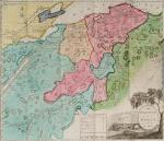
[Millar, A Survey of the Province of Moray; Historical, Geographical, and Political.

55. Handcoloured Map Art of 18th century Scotland – [Millar, William] / [Grant, John] / [Leslie, William] Forsyth, Isaac / [Hugh Houstoun].

A Survey of the Province of Moray; Historical, Geographical, and Political. [Inscribed and dedicated by scottish Mapmaker William Millar / Including the amazing, large Map of Moray and the Nairn Shires by William Millar (51 cm x 49 cm) and the engraving of “Elgin Cathedral” (also by William Millar)].

First Edition. Aberdeen, Printed for Isaac Forsyth, Bookseller, Elgin, 1798. Octavo (14 cm x 21,5 cm). Folded, hand-coloured Frontispiece-Map by William Millar, Frotispiece-Engraving of the “Elgin Cathedral” , VIII, 353 pages. Original Hardcover / Original 18th or early 19th century leather with original spinelabel. The large, hand-coloured Map with a minor tear only. Corners slightly bumped. Spine slightly starting but overall in excellent condition with some minor signs of wear only. Interesting Provenance and signed manuscript dedication by the Cartographer and Mapmaker William Millar: From the library of Aberdeen Highlander, Major Hugh Houstoun, with a dedication: “April 27th, 1798 – To Major Hugh Houstoun – from his Much obliged and Humble Servant William Millar”.

EUR 1.400,-- 

Show details   Add to cart

Barrow, Voyage dans la partie meridionale de l'Afrique

56. Barrow, John.

Voyage dans la partie meridionale de l’Afrique; fait dans les années 1797 et 1798; par John Barrow, Ex-Secretaire de Lord Macartney…Contenant des observations sur la géologie, la géographie, l’histoire naturelle de ce continent, et une esquisse du caractère physique et moral des diverses races d’habitans qui environnent l’Etablissement du Cap de Bonne-Espérance. / Accompagné: Nouveau Voyage dans la partie méridionale de l’Afrique; Où l’on examine quelle est l’importance du Cap de Bonne-Espérance pour les différentes puissances de l’Europe, considéré comme station militaire et navale; comme boulevart du commerce et de la domination des Anglais dans l’Inde; comme centre des établissemens pour la pêche de la baleine dans les mers Australes; comme acquisition territoriale, et comme entrepôt commercial en tems de paix. Accompagné d’une description statistique de la colonie rédigée sur les documens les plus hautentiques, enrichi de huit belles cartes, contenat celle de la Côte d’Afrique depuis la baie de la Table jusqu’a la baie de Saldanha, des cartes de la baie de Pletenberg, d’Algola, de Mossel et de False bay; du plan militaire de la péninsule du Cap, et de ceux de la baie de la Table et du Knisna. (2 Volumes).

First French Edition. 4 Volumes [complete set of two works with 2 Volumes each]. Paris, Dentu, 1801-1806. 35.5 cm x 55.8 cm. Collation: complete. Pagination: Volume I: XVI, 403, (1) pages / Volume II: 326, (2) pages including Errata-leaf / Volume III: X, 310 pages / Volume IV: 312 pages. Original contemporary red calf with gilt lettering and ornament to lacquer-polished-spine. The Volumes are numbered consecutively, even though these are two separate works. Excellent condition of the binding and interior of this important publication with very minor signs of foxing only ! All the maps in wonderful condition ! First french edition of “Travels into the Interior of Southern Africa” (Barrow’s journey with Lord Macartney in 1797 to the Cape of Good Hope) plus two further Volumes which describe the second journey in 1801 / 1802 to Saldanha Bay [Saldanhabaai] with an early image of Robben Island. The survey of the Dutch colonies was not only a seminal work on South Africa but the beautifully engraved, large folding map of South Africa was a turning point of african cartography and geographical illustration.

EUR 1.480,-- 

Show details   Add to cart

John Campbell, Lives of the Admirals, And other eminent British Seamen

57. Campbell, John.

Lives of the Admirals, And other eminent British Seamen; containing Their Personal Histories, and a Detail of all their Public Services. Including A new and accurate Naval History, from the earliest Account of Time; and clearly proving by a continued Series of Facts, our uninterrupted Claim to, and Enjoyment of, the Dominion of our Seas. Interspersed With many curious Passages, relating to our Discoveries, Plantations and Commerce. Supported throughout by proper Authorities.

The Third Edition. In Four Volumes (complete set). London, Printed for T.Osborne, C.Hitch and L.Hawes, H.Woodfall, J.Rivington and others, 1761. Octavo (13.5 cm x 20.5 cm). Pagination [see full list of maps and portraits below the description]: Volume I: 587 pages with one folded map and two portraits / Volume II: 580 pages with one folded map and two portraits / Volume III: 488 pages with two fold-out maps / Volume IV: 519 pages with two fold-out maps. Hardcover / Original 18th century – calf with gilt ornament and original spine-labels [of which one spine-label has been recently replaced in matching style]. Bindings all firm and with only minor signs of wear and bunping to top and bottom of spine’s. Interior, Maps and Portraits all in excellent condition. Very inor, faded dampstain to the outer margins of some pages of Volume III. From the library of Daniel Conner (Connerville / Manch House), with his Exlibris / Bookplate to pastedown.

EUR 1.480,-- 

Show details   Add to cart

Payne, A New and Complete System of Universal Geography; Describing Asia, Africa

58. Payne, John / Hardie, James / Provenance I: Signature of J.J. Westervelt [Jacobus James Westervelt (1755 – 1826) – Schraalenberg and Provenance II: Charles Sydney Clark (1925) presented this set to Johnson Free Public Library at Hackensack, New Jersey].

A New and Complete System of Universal Geography [Complete with all 20 maps / illustrations] ; Describing Asia, Africa, Europe and America; with their Subdivisions of Republics, States, Empires and Kingdoms : The Extent, Boundaries and Remarkable Appearances of each Country; Cities, Towns and Curiosities of Nature and Art. Also giving a general account of The Fossil and Vegetable Productions [with hand-coloured plates] of the Earth. The History of Man, In all Climates, Regions and Conditions; Customs, Manners, Laws, Governments and Religions: The State of Arts, Sciences, Commerce, Manufactures and Knowledge. Sketches of the Ancient and Modern History of each Nation and People to the present time. To which is added, A View of Astronomy, As connected with Geography; Of the Planetary System to which the Earth belongs; And of the Universe in General. With a copious Index annexed to each Volume. Being a Large and Comprehensive Abridgement of Universal Geography. By John Payne. With additions, corrections and Improvements from the latest and best authors by James Hardie – Author of “The Principles of Latin Grammar”, “The American Remembrancer” and “Universal Tablet of Memory” &c. In Four Volumes.

First Abridged Edition. Volumes I [Asia] and II [Africa] (of IV). New York, Printed for and Sold by John Low, Book-Seller at The Shakespeare – Head, No.332 Water-Street, 1798 – 1799. Octavo – Edition. Pagination: Volume I [Asia]: Folded Frontispiece (Map of the World), XLVIII, 518 pages plus 10 unnumbered pages of an Index and one additional page with Directions for the Bookbinder for placing the maps and illustrations as well as Errata. Volume I includes all 10 Maps / Engravings as called for / Volume II [Africa]: Folded Frontispiece (Map of Africa), 578 pages plus 12 unnumbered pages of an Index plus one additional page with Directions for the Bookbinder for placing the maps and illustrations as well as Errata. Volume II includes all 10 Maps / Engravings as called for. Hardcover / Modern Library – Binding with the original 18th century – work bound in. Former library copy of Bergen County Historical Society (cancelled) and Johnson Free Public Library in Hackensack, New Jersey, with a very boring, modern library binding and library cards applied to the endpapers only, leaving the bookblock with text and maps and illustrations entirely untouched from any library-signs. Very good condition with some signs of external wear.

EUR 1.480,-- 

Show details   Add to cart

Denon, Travels in Upper and Lower Egypt, During the Campaigns of General Bonaparte.

59. Denon, Vivant / Kendal, E.A.

Travels in Upper and Lower Egypt, During the Campaigns of General Bonaparte. Translated from the French. To which is prefixed, An Historical Account of the Invasion of Egypt by the French. By E.A. Kendal, Esq. Illustrated by Maps, Views &c. &c.

First english language edition of this important work. In two Volumes (complete set with all illustrations). London, Printed by J. Cundee for B. Crosby and Co., 1802. Octavo (14 cm x 21 cm). Volume I: Frontispiece, LXX, 264 pages / Volume II: 285 pages plus 42 unnumbered pages of Appendix and Index, also including Errata and one page of advertising for “Books printed for B.Crosby and Co.”. Hardcover / Recently rebacked original 19th-century leather with the new spines bound to style with gilt lettering and ornament. Original boards preserved. Beautifully restored set in firm and excellent condition. Page VII of Volume One loosened. The maps and engravings in unusually excellent condition. From the library of Richard Meade (Ballymartle), with his Exlibris / Bookplate to pastedown of each Volume.

EUR 1.800,-- 

Show details   Add to cart

Baert-Duholant, Tableau de la Grande-Bretagne, De L'Irlande et des Possessions Angloises dans les quatre parties du Monde.

60. Baert-Duholant, Charles-Alexandre-Balthazar-François de Paule baron de / Jean-Denis Barbié du Bocage.

Tableau de la Grande-Bretagne, De L’Irlande et des Possessions Angloises dans les quatre parties du Monde. [With five (5) large, folded Maps by Jean-Denis Barbié du Bocage: Large, oblong folded Map/Plan of Gibraltar / England / Scotland / Ireland / India] / [With four (4) stunning copper-engravings: Grotte de Fingal, Chaussée des Géants / Plan et vue de Gibraltar / Combat de Boxe (Pugilists)] / [With two (2) portraits: 1.Portrait of William Pitt (after William Owen) and 2. Portrait of Charles Jacques Fox (after Karl Anton Hickel)].

Four Volumes (complete set). Paris, Chez H.J.Jansen, L’An 8me [1800]. Octavo (20 cm x 13.5 cm). Collation: Volume I: (8), 459, (1), 11 pages with Eleven (11) copper-engravings of which are: 5 Maps / Plans and 4 Engravings: The folded view of Fingals Cave (″Grotte de Fingal dans l’Ile de Staffa” – (19.5 cm x 31 cm) / “Folded Plate of the Giants Causeway (″Vue occidentale de la Chaussee des Geans et des Caps voisins” (19.5 cm x 31 cm)) / Fantastic, large Map/Plan of Gibraltar by Jean-Denis Barbié du Bocage, with a Birds-Eye-View of the Ville de Gibraltar (19.5 cm x 63.5 cm) [also showing the Ville Irlandaise on Gibraltar] / Scenic View of Gibraltar (″Vue de Gibraltar, prise du cote de l’Espagne” (19.5 cm x 32 cm) / Large Fold-Out-Map of England by Jean-Denis Barbié du Bocage with an Inset-View of Stonehenge (43 cm x 48.5 cm) / Large Fold-Out-Map of Scotland by Jean-Denis Barbié du Bocage, including the Western Isles and Shetland, with a stunning Inset-View of the irish pilgrimage-mountain Croagh Patrick [Craig-Phadrick] in Westport, Ireland (33 cm x 39 cm)/ Large Fold-Out-Map of Ireland with an Inset-View of the Lakes of Killarney (36 cm x 40.5 cm) / Volume II: 532, (1), 12 pages with Large Fold-Out-Map of India (″Possessions Anglaises”) by Jean-Denis Barbié du Bocage – the large India-Map showing areas as far as Tibet, Siam, Sumatra and the Andaman Islands, Ceylon, Burma (53.5 cm x 40.5 cm) / Volume III: 502, 48, (2) pages with two portraits: Guillaume Pitt [William Pitt] & Charles Jacques Fox (each 19.5 cm x 12 cm)/ Volume IV: 486, 22, (2) pages with the very famous Fold-out-Illustration of Pugilists / Boxers at Odiham in Hampshire [″Combats de Boxers a Odiham”] showing a boxing-match between Humphrey and Mendoza (29.5 cm x 19.5 cm). Hardcover / Original, very decorative original half leather bindings with gilt lettering and ornament on spine. All four Volumes in protective Collector’s Mylar. Very good condition with only minor signs of external wear. Very minor wormhole-damage to a few pages.

EUR 2.200,-- 

Show details   Add to cart

Page: 1 2 3 4 5 6 7
:

Order by: Author · Title · Keyword · Year · Price (up) · Price (down) · Inventory Number · Recent Changes · Relevance

Books per page: 10 · 20 · 50 · 100

Contact

Inanna Rare Books Ltd.
Woodley House
Castletownshend Road
P81 D262 Skibbereen, County Cork
Ireland
Phone: ++353 - (0) 87 - 102 5412
E-Mail: info@inannararebooks.com
Internet: https://www.inannararebooks.com

Online Bookshop specialized in rare
and secondhand books.

Newsletter and E-Catalogue Sign Up

Enter your name and e-mail address to sign up for
our regular newsletter and catalogue service.

Payment Options

Paypal   Master Card   VISA   American Express

Legal Info

  • Terms & Conditions
  • Return Policy
  • Privacy Policy
  • Shipping Information
  • Imprint

© 2025 Inanna Rare Books Ltd. | Powered by HESCOM-Software