West Cork Rare BookfairINANNA MODERNWest Cork Reading Holidays
We ship per DHL Express

We ship per DHL Express

Books with vintage Maps (54 items)

Shuckford, The Sacred and Profane History of the World connected

27. Shuckford, Samuel.

The Sacred and Profane History of the World connected, Frome the Creation of the World to the Dissolution of the Assyrian Empire at the Death of Sardanapalus, and to the Declension of the Kingdoms of Judah and Israel, under the Reigns of Ahaz and Pekah. [Together with: “The Creation and Fall of Man” – “A Supplemental Discourse to the Preface of the First Volume of the Sacred and Prophane History of the World connected”].

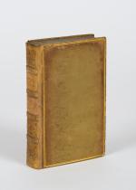
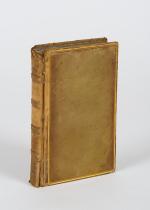
The Third Edition. 3 Volumes (of 4). London, Printed for J. and R. Tonson and S. Draper in the Strand, 1753. Octavo. LXIV,366, [10], LV, 461, [10], CXXXII, 295, [16] pages. Each Volume with its own Index. Includes two folded maps in Volume One: First Map: “A Plan of the present Chanels [sic] of the Rivers Hiddekel or Tigris and Euphrates exhibiting the Site of Moses Garden and River of Eden” / Second Map: “The Situation of the Land & Garden of Eden together with the Rivers of Paradise as they are imagined to have been Situate by some Writers who thought that the Garden of Eden was planted in that which was afterwards called the Holy Land”. Original Hardcover / 18th century full leather with new spinelabels. All three Volumes are now in protective Mylar. with dustjacket. All Volumes with some damage to spine but all still firm and holding. Overall some faint staining and foxing only at very few locations because of the excellent paper-quality of this publication. From the library of Daniel Conner (Connerville / Manch House), with his Exlibris / Bookplate to pastedown.

EUR 480,-- 

Show details   Add to cart

Derham, Astro-Theology: or, a Demonstration of the Being and Attributes of God,

29. Derham, William [Philosopher and Scientist] / [John Senex (Cartographer)].

Astro-Theology: or, a Demonstration of the Being and Attributes of God, From a Survey of the Heavens [Including a Chapter on the “Attraction of Gravity”].

Sixth Edition. London, W. Innys, 1731. Octavo. [16], LVI, [8], 246 pages,[10 pages of Index], [with 3 astronomical foldout engravings by english Cartographer and Explorer John Senex / The Engravings show the Ptolemaic Geocentric System with the Earth as centre of the Universe and discuss other models as well by pointing to pages within the text that reflect on the illustrations / Two of the Engravings are showing the Stars and Constellations over Europe, the Mediterranean, Asia Minor, Asia etc.]. ]. Original Hardcover / bound in contemporary panelled calf. The book has been sympathetically rebacked to style. Besides a spot of hard green adhesive to the front board in very good condition. The armorial 18th century bookplate of one Dr. Blackett appears on the first pastedown [″A coat of arms divided into three portions, with three stars and three scallop shells throughout. At the helm is the head of an eagle, and elaborate mantling, flowers, and leaves surround the crest. Below is the motto ‘Nous Travailler ons dans L’Esperance’”] / The text of this rare and notoriously underrated book is complete and clean with the three foldout engravings of the cosmos to the rear with only a small archival paper restoration to one of the engravings.

EUR 680,-- 

Show details   Add to cart

Daniel Paterson & Edward Mogg - Paterson's Roads [1831/1832 Edition (18th Edition) with 12 Maps]

30. [Paterson, Daniel] Mogg, Edward.

Paterson’s Roads [1831/1832 Edition (18th Edition)] – Being an entirely original and accurate Description of all the direct and Principal Cross Roads in England and Wales, with part of the roads of Scotland. [Including an “Appendix to the Eighteenth Edition of Paterson’s Roads; being An Accurate Description of the Direct and Principal Cross roads communicating with the Improved Old Passage Ferry, across the River Severn, between Aust and Beachley, near Chepstow. Accompanied by a Map of the Banks of the Wye. To which are added, Course of the Chepstow Steam Packets; and An arranged Tour through Wales, with References to the pages in the Body of the Work, where connection with various lines of Road takes place.”]. The Eighteenth Edition. To which are added Topographical Sketches of the several Cities, Market Towns and remarkable Villages and descriptive accounts of the principal seats of the Nobility and Gentry, the Antiquities, Natural Curiosities and other Remarkable Objects throughout the Kingdom. The whole Remodelled, Augmented and Improved by the Addition of Numerous New Roads and New Admeasurements, and Arranged upon A Plan at once Novel, clear and intelligible, is deduced from the latest and best Authorities: Including a Table of the Heights of Mountains from the Grand Trigonometrical Survey of the Kingdom; Also a Table of the Population, From the Census of 1831; To which is annexed the Arrival and Departure of the Mail, together with the Rates of Postage and An Entirely New Set of Maps.

London, Printed for Longman, Rees, Orme, Brown, Green and Longman, 1831/1832. Octavo (15 cm x 21,5 cm). Fontispiece – Fold-out-Map, 715 pages plus 44 pages of an Appendix. With twelve (12) Maps, including the frontipiece-map and full-page maps throughout the publication. Hardcover / Private half-leather of the early 20th century with gilt lettering on the spine. Some of the maps with visible reapirs but complete. Very good condition with only minor signs of wear. This being the so-called “Best Edition”.

EUR 750,-- 

Show details   Add to cart

Page: 1 2 3 4 5 6
: