Books with vintage Maps (64 items)

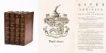
John Campbell, Lives of the Admirals, And other eminent British Seamen

53. Campbell, John.

Lives of the Admirals, And other eminent British Seamen; containing Their Personal Histories, and a Detail of all their Public Services. Including A new and accurate Naval History, from the earliest Account of Time; and clearly proving by a continued Series of Facts, our uninterrupted Claim to, and Enjoyment of, the Dominion of our Seas. Interspersed With many curious Passages, relating to our Discoveries, Plantations and Commerce. Supported throughout by proper Authorities.

The Third Edition. In Four Volumes (complete set). London, Printed for T.Osborne, C.Hitch and L.Hawes, H.Woodfall, J.Rivington and others, 1761. Octavo (13.5 cm x 20.5 cm). Pagination [see full list of maps and portraits below the description]: Volume I: 587 pages with one folded map and two portraits / Volume II: 580 pages with one folded map and two portraits / Volume III: 488 pages with two fold-out maps / Volume IV: 519 pages with two fold-out maps. Hardcover / Original 18th century – calf with gilt ornament and original spine-labels [of which one spine-label has been recently replaced in matching style]. Bindings all firm and with only minor signs of wear and bunping to top and bottom of spine’s. Interior, Maps and Portraits all in excellent condition. Very inor, faded dampstain to the outer margins of some pages of Volume III. From the library of Daniel Conner (Connerville / Manch House), with his Exlibris / Bookplate to pastedown.

EUR 1.000,-- 

Show details   Add to cart

Johannes Justus Rein, Japan nach Reisen und Studien im Auftrage der Königlich Preussischen Regierung dargestellt

57. Rein, J.J. [Johannes Justus] / [Provenienz / Provenance: Max von Baden / Bibliothek Schloss Salem].

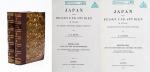
Japan nach Reisen und Studien im Auftrage der Königlich Preussischen Regierung dargestellt von J.J. Rein [Johannes Justus Rein], Professor der Geographie in Marburg [an der Lahn]. Erster Band: Natur und Volk des Mikadoreiches. Mit 5 Lichtdruckbildern [Photographien], 12 Holzschnitten, 3 Lithographischen Tafeln und 2 Karten. / Zweiter Band: Land- und Forstwirthschaft, Industrie und Handel. Mit zum Theil farbigen Tafeln, 20 Holzschnitten im Text und 3 Kaertchen.

Erste Ausgabe [First Edition]. Two Volumes. Leipzig, Verlag von Wilhelm Engelmann, 1881 – 1886. Gross-Oktav. Band I: XII, [1], 630 Seiten mit allen Abbildungen und insbesondere der Original-Photographie von Nagasaki aber ohne die “Orographish-hydrographische Karte [Japans]” am Schluss des Bandes. / Band II: XII, 678 Seiten mit den drei Falt-Karten von Japan am Schluss des Bandes . Hardcover / Original 19th century half-leather with gilt lettering and ornament to spine. / Originale Verlags-Leinenbaende. Ehemalige Exemplare der “Bibliothek Salem” und ehemaliges “Eigenthum des Prinzen Wilhelm”, mit zwei dezenten Bibliotheksschildchen der Bibliothek Salem im Innendeckel und dem Stempel des Prinzen Max von Baden [″MB” mit Krone] auf den Titelseiten. Very good condition with only minor signs of wear and only the two folded Maps missing / Sehr guter Zustand des seltenen Werks und mit nur wenigen Stockfleckchen, wie ueblich auf den Rueckseiten des Photo-papiers und Abklatsch auf den Seiten verso. Aus dem Vorwort: “Saemtliche Illustrationen dieses Buchs sind Originale – Bonn, im September 1886 – Der Verfasser”.

EUR 1.000,-- 

Show details   Add to cart

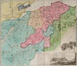
Barrow, Voyage dans la partie meridionale de l'Afrique

58. Barrow, John.

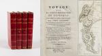
Voyage dans la partie meridionale de l’Afrique; fait dans les années 1797 et 1798; par John Barrow, Ex-Secretaire de Lord Macartney…Contenant des observations sur la géologie, la géographie, l’histoire naturelle de ce continent, et une esquisse du caractère physique et moral des diverses races d’habitans qui environnent l’Etablissement du Cap de Bonne-Espérance. / Accompagné: Nouveau Voyage dans la partie méridionale de l’Afrique; Où l’on examine quelle est l’importance du Cap de Bonne-Espérance pour les différentes puissances de l’Europe, considéré comme station militaire et navale; comme boulevart du commerce et de la domination des Anglais dans l’Inde; comme centre des établissemens pour la pêche de la baleine dans les mers Australes; comme acquisition territoriale, et comme entrepôt commercial en tems de paix. Accompagné d’une description statistique de la colonie rédigée sur les documens les plus hautentiques, enrichi de huit belles cartes, contenat celle de la Côte d’Afrique depuis la baie de la Table jusqu’a la baie de Saldanha, des cartes de la baie de Pletenberg, d’Algola, de Mossel et de False bay; du plan militaire de la péninsule du Cap, et de ceux de la baie de la Table et du Knisna. (2 Volumes).

First French Edition. 4 Volumes [complete set of two works with 2 Volumes each]. Paris, Dentu, 1801-1806. 35.5 cm x 55.8 cm. Collation: complete. Pagination: Volume I: XVI, 403, (1) pages / Volume II: 326, (2) pages including Errata-leaf / Volume III: X, 310 pages / Volume IV: 312 pages. Original contemporary red calf with gilt lettering and ornament to lacquer-polished-spine. The Volumes are numbered consecutively, even though these are two separate works. Excellent condition of the binding and interior of this important publication with very minor signs of foxing only ! All the maps in wonderful condition ! First french edition of “Travels into the Interior of Southern Africa” (Barrow’s journey with Lord Macartney in 1797 to the Cape of Good Hope) plus two further Volumes which describe the second journey in 1801 / 1802 to Saldanha Bay [Saldanhabaai] with an early image of Robben Island. The survey of the Dutch colonies was not only a seminal work on South Africa but the beautifully engraved, large folding map of South Africa was a turning point of african cartography and geographical illustration.

EUR 1.200,-- 

Show details   Add to cart

Baert-Duholant, Tableau de la Grande-Bretagne, De L'Irlande et des Possessions Angloises dans les quatre parties du Monde.

59. Baert-Duholant, Charles-Alexandre-Balthazar-François de Paule baron de / Jean-Denis Barbié du Bocage.

Tableau de la Grande-Bretagne, De L’Irlande et des Possessions Angloises dans les quatre parties du Monde. [With five (5) large, folded Maps by Jean-Denis Barbié du Bocage: Large, oblong folded Map/Plan of Gibraltar / England / Scotland / Ireland / India] / [With four (4) stunning copper-engravings: Grotte de Fingal, Chaussée des Géants / Plan et vue de Gibraltar / Combat de Boxe (Pugilists)] / [With two (2) portraits: 1.Portrait of William Pitt (after William Owen) and 2. Portrait of Charles Jacques Fox (after Karl Anton Hickel)].

Four Volumes (complete set). Paris, Chez H.J.Jansen, L’An 8me [1800]. Octavo (20 cm x 13.5 cm). Collation: Volume I: (8), 459, (1), 11 pages with Eleven (11) copper-engravings of which are: 5 Maps / Plans and 4 Engravings: The folded view of Fingals Cave (″Grotte de Fingal dans l’Ile de Staffa” – (19.5 cm x 31 cm) / “Folded Plate of the Giants Causeway (″Vue occidentale de la Chaussee des Geans et des Caps voisins” (19.5 cm x 31 cm)) / Fantastic, large Map/Plan of Gibraltar by Jean-Denis Barbié du Bocage, with a Birds-Eye-View of the Ville de Gibraltar (19.5 cm x 63.5 cm) [also showing the Ville Irlandaise on Gibraltar] / Scenic View of Gibraltar (″Vue de Gibraltar, prise du cote de l’Espagne” (19.5 cm x 32 cm) / Large Fold-Out-Map of England by Jean-Denis Barbié du Bocage with an Inset-View of Stonehenge (43 cm x 48.5 cm) / Large Fold-Out-Map of Scotland by Jean-Denis Barbié du Bocage, including the Western Isles and Shetland, with a stunning Inset-View of the irish pilgrimage-mountain Croagh Patrick [Craig-Phadrick] in Westport, Ireland (33 cm x 39 cm)/ Large Fold-Out-Map of Ireland with an Inset-View of the Lakes of Killarney (36 cm x 40.5 cm) / Volume II: 532, (1), 12 pages with Large Fold-Out-Map of India (″Possessions Anglaises”) by Jean-Denis Barbié du Bocage – the large India-Map showing areas as far as Tibet, Siam, Sumatra and the Andaman Islands, Ceylon, Burma (53.5 cm x 40.5 cm) / Volume III: 502, 48, (2) pages with two portraits: Guillaume Pitt [William Pitt] & Charles Jacques Fox (each 19.5 cm x 12 cm)/ Volume IV: 486, 22, (2) pages with the very famous Fold-out-Illustration of Pugilists / Boxers at Odiham in Hampshire [″Combats de Boxers a Odiham”] showing a boxing-match between Humphrey and Mendoza (29.5 cm x 19.5 cm). Hardcover / Original, very decorative original half leather bindings with gilt lettering and ornament on spine. All four Volumes in protective Collector’s Mylar. Very good condition with only minor signs of external wear. Very minor wormhole-damage to a few pages.


EUR 1.280,-- 

Show details   Add to cart

Nathaniel Hooke - The Roman History, From the Building of Rome to the Ruin of the Commonwealth

60. Hooke, Nathaniel.

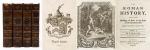
The Roman History, From the Building of Rome to the Ruin of the Commonwealth [with the printed Dedication to Alexander Pope]. Illustrated with 17 folding Maps, 4 Fontispieces and 11 other Plates [32 copper-engravings in total].

The Fourth Edition. Four Volumes (complete set with all maps and plates). London, Printed for J. and R. Tonson; Hawkins and T.Longman, 1766 – 1771. Quarto (27 cm x 22 cm). Collation: Volume I: Frontispiece, XLVI, XLVI, 634 pages with 10 plates and 3 maps / Volume II: Frontispiece, XXXII, XXXII, 668 pages with 8 maps / Volume III: Frontispiece, VI, 694 pages with 5 maps / Volume IV: Frontispiece, VII, 464 pages plus 76 unnumbered pages of a General Index and 1 plate and 1 map. Hardcover / Original 18th-century leather with gilt lettering and labels on spine. Interior of this set with all maps and illustrations in excellent, very clean condition. The boards of the bindings with abrasions and some bumping but overall very firm. Some stronger peeling of the leather on board of Volume I, Only three pages with minor tears. The large map of Northern Africa (Palestine, Egypt and Libya) with a minor tear. The stunning maps and plates in timeless beauty. Highly underestimated work, in the shadow of Gibbon but with meticulous detail in presenting the geographical impact of the Roman Conquest. From the library of Daniel Conner (Connerville / Manch House), with his Exlibris / Bookplate to pastedown.

EUR 1.280,-- 

Show details   Add to cart

Page: 1 2 3 4 5 6 7
: