

Catalogue Summer 2020 (34 items)

Jean-Denis Barbié du Bocage - Tableau de la Grande-Bretagne, De L'Irlande et des Possessions Angloises dans les quatre parties du Monde. [Large Paper Copy / Better Paper Copy / Exemplaire de Luxe]

11. Pugilism (Boxing) – Baert-Duholant, Charles-Alexandre-Balthazar-François de Paule baron de / Jean-Denis Barbié du Bocage.

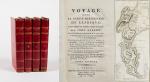
Tableau de la Grande-Bretagne, De L’Irlande et des Possessions Angloises dans les quatre parties du Monde. [Large Paper Copy / Better Paper Copy / Exemplaire de Luxe] [With five (5) large, folded Maps by Jean-Denis Barbié du Bocage: Large, oblong folded Map/Plan of Gibraltar / England / Scotland / Ireland / India] / [With four (4) stunning copper-engravings: Grotte de Fingal, Chaussée des Géants / Plan et vue de Gibraltar / Combat de Boxe (Pugilists)] / [With two (2) portraits: 1.Portrait of William Pitt (after William Owen) and 2. Portrait of Charles Jacques Fox (after Karl Anton Hickel)].

Four Volumes (complete set). Paris, Chez H.J.Jansen, L’An 8me [1800]. Octavo (21.5 cm x 14 cm). Collation: Volume I: (8), 459, (1), 11 pages with Eleven (11) copper-engravings of which are: 5 Maps / Plans and 4 Engravings: The folded view of Fingals Cave (″Grotte de Fingal dans l’Ile de Staffa” – (20.5 cm x 31.5 cm) / “Folded Plate of the Giants Causeway (″Vue occidentale de la Chaussee des Geans et des Caps voisins” (20.5 cm x 39 cm)) / Fantastic, large Map/Plan of Gibraltar by Jean-Denis Barbié du Bocage, with a Birds-Eye-View of the Ville de Gibraltar (20.5 cm x 65.5 cm) [also showing the Ville Irlandaise on Gibraltar] / Scenic View of Gibraltar (″Vue de Gibraltar, prise du cote de l’Espagne” (20.5 cm x 33 cm) / Large Fold-Out-Map of England by Jean-Denis Barbié du Bocage with an Inset-View of Stonehenge (47 cm x 51 cm) / Large Fold-Out-Map of Scotland by Jean-Denis Barbié du Bocage, including the Western Isles and Shetland, with a stunning Inset-View of the irish pilgrimage-mountain Croagh Patrick [Craig-Phadrick] in Westport, Ireland (37 cm x 50 cm)/ Large Fold-Out-Map of Ireland with an Inset-View of the Lakes of Killarney (39 cm x 44.5 cm) / Volume II: 532, (1), 12 pages with Large Fold-Out-Map of India (″Possessions Anglaises”) by Jean-Denis Barbié du Bocage – the large India-Map showing areas as far as Tibet, Siam, Sumatra and the Andaman Islands, Ceylon, Burma (48 cm x 43 cm) / Volume III: 502, 48, (2) pages with two portraits: Guillaume Pitt [William Pitt] & Charles Jacques Fox (each 20.5 cm x 12.5 cm)/ Volume IV: 486, 22, (2) pages with the very famous Fold-out-Illustration of Pugilists / Boxers at Odiham in Hampshire [″Combats de Boxers a Odiham”] showing a boxing-match between Humphrey and Mendoza (32 cm x 20.5 cm). Hardcover / Original, very decorative original half leather bindings with gilt lettering and ornament on spine. Volume One professionally rebacked by an english master bookbinder. All four Volumes in protective Collector’s Mylar. Excellent condition with only minor signs of external wear. From the library of François-Xavier de Valenzi with his bookplate / exlibris to the pastedowns of each Volume. Maps in this de Luxe Edition are all considerably larger than in the normal-paper-edition and all the maps and illustrations are in superb condition. An underestimated collectable.

EUR 1.280,-- 
Show details   Add to cart

Barrow, Voyage dans la partie meridionale de l'Afrique

12. Barrow, John.

Voyage dans la partie meridionale de l’Afrique; fait dans les années 1797 et 1798; par John Barrow, Ex-Secretaire de Lord Macartney…Contenant des observations sur la géologie, la géographie, l’histoire naturelle de ce continent, et une esquisse du caractère physique et moral des diverses races d’habitans qui environnent l’Etablissement du Cap de Bonne-Espérance. / Accompagné: Nouveau Voyage dans la partie méridionale de l’Afrique; Où l’on examine quelle est l’importance du Cap de Bonne-Espérance pour les différentes puissances de l’Europe, considéré comme station militaire et navale; comme boulevart du commerce et de la domination des Anglais dans l’Inde; comme centre des établissemens pour la pêche de la baleine dans les mers Australes; comme acquisition territoriale, et comme entrepôt commercial en tems de paix. Accompagné d’une description statistique de la colonie rédigée sur les documens les plus hautentiques, enrichi de huit belles cartes, contenat celle de la Côte d’Afrique depuis la baie de la Table jusqu’a la baie de Saldanha, des cartes de la baie de Pletenberg, d’Algola, de Mossel et de False bay; du plan militaire de la péninsule du Cap, et de ceux de la baie de la Table et du Knisna. (2 Volumes).

First French Edition. 4 Volumes [complete set of two works with 2 Volumes each]. Paris, Dentu, 1801-1806. 35.5 cm x 55.8 cm. Collation: complete. Pagination: Volume I: XVI, 403, (1) pages / Volume II: 326, (2) pages including Errata-leaf / Volume III: X, 310 pages / Volume IV: 312 pages. Original contemporary red calf with gilt lettering and ornament to lacquer-polished-spine. The Volumes are numbered consecutively, even though these are two separate works. Excellent condition of the binding and interior of this important publication with very minor signs of foxing only ! All the maps in wonderful condition ! First french edition of “Travels into the Interior of Southern Africa” (Barrow’s journey with Lord Macartney in 1797 to the Cape of Good Hope) plus two further Volumes which describe the second journey in 1801 / 1802 to Saldanha Bay [Saldanhabaai] with an early image of Robben Island. The survey of the Dutch colonies was not only a seminal work on South Africa but the beautifully engraved, large folding map of South Africa was a turning point of african cartography and geographical illustration.

EUR 1.200,-- 

Show details   Add to cart

Ireland (Carrick-A-Rede / Giant's Causeway

17. 19th century European Travel – Ireland (Carrick-A-Rede / Giant’s Causeway / Bideford (Devon) / Torrington (Devon) / Lynton (Devon) / Lynmouth (Devon) / Watersmeet (Devon) / Ilfracombe (Devon) / Carnarvon Castle (Wales) / Forth Bridge – (Wales)/

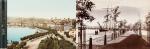
Original Photoalbum from ca. 1870 / 1880 with 37 original Albumen Print / Albumen Silver Print – Photographs of a Tour through Europe. With very interesting photographs of Ireland’s favourite attractions in County Antrim , a large section of the Devon Region in England (The DEVON – Section includes 15 photographs alone), and some beautiful and rare early colour photographs of Luzern in Switzerland: Examples of images: 8. Bideford in Devon (Promenade with ships and people) / 9. Torrington – Devon (Town Mill Bridge) / 10. Torrington – Devon (Northern Bridge) / Two smaller photographs on one board: 11. Torrington – Devon (Castle Ruins) / 12. Torrington – Devon – (Near Railway Station) / Two smaller photographs on board: 13. Torrington – Devon – (The Avenue) / 14. Torrington – Devon (Valley of Rocks / Castle Rock) / 15. Lynton – North Devon / 16. Lynton – North Devon (Castle Rock) / 17. Lynmouth – Watersmeet / 18. Lynmouth (Bridge /Watersmeet near Lynmouth) / 19. Lynmouth (Picturesque Harbourscene with old fisherhuts on left) / 20. Ilfracombe – North Devon (from the Tours Walk – Top of the Hill) / 21. Ilfracombe – Tour Walk / 22. Ilfracombe – View from Capstone Hill /

Devon, ca.1870/1880/1890. Oblong – Quarto. 37 plates. Hardcover. Recently, professionally rebound in half leather with gilt lettering on spine. The large photographs in very good condition.

EUR 380,-- 

Show details   Add to cart

Wohlgemuth - Die österreichische Polarstation Jan Mayen - Ausgerüstet durch seine Excellenz Graf Hanns Wilczek

19. First International Polar Year (1882-1883) – Wohlgemuth, Emil von.

Die österreichische Polarstation Jan Mayen – Ausgerüstet durch seine Excellenz Graf Hanns Wilczek. Geleitet von K.K. Corvetten-Capitän Emil Edlen von Wohlgemuth. Beobachtungs-Ergebnisse Herausgegeben von der Kaiserlichen Akademie der Wissenschaften. [Inklusive Ephemera] Band I – III (Komplett in vier Bänden mit dem eingebundenen Vorbericht zur Publikation welcher manchmal auch separat gebunden wurde: I. Band / II.Band 1. und 2. Abtheilung / III.Band).

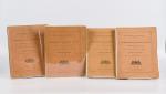
Erste und einzige Ausgabe. Wien, K. und K. Hof-und Staatsdruckerei in Commission bei Karl Gerold’s Sohn, 1886. Quarto (24.5 cm x 31.5 cm). Collation: Band I: 118 Seiten mit vier Falttafeln (Beobachtungsstation im Wilczeck-Thale / Sternwarte / Helligkeitsgrad der Polarnacht / Kreuzung / [Route] des S.M.Dampfer “Pola” laengs der Eiskante bei der Insel Jan Mayen (farbig) / ), 26, 50, 202, 76, 16,18 Seiten / Band II,1: 232 Seiten / Band II,2: 175 Seiten / Band III: X, 132, 24, 20 Seiten [The set includes 85 text-illustrations, 61 plates (some folded) and four maps (original lithographs of which one is in colour)]. Original publisher’s Hardcover-Boards, now in protective collector’s Mylar. [Inclusive grossformatiger Werbung zu den Druckschriften der kaiserlichen Akademie der Wissenschaften in Wien vom Jahre 1885] The boards of the thicker Volume One, as often, cleanly detached. All other Volumes in very good condition with only minor signs of external wear. Minor signs of foxing only. Unopened, unread version of this rare publication !

EUR 280,-- 

Show details   Add to cart

Svenska Turistföreningen, Turistföreningens Årsskrift.

20. Svenska Turistföreningen / [ edited by Boheman, Mauritz / Melander, Richard / Berg, Gustaf Ruben Gustafsson / Boheman, Ezaline / Fries, Carl].

Svenska Turistföreningens Årsskrift. [Nature perception and tourist life / Tourism and its Influence on Environment and many other topics on Ecology, Nature, Climate and Environmental Impacts in Sweden].

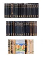
43 volumes. Stockholm, Wahlström & Widstrand, 1889, 1891-2, 1893-1914, 1916-1923, 1929-1940. 14.5 cm x 21.5 cm. Circa 17,500 pages. (1889) 256 pages; (1891-2) 403 pages; (1893) 304 pages; (1894-5) 169 pages;(1894) 387 pages; (1895) 474 pages; (1896) 309 pages; (1897) 368 pages; (1898) 444 pages; (1899) 443 pages; (1900) 422 pages; (1901) 461 pages; (1902) 447 pages; (1903) 447 pages; (1904) 463 pages; (1905) 439 pages; (1906) 402 pages; (1907) 446 pages; (1908) 438 pages; (1909) 493 pages; (1910) 462 pages; (1911) 415 pages; (1912) 407 pages; (1913) 404 pages; (1914) 441 pages; (1916) 450 pages; (1917) 382 pages; (1918) 381 pages; (1919) 341 pages; (1920-21) 783 pages; (1922) 397 pages; (1923) 398 pages; (1929) 354 pages; (1930) 366 pages; (1931) 366 pages; (1932) 376 pages; (1933) 387 pages; (1934) 407 pages; (1935) 438 pages; (1936) 395 pages; (1938) 399 pages; (1939) 383 pages; (1940) 395 pages. Numerous monochrome photographs throughout. 32 volumes in original Hardcover [Excellent, contemporary library Buckram with gilt lettering on spine]. Gilt embossment of Alpine Club Insignia on spine / Also: 12 of the volumes are original Softcovers with decoratively illustrated wrappers. Gilt top edge to the Volume covering the year 1900. Very good condition generally with only minor signs of external wear. Hardcovers- Externally, very smart with occasional very minor rubbing to the head and tail. Text block with dust-toned edges. Interior crisp and sharp cornered for the most part. Occasional foxing and some tanning throughout. Interiors unmarked. Volume for 1894-5 shows significant darkening to interior. Volumes for 1907 and 1917 show damp staining and damage to interior. Softcovers – Externally, very smart with occasional very minor rubbing to the head and tail and to corners. Interiors clean and bright. 1929 Volume, open tear to top corner of front board. Volumes for 1935 and 1937 show slight tears to spine but binding still firm and strong. Volume for1937 has detached front board and loose leaves near front. Former library copies – volumes carry subtle stamp of the Alpine Club on the preliminary pages.

EUR 1.800,-- 

Show details   Add to cart

Page: 1 2 3 4
: