


Secco, Portugallia et Algarbia qua olim Lusitania.
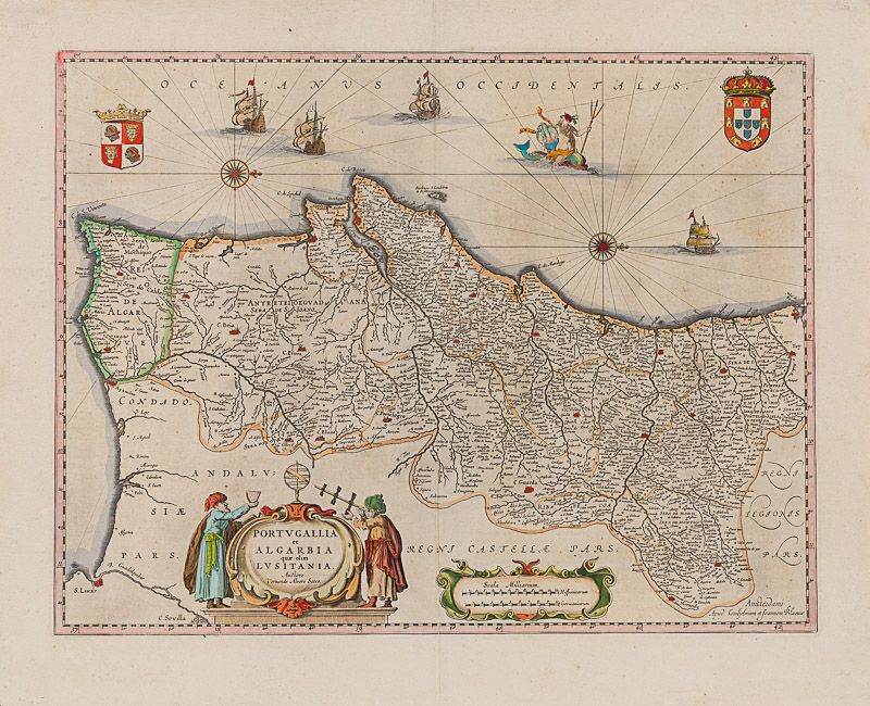
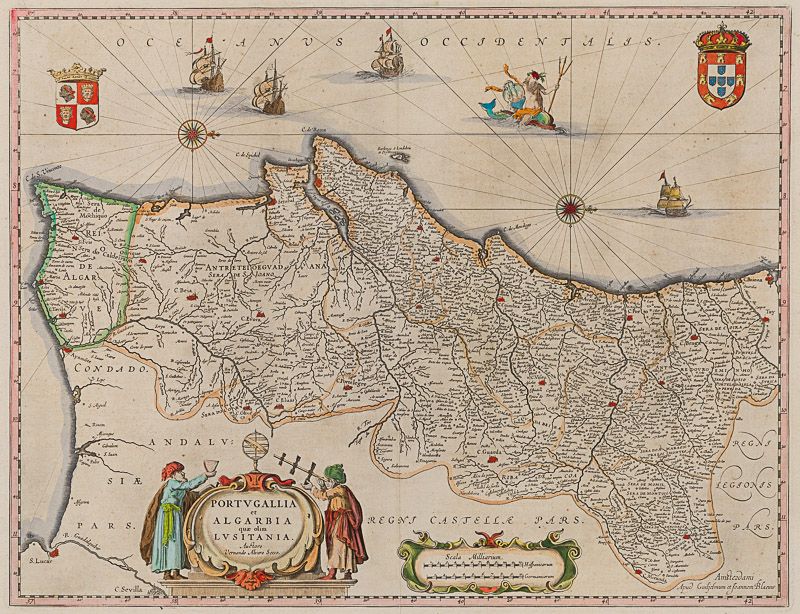
Portugallia et Algarbia qua olim Lusitania.
Original hand-coloured engraving. Amsterdam, Guiljelmum et Joannem Blaeu, [1640]. Plate Size: 49.6 cm x 38.1 cm. Sheet Size: 58 cm x 47 cm. Original map. Very good condition. Map orientated with north facing to the right. Some very minor traces of spotting near edges. Signs of foxing in top right corner of map. Minor chip and tear near lower left corner of sheet. Centre fold as issued. Latin text on reverse.
[Koeman II, 6300, “Parte septentrional do Reyno de Portugal”. By N. Sanson with P. Mariette, 1678; onde Coll. P. 104].
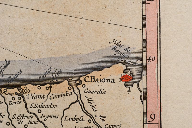
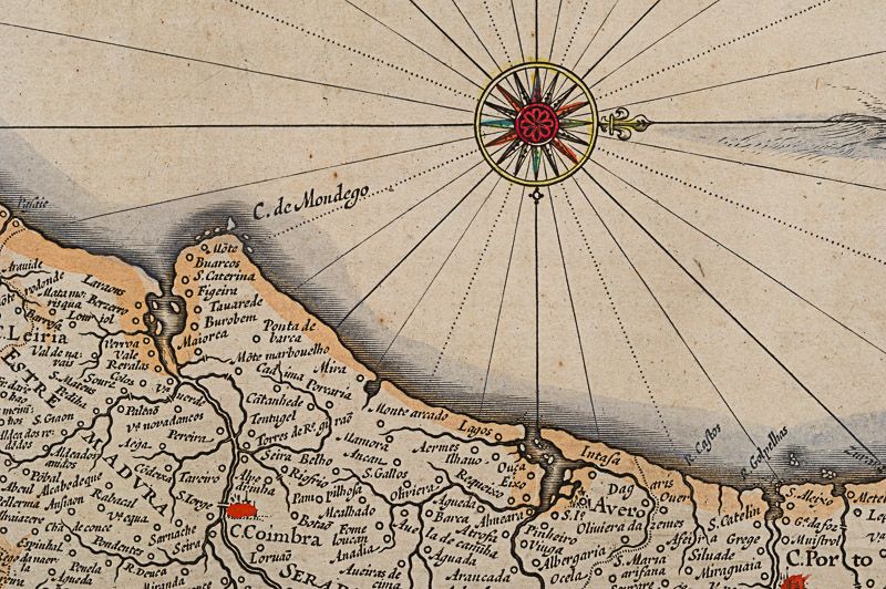
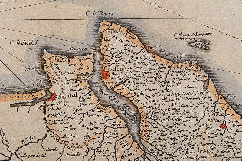
Border with longitudinal and latitudinal information. A richly detailed and very interesting map showing the Kingdom of Portugal and the Algarves. Relief shown pictorially with rivers, mountains and major and minor settlements depicted through keys. The kingdoms of the Algarves and Portugal are delineated – as are other internal political sub-divisions. The major urban centres are highlighted with red colouring.
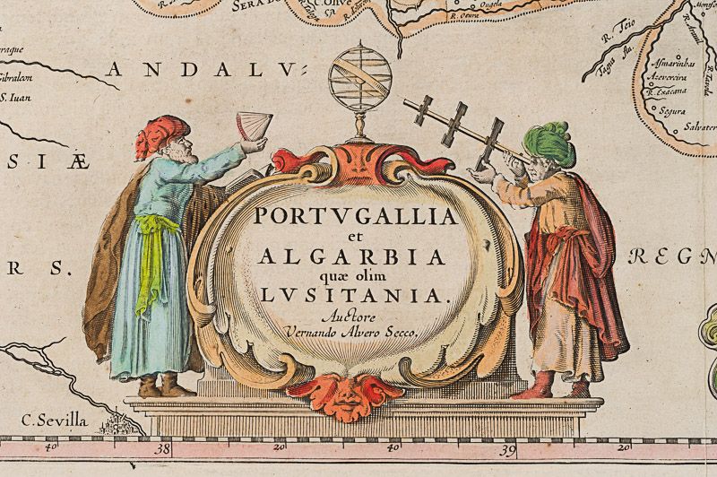
In the lower part of the map a decorative title cartouche is accompanied by two elaborately dressed scholars performing navigational exercises with their sextant and cross-staff: their gazes directed to the armillary sphere. Another cartouche encases a dual scale.
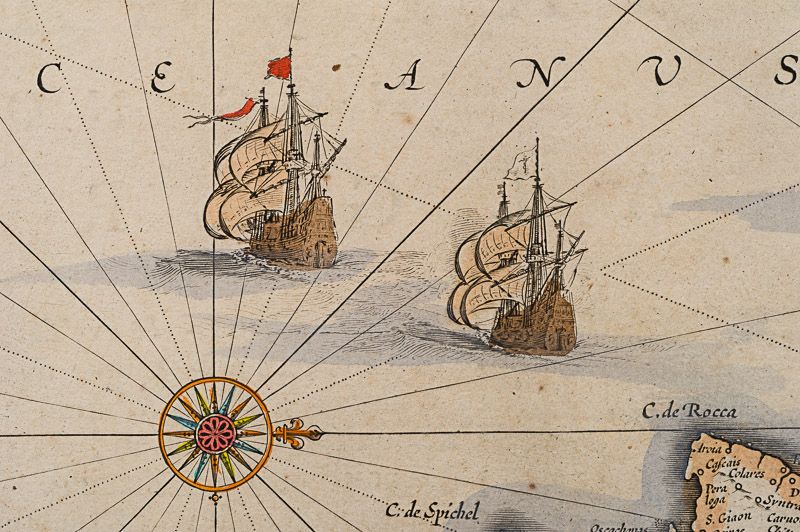
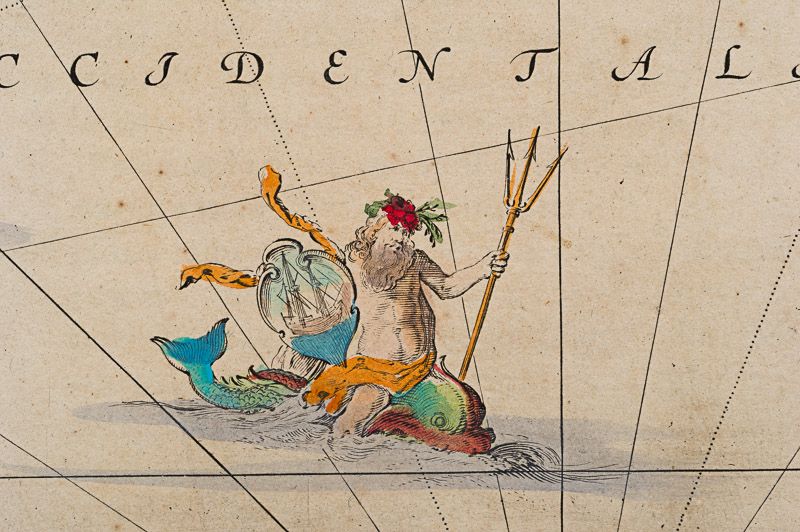
Off the coast 4 naval vessels are pictured, illustrating the rich maritime history and naval power of Portugal. Amid the ships a trident-wielding Neptune is depicted astride a Renaissance-style dolphin. The coat-of arms of the Kingdom of Portugal and the Algarves are pictured in the map’s top right and left corners respectively. Two ornamental orientation keys can also be seen just off the coast.
Fernando Alvares Seco (c.1561-85) was a Portuguese mathematician and cartographer who made the first known map of Portugal. It was engraved by Sebastiano del Re and published in Rome in 1561. Abraham Ortelius (1527-98) later reprinted the map in his Theatrum Orbis Terrarum (Theater of the world), which was first published in May 1570. (World Digital Library)
- Keywords: 17th Century · Algarves · Cartography · Catalogue No.5 – Maps of the World · Europe · Iberia · Map · Original Engraving · Original Map · Original Maps · Portugal · Rare Map Europe · Rare Map Portugal · Vintage Map
- Inventory Number: 200017AG
EUR 480,--
We ship per DHL Express
Contact
Inanna Rare Books Ltd.
Woodley House
Castletownshend Road
P81 D262 Skibbereen, County Cork
Ireland
Phone: ++353 - (0) 87 - 102 5412
E-Mail: info@inannararebooks.com
Internet: https://www.inannararebooks.com
Online Bookshop specialized in rare
and secondhand books.
Newsletter and E-Catalogue Sign Up
Payment Options


© 2024 Inanna Rare Books Ltd. | Powered by HESCOM-Software

