


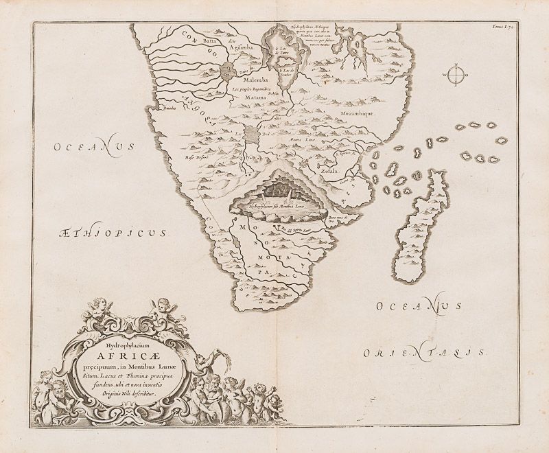
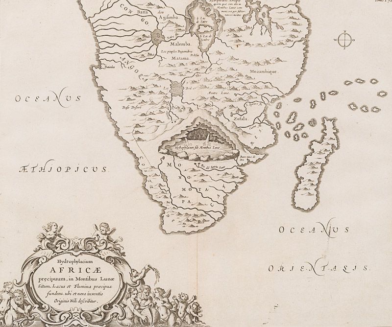
Kircher, Hydrophylacium Africae Precipuum, in Montibus Lunae Situm, Lacus et Flu
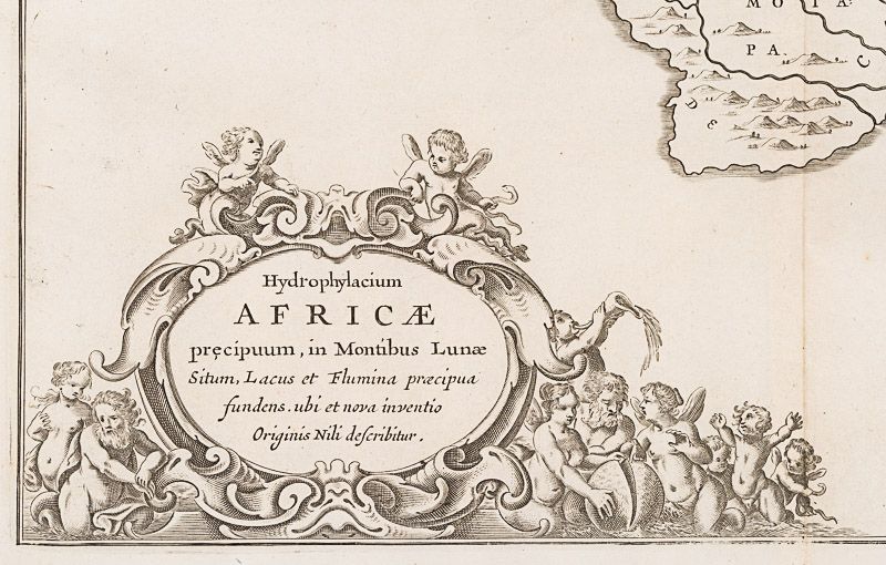
Hydrophylacium Africae Precipuum, in Montibus Lunae Situm, Lacus et Flumina Praecipua Sundens. Ubi et Nova Inventio Originis Nili describitur.
Original engraving. Amsterdam Kircher, [c.1665]. Plate Size: 41.5 cm x 34 cm. Sheet Size: 47.6 cm x 39.2 cm. Original map. In very good condition. Some very light traces of foxing near outer margins. Some very minor ink staining evident near ‘Oceanus Orientasis’ text. Otherwise, a very clean and bright map.
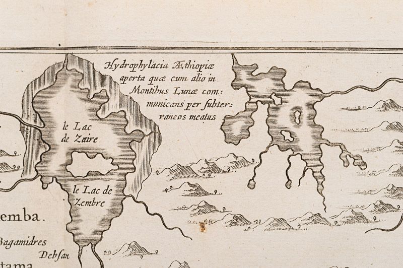
An elaborately detailed and richly imaginative map of southern Africa from the Congo/ ‘Le Lac de Zaire’ down to the Cape of Good Hope on the ‘Coste De Cafres’ and including Madagascar. River and mountain features engraved on map. ‘Oceanus Aethiopicus’ and ‘Oceanus Orientasis’ are also identifed. However the map stands out for the subterranean lake depicted underneath a mountain range at the centre of the map.
This is one of several maps prepared by Kircher to illustrate his unique hydro-geological theory. Kircher hypothesized that tides and currents are caused by water moving to and from a massive subterranean ocean. Kircher further postulated that water entered and exited the subterranean ocean via a number of great abysses situated around the globe. In addition, he believed that massive underground lakes lay beneath most of the world’s great mountain ranges – one such lake is apparent here and the obvious centerpiece of the map under the fabled Mountains of the Moon that were purported by the Ancients to be a possible source of the Nile.
The genesis of this map has its origin in an account of visiting a lake that was believed to be the Nile’s source left by a contemporary of Kircher, Peter Páez, a Jesuit explorer. Kircher copied the account and incorporated into his work, but made the imaginative leap of asserting that the Nile flows from a lake under the Mountains of the Moon. The map appeared in Kircher’s book, Mundus Subterraneus (The Subterranean World) that was first published in 1665 laying out his (pseudo-) scientific theories on hydro-geology.
Athanasius Kircher, (1602 – 1680) was a German Jesuit scholar and polymath who published around 40 major works, most notably in the fields of comparative religion, geology, and medicine. Kircher has been compared to fellow Jesuit Roger Boscovich and to Leonardo da Vinci for his enormous range of interests, and has been honoured with the title “Master of a Hundred Arts”. A refugee from the war-torn German territories, he taught for more than forty years at the Roman College, where he set up a museum-type cabinet of curiosities or wunderkammer. A resurgence of interest in Kircher has occurred within the scholarly community in recent decades. A scientific star in his day, towards the end of his life he was eclipsed by the rationalism of René Descartes and others. In the late 20th century, however, the aesthetic qualities of his work again began to be appreciated. One modern scholar, Alan Cutler, described Kircher as “a giant among seventeenth-century scholars”, and “one of the last thinkers who could rightfully claim all knowledge as his domain”. Another scholar, Edward W. Schmidt, referred to Kircher as “the last Renaissance man”. (Wikipedia)
- Keywords: 17th Century · Africa · Africa, Southern · Cartography · Catalogue No.5 – Maps of the World · Congo · Exploration · Fantasy · Geographers · Geography · Hydrology · Jesuit · Library & Collection Building · Map · Map, African · Nile · Original Engraving · Original Map · Original Maps · Rare Map Africa · Rare Maps Collection – Africa · Vintage Map
- Inventory Number: 200008AG


Contact
Inanna Rare Books Ltd.
Woodley House
Castletownshend Road
P81 D262 Skibbereen, County Cork
Ireland
Phone: ++353 - (0) 87 - 102 5412
E-Mail: info@inannararebooks.com
Internet: https://www.inannararebooks.com
Online Bookshop specialized in rare
and secondhand books.
Newsletter and E-Catalogue Sign Up
Payment Options


© 2026 Inanna Rare Books Ltd. | Powered by HESCOM-Software
Follow Us

