


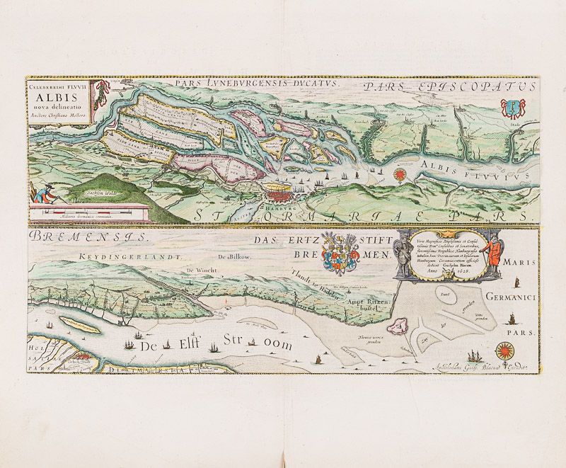
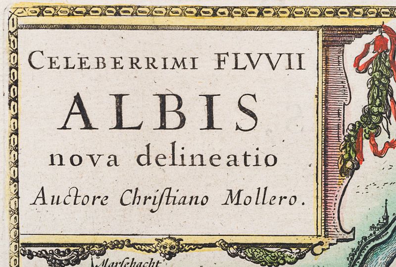
Blaeu, Celeberrimi Fluvii Albis nova Delineatio.
Celeberrimi Fluvii Albis nova Delineatio.
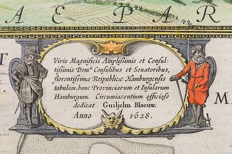
Original hand-coloured engraving. Amsterdam, Blaeu, 1628. Plate Size: 53 cm x 30.6 cm. Sheet Size: 60 cm x 48.7 cm. Original map. In very good condition. Clean and bright with generous margins. Very minor tear to centre-fold at lower edge. French text on reverse.
From Theatrum Orbis Terrarum.
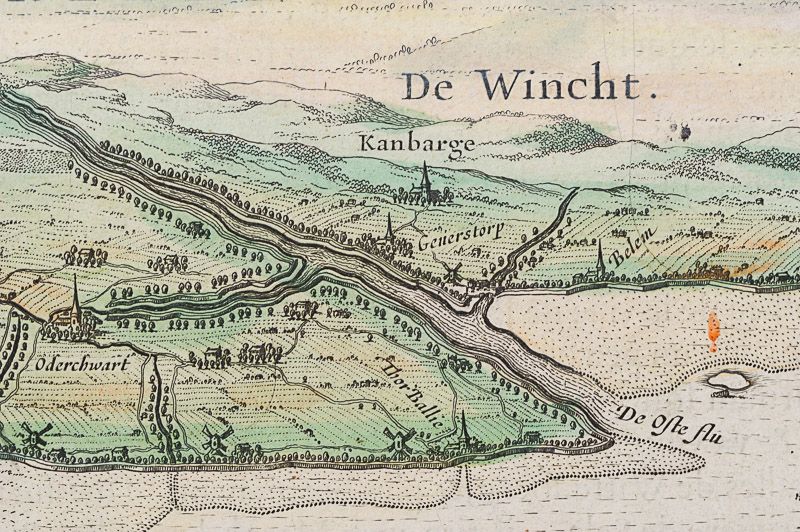
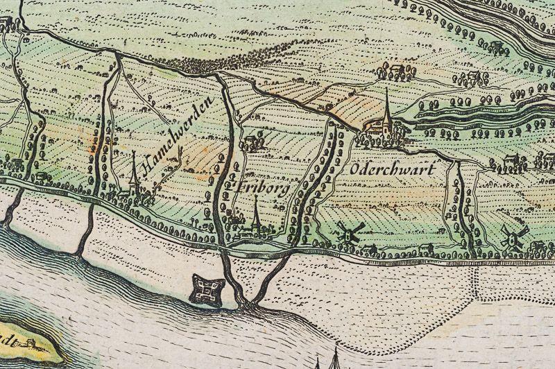
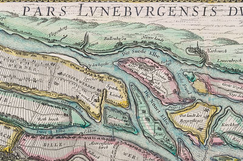
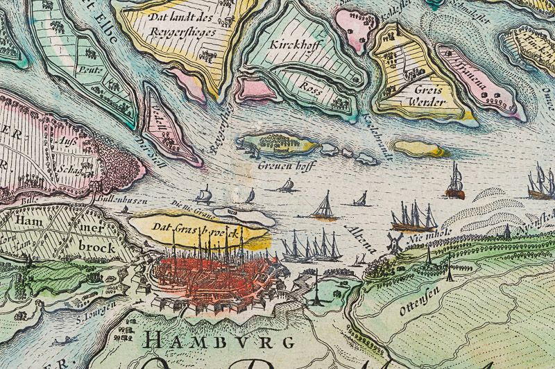
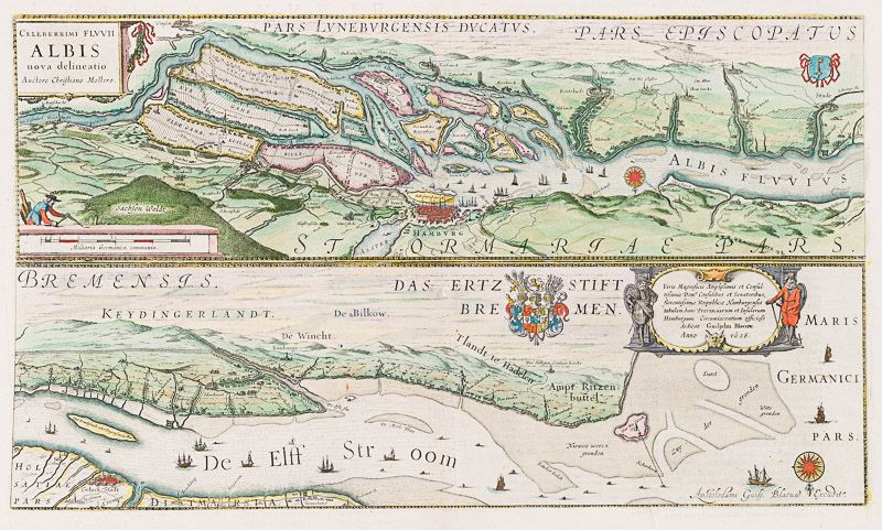
The map, which is in two strips one above the other, shows the course of river Elbe in Germany. Text in Latin and German. The upper map, orientated with South facing the upper border, focuses on the area around Hamburg with the islands that are surrounding it within the Elbe. The regions’ names are given in Latin: Ducatus Luneburgensis and Stormariae Pars, for example. The nearby towns, such as Buxtehude and Fliegenberg are also included. The islands along the Elbe’s estuary are identified: for example, Das Grass broeck, Kirckhoff and Ross. The maritime and commercial importance of the prosperous city-port is suggested by the many ships seen along the river. Title cartouche, coat of arms and decorative bar scale also included in upper map.
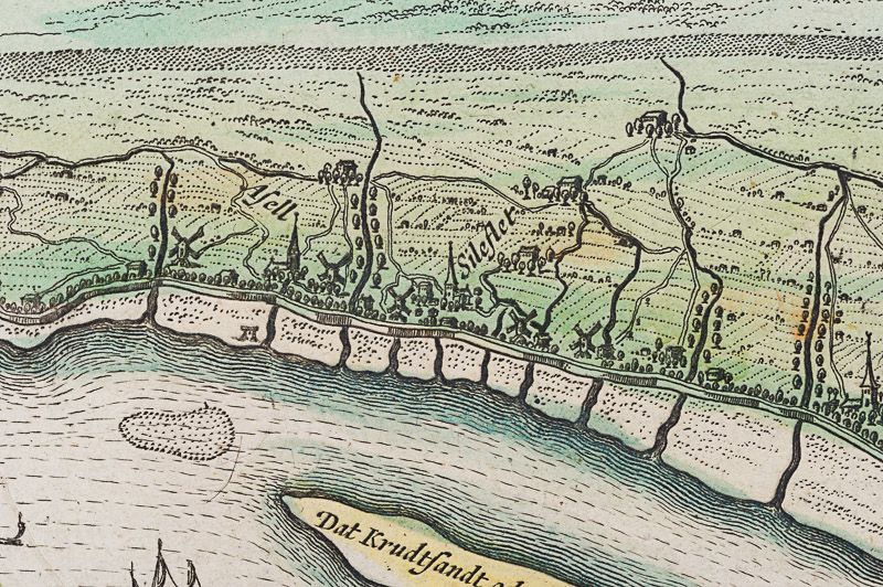
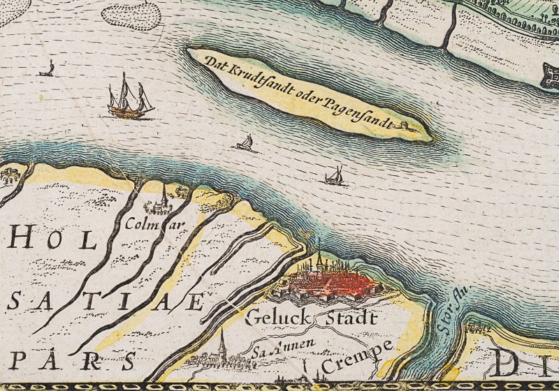
The lower map shows the continued course of the river (‘De Elff Stroom’) out to the North Sea, passing along Keydingerland, De Bilkow and the riverbank towns such as Glückstadt, Altrendorp and Brunsbuttel. The islands are identified as ‘Dat Krudtstandt oder Pagensandt’ and ‘Dat Nie Werk’. Decorative cartouche with explanatory and provenantial text, coat-of-arms, compass rose and ships to sea are also shown on the lower map.
Willem Janszoon Blaeu (1571-1638) was a Dutch cartographer, atlas maker and publisher. Along with his son Johannes Blaeu, Willem is considered one of the notable figures of the Netherlandish/Dutch school of cartography in its golden age (the 16th and 17th centuries). Blaeu set up his mapmaking and publishing business in Amsterdam, where he sold instruments and globes, published maps, and edited the works of intellectuals like Descartes and Hugo Grotius. In 1633 he was appointed map-maker of the Dutch East India Company. In 1635, he released his atlas, Theatrum Orbis Terrarum, sive, Atlas novus.
Willem died in 1638. He had two sons, Cornelis (1610-1648) and Johannes (1596-1673). Joan trained as a lawyer but joined his father’s business rather than practice. After his father’s death, the brothers took over their father’s shop and Joan took on his work as hydrographer to the Dutch East India Company. Later in life, Joan would modify and greatly expand his father’s Atlas novus, eventually releasing his masterpiece, the Atlas maior, between 1662 and 1672. (Wikipedia)
- Keywords: 17th Century · Cartography · Catalogue Four – International Art · Catalogue No.5 – Maps of the World · City · Elbe · Germany · Hamburg · Map · Original Aquatint · Original Decorative Art Rare · Original Engraving · Original Map · Original Maps · Rare Map – Germany · Travel Europe – Rare · Travel Germany – Rare · Vintage Map
- Inventory Number: 200059AG
EUR 295,--
We ship per DHL Express


Contact
Inanna Rare Books Ltd.
Woodley House
Castletownshend Road
P81 D262 Skibbereen, County Cork
Ireland
Phone: ++353 - (0) 87 - 102 5412
E-Mail: info@inannararebooks.com
Internet: https://www.inannararebooks.com
Online Bookshop specialized in rare
and secondhand books.
Newsletter and E-Catalogue Sign Up
Payment Options


© 2026 Inanna Rare Books Ltd. | Powered by HESCOM-Software
Follow Us

