


Payne, Universal Geography - Formed Into A New And Entire System; Describing Asi
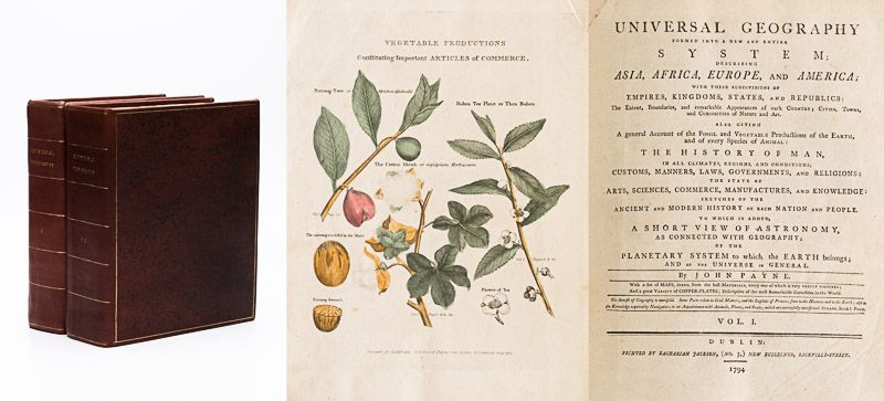
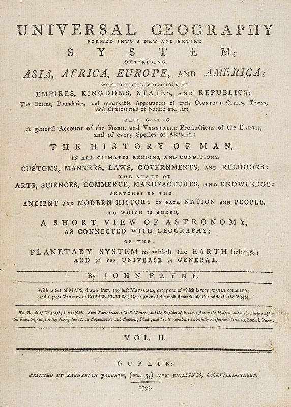
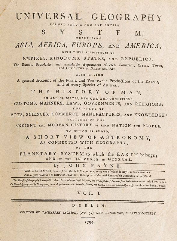
Universal Geography – Formed Into A New And Entire System; Describing Asia, Africa, Europe And America ; With Their Subdivision Of Empires, Kingdoms, States And Republics : The Extend, Boundaries, and remarkable Appearances of each Country ; Cities, Towns, and Curiosities of Nature and Art. Also giving A general Account of the Fossil and Vegetable Production of the Earth, and of every Speciesof Animal : The History of Man, In all Climates, Regions, And Conditions ; Customs, Manners, Laws, Governments, And Religions : The State of Arts, Sciences, Commerce, Manufactures, And Knowledge : Sketches of the Ancient and Modern History of each Nation and People. To which is added, A Short View of Astronomy, As Connected With Geography ; Of The Planetary System to which the Earth belongs ; And of the Universe in General. With a Set of Maps, drawn from the best Materials, every one of which is very neatly coloured ; And a great Variety of Copper-Plates ; Descriptive of the most Remarkable Curiosities in the World. [This Edition with all three Volumes but only with 14 Maps, 3 Colour-Engravings and 5 Black-and-White Engravings (see detailed listing of these Maps and Engravings at the end of this Bibliography)].
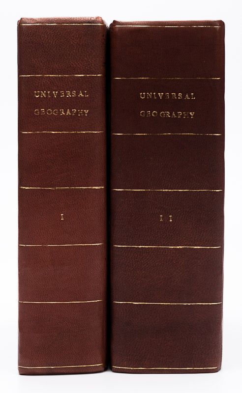
Two Volumes in Three Parts (bound in Two Volumes). Dublin, Printed by Zachariah Jackson, 1793 – 1794 Quarto (23 cm wide x 28 cm high). Pagination: Volume I: Hand-coloured Frontispiece, VI [Subscribers], XIII, 894 pages [page 555 misprinted as 454] [Stating “The End” at the end of the Volume] / Volume II: Hand-coloured Frontispiece, 792 pages [Stating “End Of The Second Volume” at the end of Volume II] / [Volume III] is Bound to the rear of Volume II and is falsely ending with “End of The Second Volume” as well even though it is the “Continuation of Book IV” and in all other listings of this book internationally is accepted to be Volume III. Pagination of [Volume III]: Hand-coloured Frontispiece, [No separate titlepage], 416 pages, XXXIII pages of an Index, 1 page “Directions to the Binder”, 10 pages “A Chronological Table of Remarkable Events, Discoveries and Inventions. Hardcover / Modern Binding in the style of the 18th century. Full leather with gilt lettering on spine. Very minor signs of neglectable, minimal wormhole-damage. Obviously this work was robbed of many of the maps but those which remain have the original hand-colouring in stunning condition (see description). Overall near Fine condiiton of this extremely rare set, with only minor signs of wear. Page 199/200 of Volume II with longer cut (Text not effected). All the engravings and maps without defects.
[ESTC T202828]
Illustrations in the Volumes include:
Volume I:
1.
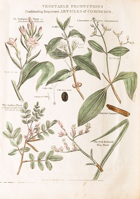
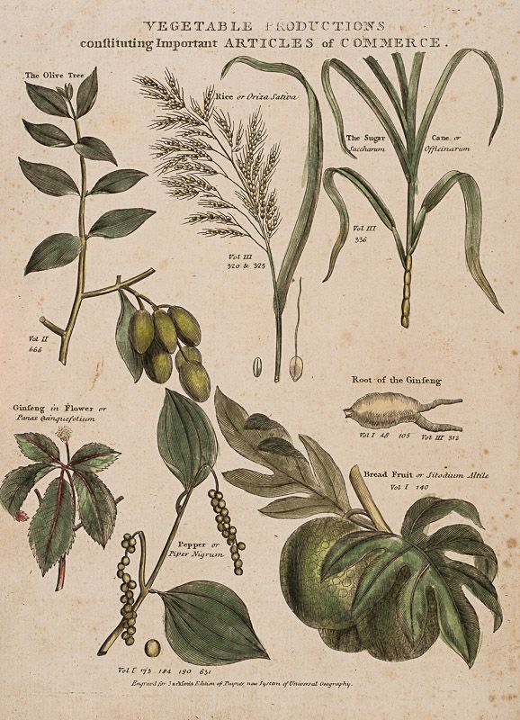
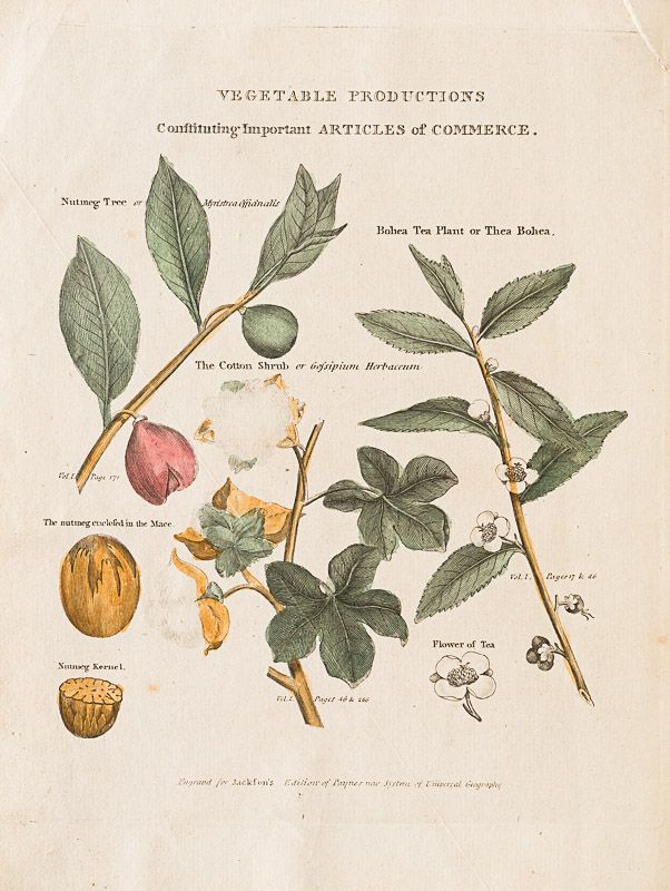
Hand-coloured Frontispiece with “Vegetable Production” [Colour]
2.
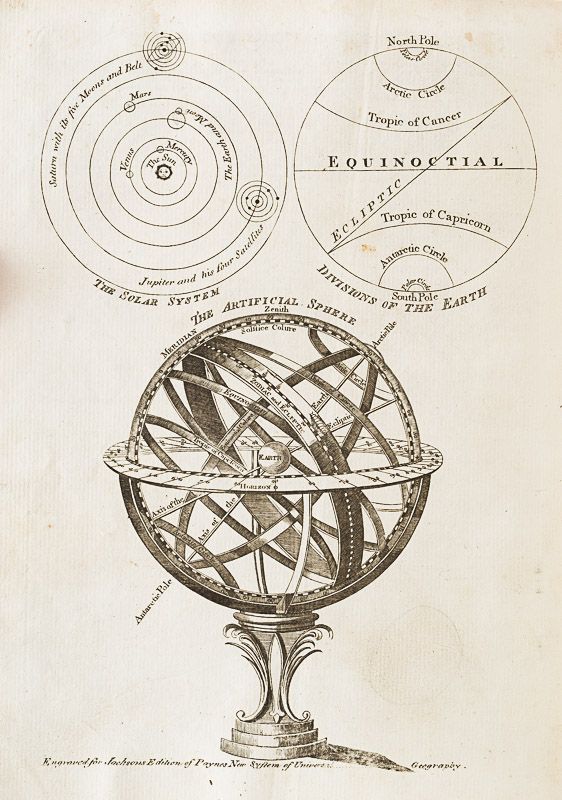
The Artificial Sphere [Black-and White]
3.
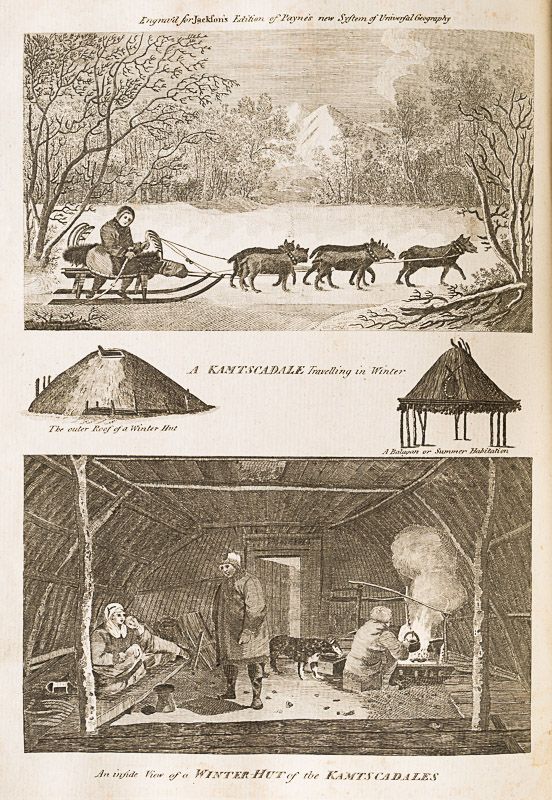
[Kamtschatka] – An inside View of a Winter-Hut of the Kamtscadales [Black-and-White]
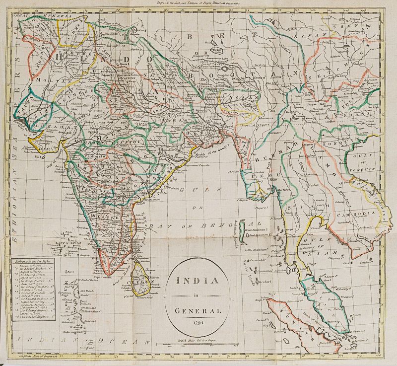
4.
[India] – Hand-coloured Large Fold-out-Map of India in General (1794) [Colour Map – 41.5 cm wide x 35.5 cm high]
5.
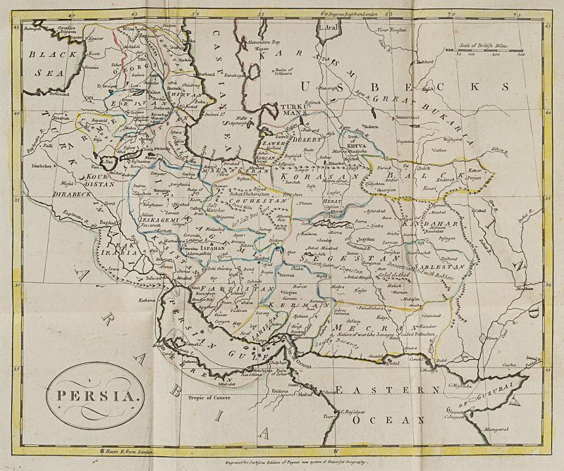
[Persia] – Hand-coloured Large Fold-out-Map of Persia / Irak / Iran / Caspian Sea / Behrein [Bahrain] / Persian Gulf / Street of Ormus [32 cm wide x 27 cm high]
6.
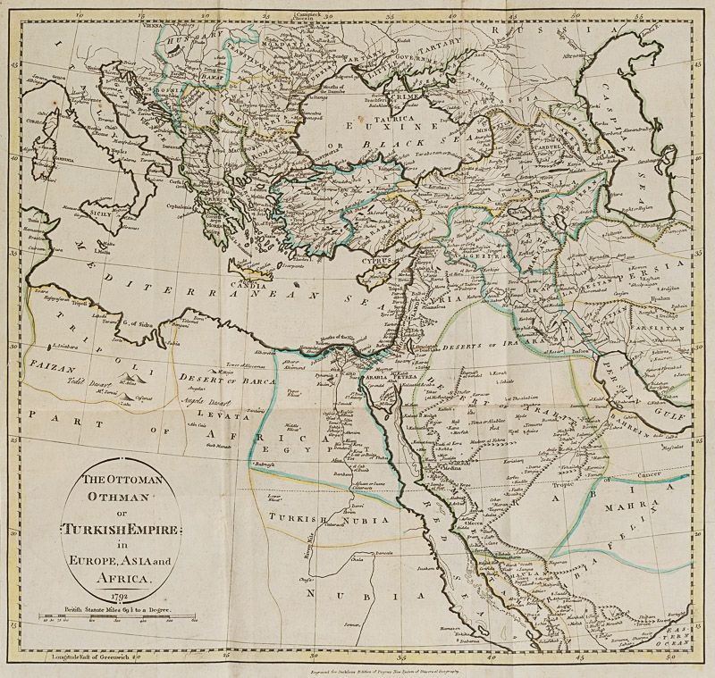
[Ottoman / Turkish Empire] Hand-coloured Large Fold-out-Map of “The Ottoman, Othman or Turkish Empire in Europe, Asia and Africa (1792) [36 cm wide x 34.5 cm wide]
7.
[Barbary / Northern Africa] Hand-coloured Large Fold-out-Map of “The States of Barbary comprehending the Northern parts of Africa” by J.Payne, (1792) [including Morocco, Fez, Algiers, Tunis and Tripoli] [40 cm wide x 21 cm high]
Volume II:
1.
Hand-coloured Frontispiece with “Vegetable Production” [Colour]
2.
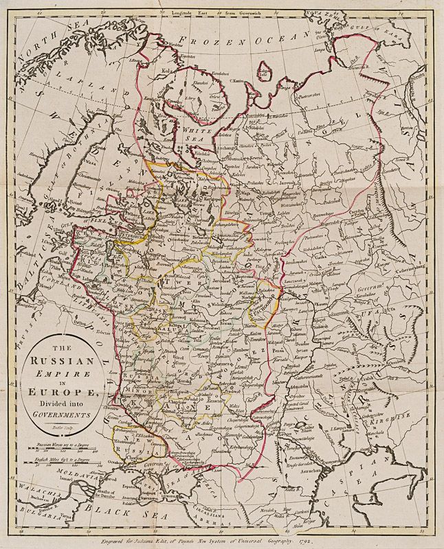
[Russia] – Hand-coloured Large Fold-out-Map of “The Russian Empire in Europe, divided into Governments” (1792)
With sections showing “Ukraine” south of “Russia Minor” and “New Russia” being the Region around “Cherson” and “Bachmut” in a Region called “Asov” [Colour Map – 33 cm wide x 41 cm high]
3.
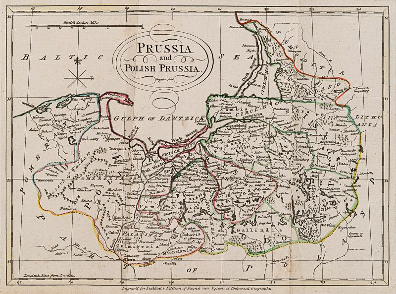
[Prussia and Poland] – Hand-coloured Large Fold-out-Map of “Prussia and Polish Prussia” [Colour Map – 30 cm wide x 22 cm high]
Showing the “Gulph of Dantzick” [Danzig]
4.
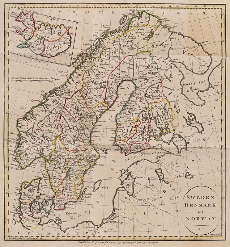
[Sweden, Denmark, Norway and Iceland] – Hand-coloured Large Fold-out-Map of “Sweden – Denmark and Norway” (1792)
[Colour Map – 36 cm wide x 37 cm high] With an Inset-Map of “Iceland” and the Map also showing German Prussia, Courland with Riga, Gulf of Riga, Gulf of Livonia, Revel, the White Sea, Russian Lapland
5.
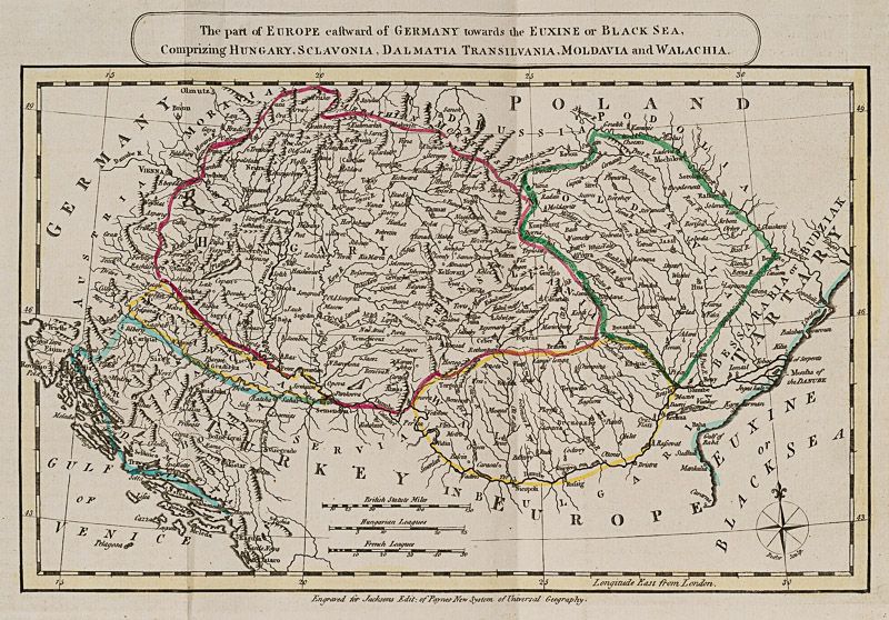
[Danube Region] – Hand-coloured Large Fold-out-Map of “The Part of Europe eastward of Germany towards the Euxine or Black Sea, Comprizing Hungary, Sclavonia, Dalmatia, Transilvania, Moldavia and Walachia [Colour Map – 30 cm wide x 20 cm high]
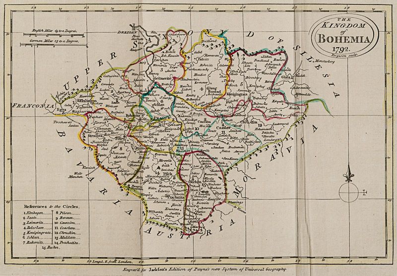
6.
[Bohemia (Boehmen)] – Hand-coloured Large Fold-out-Map of “The Kingdom of Bohemia” (1792) [Colour Map – 28.5 cm wide x 20 cm high]
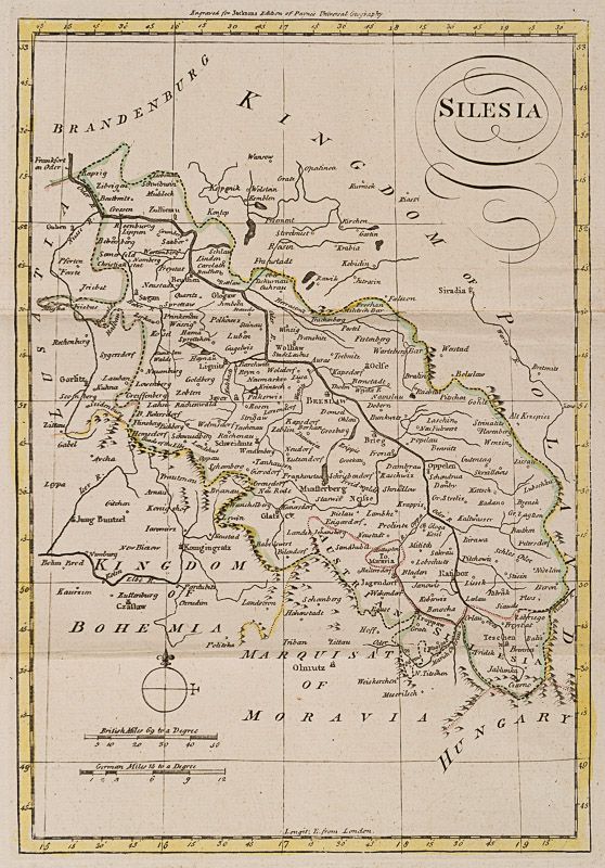
7.
[Silesia (Schlesien)] – Hand-coloured Large Fold-out-Map of “Silesia” (1794) [Colour Map – 20 cm wide x 29 cm high]
8.
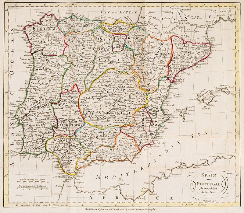
[Spain / Portugal] – Hand-coloured Large Fold-out-Map of “Spain and Portugal from the latest Authorities”
[Colour Map – 35 cm wide x 31 cm high] With Majorca, Minorca and Ivica
9.
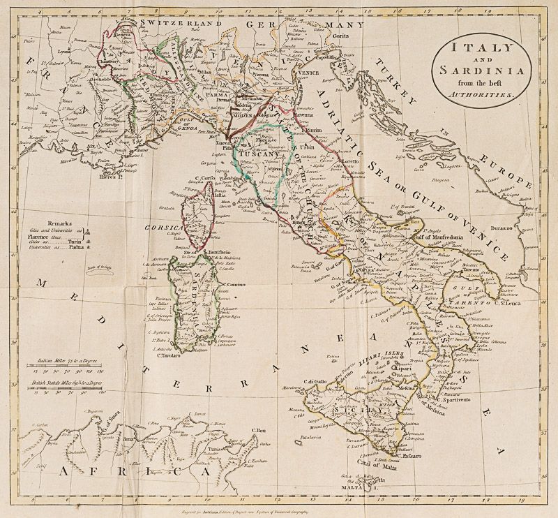
[Italy and Sardinia] – Hand-coloured Large Fold-out-Map of “Italy and Sardinia from the best Authorities
[Colour Map – 37 cm wide x 35 cm high]
10.
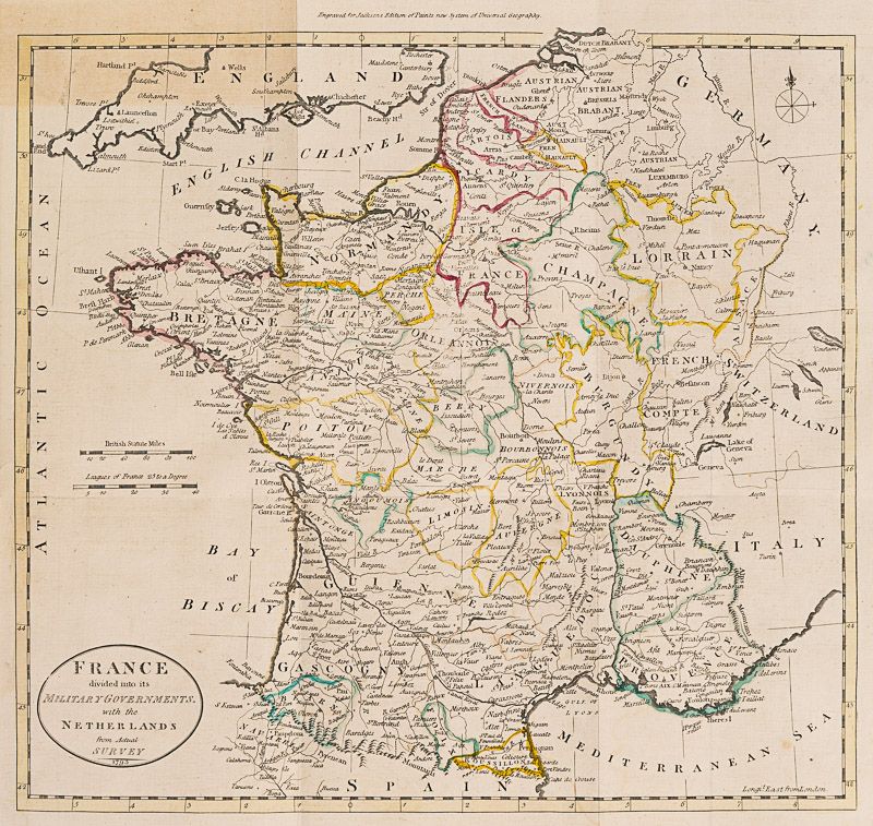
[France] – Hand-coloured Large Fold-out-Map of “France divided into its Military Governments with the Netherlands from Actual Survey”(1793) [Colour Map – 37.5 cm wide x 68 cm high]
11.
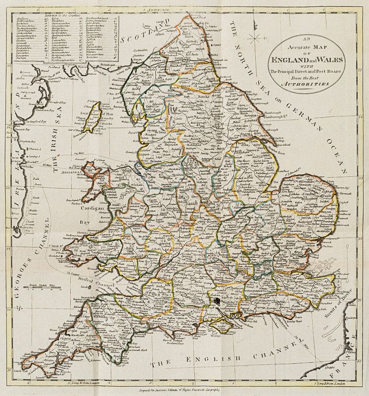
[England and Wales] – Hand-coloured Large Fold-out-Map of “An Accurate Map of England and Wales with The Principal Direct and Post Roads From the Best Authorities” [Colour Map – 33 cm wide x 33 cm high]
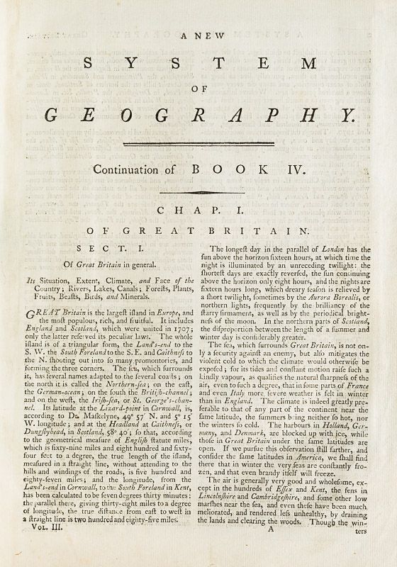
Volume III:
1.
Hand-coloured Frontispiece with “Vegetable Production” [Colour]
2.
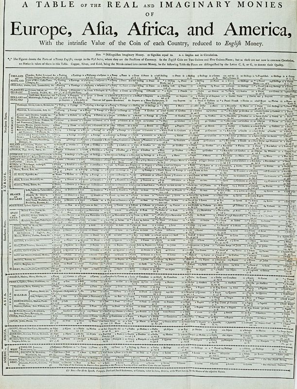
[Money Table] “A Table of the Real and Imaginary Monies of Europe, Asia, Africa and America – With the intrinsic Value of the Coin of each Country, reduced to English Money” [Black-and-White] / [45 cm wide x 59 cm high]
3.
Copper-Engraving showing “George III – King of Great Britain, France and Ireland” as well as “William V. Prince of Orange and Nassau Stadtholder” – Engraved for this work [26 cm wide x 22.5 cm high] / [Black-and-White]
4.
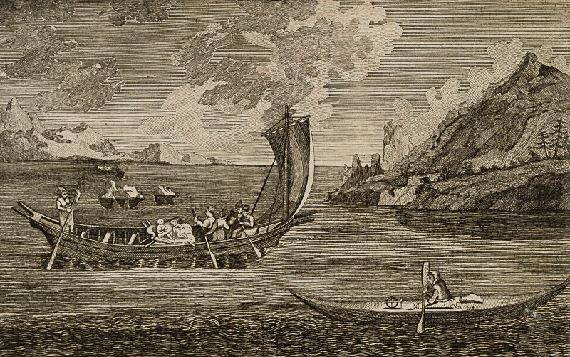
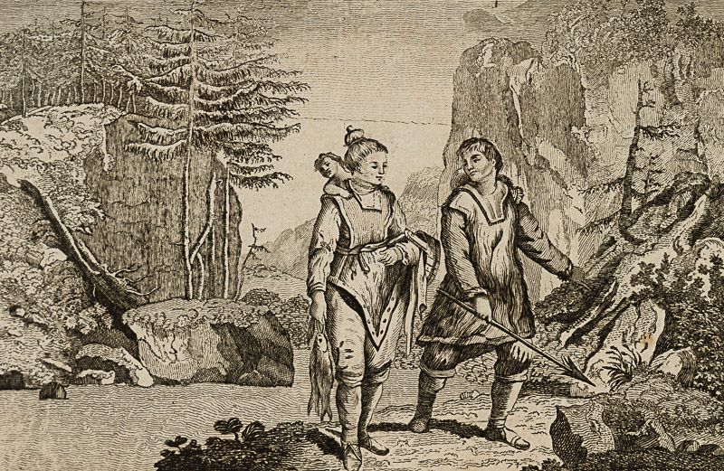
Copper-Engraving showing “Canoes used by the Greenlanders” and “Habit of the Natives of Greenland″
[Black-and-White]
With a detailed History of “Groenland, or Greenland”, talking about the Danish Colonists and the early discovery by John Davis.
- Keywords: Books with vintage Maps · Dublin – 18th century Printing History · Geography Rare · Greenland · Grønland · Maps · Maps of England · Maps of France · Maps of Russia · Maps of Scandinavia · Russia · Travel & Expedition – Rare · Travel and Exploration · Zachariah Jackson (Dublin Printer)
- Language: English
- Inventory Number: 32417AB
EUR 2.800,--
We ship per DHL Express


Contact
Inanna Rare Books Ltd.
Woodley House
Castletownshend Road
P81 D262 Skibbereen, County Cork
Ireland
Phone: ++353 - (0) 87 - 102 5412
E-Mail: info@inannararebooks.com
Internet: https://www.inannararebooks.com
Online Bookshop specialized in rare
and secondhand books.
Newsletter and E-Catalogue Sign Up
Payment Options


© 2026 Inanna Rare Books Ltd. | Powered by HESCOM-Software

