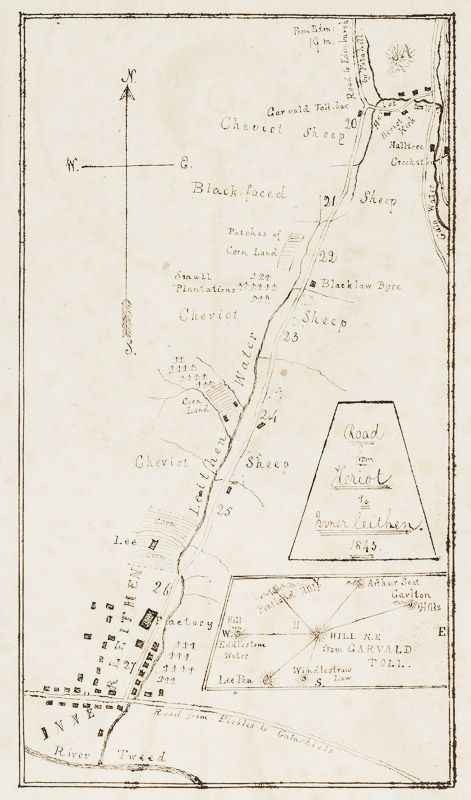
Anonymus - Vintage manuscript map of "Road from Heriot to Innerleithen - 1843".
Vintage manuscript map of “Road from Heriot to Innerleithen – 1843”. [With an inset of wider dirctions to Pentland Hills, Arthurs Seat / showing the River Tweed in the South and names the kinds of sheep that are kept along the road to Edinburgh (″Black-Faced Sheep” – “Cheviot Sheep”)].
Ink on Paper. [Britain], 1843. 9.8 cm wide x 17 cm high. Very good condition. Some mild browning. From a wonderful collection of maps at South Shields Library (tiny stamp verso (on the back) of this map).
Heriot is a small village in the Moorfoot Hills southeast of Edinburgh, Scotland, within Eildon (part of the Scottish Borders council area). The village comprises some 150 dwellings, spread over a geographical area of around 50 square miles (130 km2), most of which is moorland. Connected to the rest of the world primarily through the A7 road, Heriot had a railway and station from 1849 until the branch line closures instigated by Beeching caused the track to be uplifted in the 1960s. The Scottish Parliament voted, in 2006, to reinstate the railway, but without a station at Heriot. The School (as of Sept 2006) has 56 pupils. There are numerous community groups operating in the village including drama groups, WRI, a walking group, a community choir and a karate club.
Places near to Heriot include Borthwick, Carcant, Crichton, Fala, Stow of Wedale and Innerleithen. (Wikipedia)
- Keywords: 18.Jahrhundert · 18th Century Map · 18th Century Maps · Cartography · Catalogue No.5 – Maps of the World · Manuscript Map · Original Map · Original Maps · Rare Manuscript Map · Rare Map Scotland · Scottish Highlands · Scottish History Rare · Scottish Landscape · Scottish Map · Travel & Expedition – Rare · Travel Europe – Rare · Travel Scotland – Rare · Vintage Map
- Inventory Number: 406AG
EUR 375,--
© 2025 Inanna Rare Books Ltd. | Powered by HESCOM-Software


