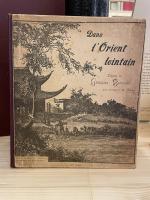
Travel & Expedition – Rare (130 items)

Cary's New Itinerary: Or an Accurate Delineation of the Great Roads, Both Direct and Cross throughout England and Wales: With Many of the Principal Roads in Scotland.

21. Cary, John.

Cary’s New Itinerary: Or an Accurate Delineation of the Great Roads, Both Direct and Cross throughout England and Wales: With Many of the Principal Roads in Scotland. From an Actual Admeasurement by John Cary: Made by Command of his Majesty’s Postmaster General for official purposes: Under the Direction and Inspection of Thomas Hasker Esq., Surveyor and Superintendant of the Mail Coaches. [Including an advertising for Cary’s New Celestial and Terrestrial Globes (with Illustrations of Globes)]. [Subtitle:] This work shows the immediate Route from the Metropolis [London] to all parts of England and Wales: And from Town to Town in every direction, distinguishing also the Cities, Market, Borough and Corporate Towns: And those at which the Assizes are held and gives the time of the Mails, Arrival and Departure from each, Describes the Line of the Navigable Canals and the Course of the Rivers passed over, The Number of Houses and Inhabitants contained in each Town, And those Inns which supply Post Horses and Carriages. Also The Inn’s throughout the Metropolis [London] from which the Mail and Stagecoaches go, their time of departure & the Route they seveerally take. The Noblemen and Gentlemen’s Seats situate near the Roads, A List of the Packet Boats and their time of sailing. Copious Indexes. Maps of the Lot Wight Environs of London, Bath, Brighton, Margate & Cheltenham & a Large Map of England and Wales peculiarly adapted to the Work. – [An Advertisement juxtaposed to the titlepage reads: “This Edition contains the Routes to upwards of Nine Thousand Places, which have never been given in any work of a similar Description; being a complete Directory to every Parish situate out of the Line of the Direct and Cross Roads throughout England and Wales”].

Seventh Edition, with Improvements [complete with all maps as called for]. London, Printed for J. Cary, 1817. Octavo. Pagination: [1], 647 pages plus 7 maps / Detailed pagination see here: [1], Title, Large Folding Map, [121], 6 folded Maps, [526] pages. Modern, recent Hardcover / Very decorative half-leather with marbled-paper-covered boards. Gilt lettering on new sppine-label. New endpapers. Protective Mylar. Only the large folding map with a inor tear (one part of the map deliberately bound separate (geniously folding out to meet th erest of the map). Interior text and maps all in excellent, unusually clean condition !!

EUR 780,-- 

Show details   Add to cart

Der Tourist, Der Tourist.

27. [Rickmer Rickmers, Willi] Jäger, Gustav (Herausgeber).

Der Tourist – Organ für Natur- und Alpenfreunde [plus einige Jahrgaenge der Beilagen “Das Alpenhorn” und “Bei Nebel und Regen” beigebunden]. 27 Bände in 20 / Es fehlen die No.39 und 40 im Jahrgang 1869 (dies sind die Seiten 609-640 und es fehlen die Jahrgaenge 1893 bis 1896) . Einige Jahrgaenge sind in zwei Baenden erschienen und hier immer in einem Band gebunden. Diese wurden von uns aber bei der Gesamtzahl von 27 Baenden nicht doppelt gezaehlt und immer als “ein Band” gewertet. / 27 volumes of a consecutive run from 1869 bound in 20 volumes with only four annuals (1893-1896) as well as two numbers missing [No.39 and 40 in Volume 1 (year 1869)]. [Als weitere Zugabe: Dublette des Jahrgangsband 1876-1877 vom “Alpine-Club” (London) mit einer beigebundenen Ausgabe: Gustav Jaeger – “Der Fuehrer auf der Kronprinz Rudolfbahn von der Donau bis Laibach enthaltend: Die Beschreibung der Kunstbauten und Eisenbahnfahrten auf der Hauptlinie und den Seitenfluegeln, sowie die Schilderung der Ortschaften und Ausfluege von saemtlichen Bahnstationen in Nieder- und Oberoesterreich, Steiermark, Kaernten und Krain. Wien, 1876. 213 (6) Seiten].

Wien, Carl Finsterbeck, 1869 – 1892 & 1897-1898. 14.5 cm x 21.5 cm / 24.5 cm x 30.5 cm / 25 cm x 32.5 cm. 23.5 cm x 31.5 cm ca. 9800 Seiten (siehe Paginierung im englischen Teil der Beschreibung). [Mit der farbigen Lithographie “Der Sonnblick” im Maltathal in Band 1 (1869 / eingebunden nach Seite 202) sowie der zweiten Lithographie “″Glokner” (eingebunden nach Seite 728)/ Lithographie in Band 2 (1870) fehlt [Allerdings haben wir der Ausgabe den 2. Jahrgangsband 1870 als Dublette beigelegt und die Dublette fuer 1870 enthaelt die seltene Lithographie “Der Blaue Tumpf im Maltathale (Kaernten)” [siehe die Photos]. Die Reihe enthaelt ausserdem das wunderbare, grosse Panorama vom “Hochwechsel” / Circa. 9,200 pages – Vol.I (1869), 768 pages with both Lithographs as called for (pages 609-640 missing) plus “Das Alpenhorn” (Nummern 29 – 48 des 1.Jahrgangs) / Vol.II (1870), 696 pages with the Lithograph missing – Angebunden: “Das Alpenhorn” – Kompletter II.Jahrgang [Als Zugabe: Band 2 liegt hier bei mit der Lithographie] / Vol.III (1871), 726 pages plus “Das Alpenhorn” Teil des III.Jahrgangs / Vol.IV (1872), 552 pages plus der komplette IV. Jahrgang “Das Alpenhorn” / Vol.V (1873), 436 pages plu Jahrgang V of “Das Alpenhorn” / Vol.VI (1874), 442 pages plus Jahrgang VI of “Das Alpenhorn” / VII. (1875), 412 pages mit “Das Alpenhorn” Jahrgang VII. / Vol.VIII (1876) – 2 Volumes in 1: 228 pages & 244 pages plus “Das Alpenhorn” Jahrgang VIII / Vol.IX (1877) – 2 Volumes in 1: 204 & 236 pages plus 48 pages “Bei Nebel und Regen” & “Das Alpenhorn” IX.Jahrgang / Vol.X (1878)-2 Volumes: 234 & 242 pages plus einige Nummern von “Bei Nebel und Regen” & “Das Alpenhorn” / Vol.XI-XII (1879-80) c.416 pages / Vol.XIII-XIV (1881-82), c.384 pages / Vol. XV-XVI (1883-84), c.384 pages / Vol.XVII-XVIII (1885-1886), c.384 pages/ Vol.XIX-XX (1887-88), c.384 pages / Vol.XXI-XXII (1889-90), c.384 pages / Vol.XXIII-XXIV (1891-92), c.384 pages / Vol.14 (1897), 458 pages / Vol.15 (1898), 586 pages / Vol.16 (1899), 668 pages. / In addition the periodical includes a duplicate of Volume II (Annual for 1870) and this Duplicate includes the rare original Lithograph. Originale Halbleinenbaende des 19.Jahrhunderts mit Rueckenvergoldung. / Hardcover. Contemporary cloth with gilt lettering on spine / [2 with marbled boards, the remainder with dark cloth boards]. 3 volumes with navy cloth boards. Zehn Baende in Gross-Quart, die anderen in Oktav-Format. Sehr guter Zustand dieser seltenen, korrespondierenden Reihe mit nur wenigen Gebrauchsspuren an den Bindungen. Very good condition with only minor signs of external wear. Some minor abrasions to cloth for volumes 1872 and 1875. Baende fuer die Jahre 1872 und 1875 mit kleinen Einrissen am Ruecken. Periodikum aus der Bibliothek von Wilhelm Gustav Rickmer Rickmers, mit seinem Exlibris in nahezu allen Baenden / Minor rubbing only to head and heel of spines and board corners. Interiors clean and bright for the most part. Slight tanning throughout. Former copies from the library of Wilhelm Gustav Rickmer Rickmers, with his large, beautiful and artistic bookplate “Bibliotheka Rickmersiana” [designed and monogrammed by Otto Barth] in most of the Volumes. Also Bookplate of Bibliothek Central-Ausschuss Deutscher und Österreichischer Alpenverein. Library stamp on front endpaper / The collection subsequently was part of the library of the Alpine Club in London.

EUR 2.400,-- 

Show details   Add to cart

Wohlgemuth - Die österreichische Polarstation Jan Mayen - Ausgerüstet durch seine Excellenz Graf Hanns Wilczek

29. First International Polar Year (1882-1883) – Wohlgemuth, Emil von.

Die österreichische Polarstation Jan Mayen – Ausgerüstet durch seine Excellenz Graf Hanns Wilczek. Geleitet von K.K. Corvetten-Capitän Emil Edlen von Wohlgemuth. Beobachtungs-Ergebnisse Herausgegeben von der Kaiserlichen Akademie der Wissenschaften. [Inklusive Ephemera] Band I – III (Komplett in vier Bänden mit dem eingebundenen Vorbericht zur Publikation welcher manchmal auch separat gebunden wurde: I. Band / II.Band 1. und 2. Abtheilung / III.Band).

Erste und einzige Ausgabe. Wien, K. und K. Hof-und Staatsdruckerei in Commission bei Karl Gerold’s Sohn, 1886. Quarto (24.5 cm x 31.5 cm). Collation: Band I: 118 Seiten mit vier Falttafeln (Beobachtungsstation im Wilczeck-Thale / Sternwarte / Helligkeitsgrad der Polarnacht / Kreuzung / [Route] des S.M.Dampfer “Pola” laengs der Eiskante bei der Insel Jan Mayen (farbig) / ), 26, 50, 202, 76, 16,18 Seiten / Band II,1: 232 Seiten / Band II,2: 175 Seiten / Band III: X, 132, 24, 20 Seiten [The set includes 85 text-illustrations, 61 plates (some folded) and four maps (original lithographs of which one is in colour)]. Original publisher’s Hardcover-Boards, now in protective collector’s Mylar. [Inclusive grossformatiger Werbung zu den Druckschriften der kaiserlichen Akademie der Wissenschaften in Wien vom Jahre 1885] The boards of the thicker Volume One, as often, cleanly detached. All other Volumes in very good condition with only minor signs of external wear. Minor signs of foxing only. Unopened, unread version of this rare publication !

EUR 680,-- 

Show details   Add to cart

Page: 1 2 3 4 5 6 ... 12 13
: