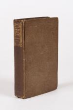
5. Pugilism (Boxing) – Baert-Duholant, Charles-Alexandre-Balthazar-François de Paule baron de / Jean-Denis Barbié du Bocage.
Tableau de la Grande-Bretagne, De L’Irlande et des Possessions Angloises dans les quatre parties du Monde. [Large Paper Copy / Better Paper Copy / Exemplaire de Luxe] [With five (5) large, folded Maps by Jean-Denis Barbié du Bocage: Large, oblong folded Map/Plan of Gibraltar / England / Scotland / Ireland / India] / [With four (4) stunning copper-engravings: Grotte de Fingal, Chaussée des Géants / Plan et vue de Gibraltar / Combat de Boxe (Pugilists)] / [With two (2) portraits: 1.Portrait of William Pitt (after William Owen) and 2. Portrait of Charles Jacques Fox (after Karl Anton Hickel)].
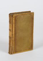
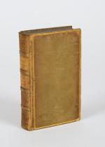
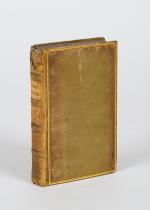
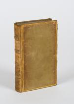
Four Volumes (complete set). Paris, Chez H.J.Jansen, L’An 8me [1800]. Octavo (21.5 cm x 14 cm). Collation: Volume I: (8), 459, (1), 11 pages with Eleven (11) copper-engravings of which are: 5 Maps / Plans and 4 Engravings: The folded view of Fingals Cave (″Grotte de Fingal dans l’Ile de Staffa” – (20.5 cm x 31.5 cm) / “Folded Plate of the Giants Causeway (″Vue occidentale de la Chaussee des Geans et des Caps voisins” (20.5 cm x 39 cm)) / Fantastic, large Map/Plan of Gibraltar by Jean-Denis Barbié du Bocage, with a Birds-Eye-View of the Ville de Gibraltar (20.5 cm x 65.5 cm) [also showing the Ville Irlandaise on Gibraltar] / Scenic View of Gibraltar (″Vue de Gibraltar, prise du cote de l’Espagne” (20.5 cm x 33 cm) / Large Fold-Out-Map of England by Jean-Denis Barbié du Bocage with an Inset-View of Stonehenge (47 cm x 51 cm) / Large Fold-Out-Map of Scotland by Jean-Denis Barbié du Bocage, including the Western Isles and Shetland, with a stunning Inset-View of the irish pilgrimage-mountain Croagh Patrick [Craig-Phadrick] in Westport, Ireland (37 cm x 50 cm)/ Large Fold-Out-Map of Ireland with an Inset-View of the Lakes of Killarney (39 cm x 44.5 cm) / Volume II: 532, (1), 12 pages with Large Fold-Out-Map of India (″Possessions Anglaises”) by Jean-Denis Barbié du Bocage – the large India-Map showing areas as far as Tibet, Siam, Sumatra and the Andaman Islands, Ceylon, Burma (48 cm x 43 cm) / Volume III: 502, 48, (2) pages with two portraits: Guillaume Pitt [William Pitt] & Charles Jacques Fox (each 20.5 cm x 12.5 cm)/ Volume IV: 486, 22, (2) pages with the very famous Fold-out-Illustration of Pugilists / Boxers at Odiham in Hampshire [″Combats de Boxers a Odiham”] showing a boxing-match between Humphrey and Mendoza (32 cm x 20.5 cm). Hardcover / Original, very decorative original half leather bindings with gilt lettering and ornament on spine. Volume One professionally rebacked by an english master bookbinder. All four Volumes in protective Collector’s Mylar. Excellent condition with only minor signs of external wear. From the library of François-Xavier de Valenzi with his bookplate / exlibris to the pastedowns of each Volume. Maps in this de Luxe Edition are all considerably larger than in the normal-paper-edition and all the maps and illustrations are in superb condition. An underestimated collectable.


![[Catharine II] Castera, The Life of Catharine II. Empress of Russia](/images/thumbnails/31335AB.jpg)

![Jean-Denis Barbié du Bocage - Tableau de la Grande-Bretagne, De L'Irlande et des Possessions Angloises dans les quatre parties du Monde. [Large Paper Copy / Better Paper Copy / Exemplaire de Luxe]](/images/thumbnails/28935AB.jpg)



![[Tasso, Jerusalem Delivered; an Heroic Poem. [Large / Illustrated / Better Paper Edition].](/images/thumbnails/29355AB.jpg)
![[Richard Parker] - Die schwimmende Republik. ['The Floating Republic']](/images/thumbnails/29237AB.jpg)

![Cooper, A Practical Guide For The Light Infantry Officer [Original Edition of this rare Military Drill Exercise Book from 1806 - NOT a Reprint]](/images/thumbnails/31866AB.jpg)
![[Magasin des Enfans]. Le Bureau Typographique](/images/thumbnails/29202AB.jpg)


![[Byron Circle] Haygarth, Greece, A Poem, In Three Parts - with 9 Sepia Aquatints - First Edition - 1814](/images/thumbnails/31707AB.jpg)



![[Molière] Petitot, Oeuvres de Molière (6 Volumes)](/images/thumbnails/31984AB.jpg)


![[Conder, Mexico and Guatemala [Guatimala] [in: The Modern Traveller - A Popular](/images/thumbnails/200476AB.jpg)







![[Henry Bathurst] - Selection of Parochial Examinations Relative to the Destitute Classes in Ireland - Original 1835 Edition](/images/thumbnails/29903AB.jpg)
