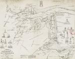
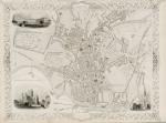
A Chart of the Approaches to Liverpool. From the Best and latest Surveys for Fargher’s Edition of Jefferson’s Almanac.
Original Lithographed Map. Probably printed on the Isle of Man, Robert Fargher, 1862. 40 cm wide x 31.5 cm high. Mounted on paper. Very good condition. From a wonderful collection of Maps from an old english library (South Shields) – with a tiny library stamp to the outer margin of the map and verso to the mounting paper.
EUR 295,--


