Inanna Rare Books

Inanna Rare Books

Inanna Rare Books

    • Home
    • About us
    • Shipping Information
    • Search File
    • Contact
    • Cart
    • Rare Book Room
      • Books on Books
      • History - Politics - Law
      • Literature
      • Philosophy & Religion
      • Social Sciences - Education
      • Medicine
      • The Arts
      • Travel & Exploration
      • Mathematics
      • Science & Technology
      • Farming - Fishing - Hunting
      • Natural History
      • Games - Sport
      • Complete Catalogue
    • Art & Map Gallery
      • Art Gallery
      • Rare Maps & Cartography
    • Manuscripts
      • Manuscripts - Literature
      • Manuscripts - History
      • Manuscripts - Travel
      • Manuscripts - Food
      • Manuscripts - Music
      • Manuscripts - Secret Knowledge
      • Manuscript Letters/Autographs
      • Manuscripts - Art
      • Manuscripts - Philosophy
    • Gift Ideas / New Arrivals
      • New Arrivals
      • Gift Ideas for Collectors
      • Gift Wrapping Available
      • Handmade Paper
      • Gift Wrapping Available
    • Inanna Publishing
    • Libraries & Collections
      • African Maps Collection
      • Henry David Aiken - Collection
      • Samuel Beckett - Collection
      • Walter Benjamin - Collection
      • Alexander Calder Collection
      • Castlefreke - Collection
      • Alice Curtayne Collection
      • Fly Fishing / Angling Collection
      • Vere Foster - Collection
      • William Daniel Gill Collection
      • John Minihan Collection
      • David (Dave) Naylor - Collection
      • Roger O'Connor Collection
      • David Puttnam Collection
      • Savigny Collection
      • Eric Ravilious Collection SOLD
    • Catalogues
    • News / Events
  • Advanced Search
  • List
    • Terms & Conditions
    • Contract Withdrawal
    • Cancellation Policy
    • Privacy Policy
    • Shipping Information
    • Imprint
INANNA MODERNWest Cork Reading Holidays
We ship per DHL Express

We ship per DHL Express

Advanced Search
  • Rare Book Room
    • Books on Books
    • History - Politics - Law
    • Literature
    • Philosophy & Religion
    • Social Sciences - Education
    • Medicine
    • The Arts
    • Travel & Exploration
    • Mathematics
    • Science & Technology
    • Farming - Fishing - Hunting
    • Natural History
    • Games - Sport
    • Complete Catalogue
  • Art & Map Gallery
    • Art Gallery
    • Rare Maps & Cartography
  • Manuscripts
    • Manuscripts - Literature
    • Manuscripts - History
    • Manuscripts - Travel
    • Manuscripts - Food
    • Manuscripts - Music
    • Manuscripts - Secret Knowledge
    • Manuscript Letters/Autographs
    • Manuscripts - Art
    • Manuscripts - Philosophy
  • Gift Ideas / New Arrivals
    • New Arrivals
    • Gift Ideas for Collectors
    • Gift Wrapping Available
    • Handmade Paper
    • Gift Wrapping Available
  • Inanna Publishing
  • Libraries & Collections
    • African Maps Collection
    • Henry David Aiken - Collection
    • Samuel Beckett - Collection
    • Walter Benjamin - Collection
    • Alexander Calder Collection
    • Castlefreke - Collection
    • Alice Curtayne Collection
    • Fly Fishing / Angling Collection
    • Vere Foster - Collection
    • William Daniel Gill Collection
    • John Minihan Collection
    • David (Dave) Naylor - Collection
    • Roger O'Connor Collection
    • David Puttnam Collection
    • Savigny Collection
    • Eric Ravilious Collection SOLD
  • Catalogues
  • News / Events

Rare Maps – Africa (27 items)

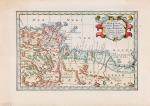
Sanson d'Abbeville, Partie de Barbarie,

11. Tunisia / Libya – Sanson d’Abbeville, Nicolas. (1600 – 1667).

Partie de Barbarie, ou sont les Royaumes de Tunis, et Tripoli, Tires de Sanut et d’Autres.

Original hand-coloured engraving. Paris, Sanson d’Abbeville, [c.1658]. Plate Size: 28 cm x 18.2 cm. Sheet Size: 35.6 cm x 25 cm. Original map. In very good condition. With only the faintest signs of browning. Map orientated to the north.

Show details

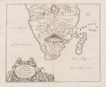
Kircher, Hydrophylacium Africae Precipuum

12. Southern Africa – Kircher, Athanasius. (1602 – 1680).

Hydrophylacium Africae Precipuum, in Montibus Lunae Situm, Lacus et Flumina Praecipua Sundens. Ubi et Nova Inventio Originis Nili describitur.

Original engraving. Amsterdam Kircher, [c.1665]. Plate Size: 41.5 cm x 34 cm. Sheet Size: 47.6 cm x 39.2 cm. Original map. In very good condition. Some very light traces of foxing near outer margins. Some very minor ink staining evident near ‘Oceanus Orientasis’ text. Otherwise, a very clean and bright map.

Show details

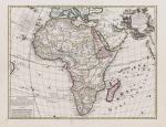
De L'Isle, Africa, Concinnata Secundum Ob, Servationes Membror Acad.

13. Africa. De L’Isle, Guillaume. (1675 – 1726).

Africa, Concinnata Secundum Observationes Membror Acad. Regal Scientiarum et non nullorum aliorum, et juxta recentissimas annotationes.

Original hand-coloured copper engraving. Augsburg, Jeremiam Wollf, 1710. Plate Size: 57.7 cm x 44.5 cm. Sheet Size: 65.5 cm x 51 cm. Original map. Very good condition. Slight staining barely evident near centre of map. Two minor stains to lower margin of map. Very minor tear to top edge and recto fore edge. Trace of foxing to verso edge.

Show details

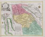
Lotter, Le Cours Entier du Grand et Fameux Nil.

14. Egypt – Lotter, Tobie Conrad. (1717 – 1777).

Le Cours Entier du Grand et Fameux Nil.

Original hand coloured engraving. Augsburg, Lotter, [c.1740]. Plate Size: 59.8 cm x 48.4 cm. Sheet Size: 65.4 cm x 53.6 cm. Original map. In very good condition. Partially coloured. Repaired tear to left edge of sheet. Minor tear to foot of sheet outside border. Central vertical fold as issued. Map is orientated to the north.

Show details

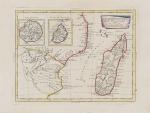
Hand-coloured border with latitudinal and longitudinal lines. Coloured interior map borders. Very interesting and decorative map of the east coast of Africa (in modern-ay Mozambique), which was then u

15. East Africa – Zatta, Antonio. (1722 – 1804).

Parte Della Costa Orientale Dell’Africa con l’Isola dei Madagasear e le Carte particolari dell’Isole di Francia e di Borbon.

Original hand-coloured engraving. Venezia, Antonio Zatta E Figli, 1784. Plate Size: 40 cm x 30.5 cm. Sheet Size: 51 cm x 38.8 cm. Original map with good margins. Very good condition, with the only slightest traces of browning to outer margins.

Show details

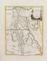
Zatta, L'Egitto Antico E Moderno.

16. Egypt – Zatta, Antonio. (1722 – 1804).

L’Egitto Antico E Moderno.

Original hand-coloured engraving. Venezia, Antonio Zatta E Figli, 1784. Plate Size: 31 cm x 40 cm. Sheet Size: 39 cm x 50.7 cm. Original map. Very good condition, with the slight traces of staining to lower section of map.

Show details

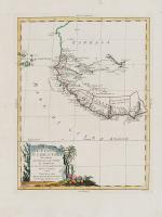
Zatta, La Guinea Occidentale.

17. Equatorial Guinea – Zatta, Antonio. (1722 – 1804).

La Guinea Occidentale.

Original hand-coloured engraving. Venezia, Antonio Zatta E Figli, 1784. Plate Size: 31 cm x 40 cm. Sheet Size: 51.7 cm x 38.8 cm. Original map. Very good condition. Map orientated to the north. Very minor foxing along top edge of sheet.

Show details

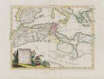
Zatta, Le Coste Di Barbaria

18. North Africa – Zatta, Antonio. (1722 – 1804).

Le Coste Di Barbaria Ovvero I Regni di Marocco di Fez di Algers di Tunisi di Tipoli coi Paesi Circonvicini.

Original hand-coloured engraving. Venezia, Antonio Zatta E Figli, 1784. Plate Size: 41.5 cm x 30.5 cm. Sheet Size: 50.6 cm x 38.8 cm. Original map with generous margins. Very good condition, with the only slightest traces of browning.

Show details

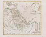
Vaugondy, Karte von Egypten.

19. Egypt – Vaugondy, Robert. (1723 – 1786).

Karte von Egypten.

Original hand-coloured engraving. Augsburg, Joh. Walch, 1798. Plate Size: 54.5 cm x 49.2 cm. Sheet Size: 67.3 cm x 55.1 cm. Original map. In very good condition. Large margin between plate and sheet edges. Some spotting along sheet edges beyond map border. Central vertical fold as issued. Map is orientated to the north.

Show details

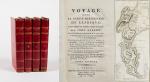
Barrow, Voyage dans la partie meridionale de l'Afrique

20. Barrow, John.

Voyage dans la partie meridionale de l’Afrique; fait dans les années 1797 et 1798; par John Barrow, Ex-Secretaire de Lord Macartney…Contenant des observations sur la géologie, la géographie, l’histoire naturelle de ce continent, et une esquisse du caractère physique et moral des diverses races d’habitans qui environnent l’Etablissement du Cap de Bonne-Espérance. / Accompagné: Nouveau Voyage dans la partie méridionale de l’Afrique; Où l’on examine quelle est l’importance du Cap de Bonne-Espérance pour les différentes puissances de l’Europe, considéré comme station militaire et navale; comme boulevart du commerce et de la domination des Anglais dans l’Inde; comme centre des établissemens pour la pêche de la baleine dans les mers Australes; comme acquisition territoriale, et comme entrepôt commercial en tems de paix. Accompagné d’une description statistique de la colonie rédigée sur les documens les plus hautentiques, enrichi de huit belles cartes, contenat celle de la Côte d’Afrique depuis la baie de la Table jusqu’a la baie de Saldanha, des cartes de la baie de Pletenberg, d’Algola, de Mossel et de False bay; du plan militaire de la péninsule du Cap, et de ceux de la baie de la Table et du Knisna. (2 Volumes).

First French Edition. 4 Volumes [complete set of two works with 2 Volumes each]. Paris, Dentu, 1801-1806. 35.5 cm x 55.8 cm. Collation: complete. Pagination: Volume I: XVI, 403, (1) pages / Volume II: 326, (2) pages including Errata-leaf / Volume III: X, 310 pages / Volume IV: 312 pages. Original contemporary red calf with gilt lettering and ornament to lacquer-polished-spine. The Volumes are numbered consecutively, even though these are two separate works. Excellent condition of the binding and interior of this important publication with very minor signs of foxing only ! All the maps in wonderful condition ! First french edition of “Travels into the Interior of Southern Africa” (Barrow’s journey with Lord Macartney in 1797 to the Cape of Good Hope) plus two further Volumes which describe the second journey in 1801 / 1802 to Saldanha Bay [Saldanhabaai] with an early image of Robben Island. The survey of the Dutch colonies was not only a seminal work on South Africa but the beautifully engraved, large folding map of South Africa was a turning point of african cartography and geographical illustration.


EUR 1.200,-- 

Show details   Add to cart

Page: 1 2 3
:

Order by: Author · Title · Keyword · Year · Price (up) · Price (down) · Inventory Number · Recent Changes · Relevance

Books per page: 10 · 20 · 50 · 100

Contact

Inanna Rare Books Ltd.
Woodley House
Castletownshend Road
P81 D262 Skibbereen, County Cork
Ireland
Phone: ++353 - (0) 87 - 102 5412
E-Mail: info@inannararebooks.com
Internet: https://www.inannararebooks.com

Online Bookshop specialized in rare
and secondhand books.

Newsletter and E-Catalogue Sign Up

Enter your name and e-mail address to sign up for
our regular newsletter and catalogue service.

Payment Options

Paypal   Master Card   VISA   American Express

Legal Info

  • Terms & Conditions
  • Contract Withdrawal
  • Cancellation Policy
  • Privacy Policy
  • Shipping Information
  • Imprint

© 2026 Inanna Rare Books Ltd. | Powered by HESCOM-Software

Follow Us