160. [Anonymous].
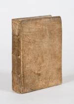
The Criminal Recorder ; Or, Biographical Sketches of Notorious Public Characters including Murderers, Traitors, Pirates, Mutineers, Incendiaries, Defrauders, Rioters, Sharpers, Highwaymen, Footpads, Pickpockets, Swindlers, Housebreakers, Coiners, Receivers, Extortioners, And other noted persons who have suffered the Sentence of the Law for Criminal Offences : Embracing a variety of curious and singular cases, anecdotes, &c. with occasional notes : to which is added an account of the various punishments inflicted on those who transgress the laws of their country, With a Description of the Crimes by which those punishments are incurred &c. alphabetically arranged under appropriate Heads and illustrated with Portraits and other Engravings. By a Student of the Inner Temple.
Volume I (of IV). London, Printed and Published by James Cundee, 1804. Duodecimo. Portrait-Frontispice,[4], 464 pages [of 466]. / [This First of four Volumes ends at the letter “H”]. Original Full Leather. Binding in poor condition. Two pages missing. Illustrations (Portraits) throughout.






![Andrews, Dublin Made Me / Man of No Property [Autobiography]](/images/thumbnails/100877AB.jpg)






![[Anonymous]. The Criminal Recorder](/images/thumbnails/31769AB.jpg)


