West Cork Rare BookfairINANNA MODERNWest Cork Reading Holidays
We ship per DHL Express

We ship per DHL Express

Travel – Asia (22 items)

Bushby, Round the World from North to South with Rod & Camera

5. Bushby, John / [Maori Village Travels] –

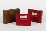
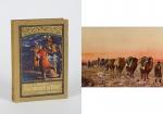
Round the World from North to South with Rod & Camera / Collection of three Volumes of printed and manuscript travelogue (reads like a logbook) / Travel Diary. Volume I – Privately printed, luxury photoalbum from the year 1907 – 1908 with 142 pages of printed photographs of a trip through Canada, Alaska South Sea Islands (Suva, Fiji), Tonga, New Zealand with several photographs of a trip on S.S.Manuka (Union Steam Ship Company) with images of life on board and of the trip to Maori Villages, Rotoiti, Tu Moana, Cape Horn, Rio de Janeiro, Teneriffe, Hunting, Fishing, Camping etc. / Volume II: Manuscript Volume in an easy decipherable hand of a trip on the steamer “Pretorian” from Liverpool on July 30th, 1903 to New York, Maryland, then on to Vancouver and Japan with excellent travel descriptions and list of costs of lodging in Yokohama, Kyoto, Nagasaki etc. / Volume III: Continues the Travelogue to Singapore, Siam, Java, Japan, Hawaii (Honolulu and back to California) – With extensive listing of costs for Passage, Hotels etc. in New York, Honolulu, Hongkong, etc. This Volume with longer descriptions of Hong Kong etc.

Daere (Cumberland), Privately printed and original manuscript, 1903 – 1908. Octavo. Volume I – 142 pages / Volume II (Manuscript) – 89 pages / Volume III (Manuscript) – 185 pages. Original Hardcover and flexible red leather. Very good condition with only minor signs of external wear. Magnificent account with exact and vivid descriptions of localities and the technique of the trip and its expenses. Ticket Prices, Hotel Costs, Voyage costs from Harbour to Harbour etc. etc. Unpublished account of a british merchant family’s private (Cotton Merchant) trip around the world.

EUR 2.800,-- 

Show details   Add to cart

Payne, Universal Geography formed into a new and entire system

15. Payne, John.

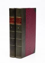
Volume I (of III) of the “Universal Geography” [Including Asia, Africa and Voyages of English Navigators] – formed into a new and entire system; describing Asia, Africa, Europe, and America; with their subdivisions of Empires, Kingdoms, States, and Republics: the extent, boundaries, and remarkable appearances of each country; cities, towns, and curiosities of Nature and Art. Also giving a general account of the fossil and vegetable productions of the Earth, and of every species of animal: The History of Man, in all Climates, Regions and Conditions; Customs, Manners, Laws, Governments and Religions: The State of Arts, Sciences, Commerce, Manufactures and Knowledge. Sketches of the Ancient and Modern History of each Nation and People to which is added, A Short View of Astronomy, as connected with Geography; of the Planetary System to which the Earth belongs; and of the Universe in General. With a set of Maps, drawn from the best Materials, every one of which is very neatly coloured; and a great Variety of Copper-Plates; descriptive of the most remarkable curiosities in the world. With an Appendix in two Parts, containing I. The History of the Voyages round the World, and toward the North and South Pole, which have been made since the year 1764 by English Navigators and II. A Digested and Geographical Account of the most considerable Islands and Countries which have been either discovered or explored during those Voyages, collected from every writer upon those subjects. Part I on the Appendix includes: 1. The First Voyage round the world, performed by Commodore Byron, in the Dolphin, accompanied by the Tamar Sloop / 2. Captain Wallis’s Voyage round the World, being the Second performed in the Dolphin / 3. Continuation of Captain Carteret’s Voyage round the World in the Swallow / 4. Lieutenant Cook’s Voyage round the World, in the Endeavour Bark (First Voyage, Second Voyage and Third Voyage including a stunning engraving of Cook, together with Portraits of inhabitants of the Sandwich Islands, Mangea and Ulietea) / The Appendix Part II contain a Geographical Account and Description of the Islands which have been lately discovered or visited in the South-Sea, proceeding from East to West (Easter Island / The Society Islands / The FRiendly Islands / The New Hebrides, Mallicolo and New Caledonia / New Zealand / New Holland / The Sandwich Islands //

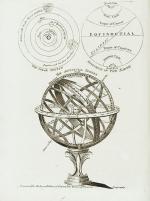
First Edition. Dublin, Printed by Zachariah Jackson (Great Ship-Street), 1792. Quarto. XV, 894 pages with a list of subscribers and eight fantastic full-page copper engravings (NO MAPS in this Volume) / Frontispiece (The beautiful Frontispiece-plate is cleanly detached and now comes with this beautifully restored book framed): Plates included are: 1. Frontispiece: Vegetable Productions constituting important Articles of Commerce: Nutmeg Tree / Bohea Tea Plant or Thea Bohea / The Cotton Shrub / The Nutmeg enclosed in the Mace and Nutmeg Kernel / Flower of Tea / The Cotton Shrub – This plate is hand-coloured ! / 2. The Artificial Sphere (Globe) with the Solar System and Divisions of the Earth / 3. [Kamtschatka] – A Kamtscadale Travelling in Winter / An inside View of a Winter-Hut of the Kamtschadales / 4. Animals in the Southern Parts of Africa (The Rhinoceros Bicornis / The Buffalo / The Hippopotamus, called by the Hottentots the Seacow) / 5. The Country contiguous to the Cape of Good Hope – Hottentots and their Huts &c. &c. / 6. Portrait – Collection on one plate of Captain James Cook – Killed on the Island of Owhyhee – 14th of February 1779 (From a painting by Dance in the possession of Sir Joshua Banks) – other portraits on that page include A woman and a man of the Sandwich Islands / A Man of the Magea – Omai or Omia , a Native of Ulietea / 7. Portrait – Collection on one plate of: Poulaho – King of the Friendly Islands / A Man of van Diemen’s Land / A Woman from van Diemen’s Land / A Woman of Prince William’s Sound / A Man of Prince William’s Sound / 8. Portrait-Collection on one plate of: A woman of Otaheite Island (Tahiti) bringing a present / A Woman of Otaheite (Tahiti) dancing / An Otahetian (Tahiti) in the Dress of his Country / A New Zealand Warrior completely armed (Maori) // Hardcover / Professionally restored original 18th-century leather with original gilt ornament and new labels on spine. Binding rubbed but after the masterful restoration in very good condition. Some of the plates slightly loose but not detached. Very few minor wormhole damage to the last 250 pages. Rare with the plates ! From the library of Richard Meade, Ballymartle, with his original bookplate to the pastedown. One of the early accounts of english Navigation and Discovery.

EUR 1.200,-- 

Show details   Add to cart

Payne, A New and Complete System of Universal Geography; Describing Asia, Africa

16. Payne, John / Hardie, James / Provenance I: Signature of J.J. Westervelt [Jacobus James Westervelt (1755 – 1826) – Schraalenberg and Provenance II: Charles Sydney Clark (1925) presented this set to Johnson Free Public Library at Hackensack, New Jersey].

A New and Complete System of Universal Geography [Complete with all 20 maps / illustrations] ; Describing Asia, Africa, Europe and America; with their Subdivisions of Republics, States, Empires and Kingdoms : The Extent, Boundaries and Remarkable Appearances of each Country; Cities, Towns and Curiosities of Nature and Art. Also giving a general account of The Fossil and Vegetable Productions [with hand-coloured plates] of the Earth. The History of Man, In all Climates, Regions and Conditions; Customs, Manners, Laws, Governments and Religions: The State of Arts, Sciences, Commerce, Manufactures and Knowledge. Sketches of the Ancient and Modern History of each Nation and People to the present time. To which is added, A View of Astronomy, As connected with Geography; Of the Planetary System to which the Earth belongs; And of the Universe in General. With a copious Index annexed to each Volume. Being a Large and Comprehensive Abridgement of Universal Geography. By John Payne. With additions, corrections and Improvements from the latest and best authors by James Hardie – Author of “The Principles of Latin Grammar”, “The American Remembrancer” and “Universal Tablet of Memory” &c. In Four Volumes.

First Abridged Edition. Volumes I [Asia] and II [Africa] (of IV). New York, Printed for and Sold by John Low, Book-Seller at The Shakespeare – Head, No.332 Water-Street, 1798 – 1799. Octavo – Edition. Pagination: Volume I [Asia]: Folded Frontispiece (Map of the World), XLVIII, 518 pages plus 10 unnumbered pages of an Index and one additional page with Directions for the Bookbinder for placing the maps and illustrations as well as Errata. Volume I includes all 10 Maps / Engravings as called for / Volume II [Africa]: Folded Frontispiece (Map of Africa), 578 pages plus 12 unnumbered pages of an Index plus one additional page with Directions for the Bookbinder for placing the maps and illustrations as well as Errata. Volume II includes all 10 Maps / Engravings as called for. Hardcover / Modern Library – Binding with the original 18th century – work bound in. Former library copy of Bergen County Historical Society (cancelled) and Johnson Free Public Library in Hackensack, New Jersey, with a very boring, modern library binding and library cards applied to the endpapers only, leaving the bookblock with text and maps and illustrations entirely untouched from any library-signs. Very good condition with some signs of external wear.

EUR 2.480,-- 

Show details   Add to cart

Staunton - An Authentic Account of an Embassy from the King of Great Britain to the Emperor of China

19. Staunton, Sir George / Lord Macartney.

An Authentic Account of an Embassy from the King of Great Britain to the Emperor of China [First Dublin Edition with 34 full-page-plates]; Including Cursory Observations Made, and Information Obtained, in Travelling Through That Ancient Empire, and a Small Part of Chinese Tartary. Together with a Relation of the Voyage undertaken on the Occasion by his Majesty’s Ship ‘The Lion’, and the Ship ‘Hindestan’ in the East India Company’s Service, to the Yellow Sea, and Gulf of Pekin [sic]; as well as of their return to Europe. With Notices of the several places where they stopped in their way out and home: being the Islands of Madeira, Teneriffe and St.Jago, the Port of Rio de Janeiro in South America; the Islands of St.Helena, Tristan da Cunha and Amsterdam, the Coast of Java and Sumatra, the Nanka Isles, Pulo-Condore and Cochin-China. Taken chiefly from the Papers of his Excellency, the Earl of Macartney, Knight of the Bath, his Majesty’s Embassador Extraordinary and Plenipotentiary to the Emperor of China; Sir Erasmus Gower, Commander of the Expedition and other Gentlemen in the several Departments of the Embassy.

Two Volumes (complete set). Dublin, Printed for P.Wogan, R.Cross, P.Byrne and others, 1798. Octavo. Volume I: XV, 449 pages with 8 full-page plates / Volume II: XVIII, 430 pages, with 26 full-page-plates and including an Appendix. Hardcover / Original, early 19th century half leather with original spinelabels. Bindings firm and strong but rather worn. Bookplate of Richard Meade, Ballymartle, to the pastedown of Volume I. Overall in very good condition with some stronger signs of wear but with all the illustrations / engravings, called for in the Dublin Edition.

EUR 1.280,-- 

Show details   Add to cart

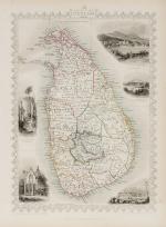
Tallis, Ceylon (British Ceylon) - with Vignettes and illustrations

21. Tallis, John / Rapkin, John. (1817 – 1876)

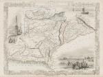
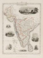
Ceylon (British Ceylon) – with Vignettes and illustrations of the Lake of Kandy, Adam’s Peak from the Lake of Colombo, a beautiful scenery of Colombo, Temple of Buddha , Kalany, Ruins of A Dagora at Toophamaraya. The map is divided in the old regions of British Ceylon: The Eastern Provinces (Kattoe, Colompattoo, Tamblegam, Kottiar, Tambankadewa, Koorle, Eraquer, Mamoene, Karrewitte, Chiam Pature, Erwiel, Nadene, Akkrepattoo, Ghiam Pature, Veddag, Ratte, Nadekadoe, Panowa / The Western Provinces (Anewoelandan, Rajawania, Seram, Sevien Korles, Rajawanny) / Northern Provincec (Wademo Ratchi, Welligammo, Jafnapatam, Leyden, Ponoryn, Manaar, Mantotte, Pomparipo, Moessellie, Neurawanny, Meel-Pattoo, Poedoe, Koe-Dirpo, Moeliawalle, Karie-Kattoe-Molle, Tinne-Mar, Re-waddie, Patchilapelle, Negammo / Central Provinces – Matelle, Doombera, Toompane, Erris Pattoo, Yattenoowere, Dollos Bage, Lower Ouna, Hewahetta, Wellassee / Western Provinces – Hapeti Gam, Pasdum, Caltura, Three Korles, Hewagam Korle, Hina Korle, Saffragam etc. / South Provinces – Wallawitte, Gangebodde, Gangedode, Mahagam, Pattoo, Morva, Talpe, Belligam, Wellerode etc.

Original steel engraving / Vintage map. Drawn and engraved by John Rapkin. Partly hand-coloured. London & New York, J & F. Tallis, 1851. Beautifully Framed. Size of frame with map: 40.5 cm x 50.5 cm. Size of the actual map: 27 cm x 37 cm. Excellent condition.

EUR 350,-- 

Show details   Add to cart

Page: 1
: