West Cork Rare BookfairINANNA MODERNWest Cork Reading Holidays
We ship per DHL Express

We ship per DHL Express

Travel Europe – Rare (57 items)

Bellin / Senex / Ogilby - The Roads through England or Ogilby's Survey. Revised, improved and reduced by Senex. [Enlarged Edition of John Ogilby's 1675 published "Britannia"]

7. [Bellin, Jacques Nicholas / Senex, John / Ogilby, John]

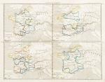
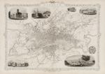
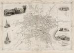
The Roads through England or Ogilby’s Survey. Revised, improved and reduced by Senex. [Enlarged Edition of John Ogilby’s 1675 published “Britannia”] Distinctly laid down on onehundred & one Plates with the addition of some Roads newly drawn and several corrections of more general use to Travellers. [Including an Appendix with Cityplans of London (double-page), Plymouth, Shrewsbury, Yorck (York), Chester, [Scene of Carrick-Fergus (Ireland)], Waterford, Oxford, Leith [Edinburgh], Harwich, Scenery of Edinburgh / Itinéraire de toutes les routes de l ‘Angleterre. Revues corrigées, augmentées & réduites par Senex en 101 Cartes. [Titlepage bilingual in french and english].

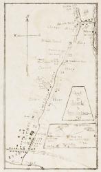
Paris, Desnos, 1766. Quarto (30 cm x 22.5 cm). Collation complete: Bilingual titlepage, 12 double-page maps of England, partly beautifully border-coloured, 6 unnumbered pages of Index with distances in miles, one (1) General Map of England (″Carte Generale” of Engand by D’Ogilby), 101 full-page maps of routes/streets, Engraved titlepage for the Appendix, One (1) double-page of explanations for the London-City-Plan, 17 beautiful maps and engravings of a variety of english cities, also with a section on Ireland (Dublin, Waterford, Kinsale, Galway, Limerick). Original 18th-century contemporary calf with gilt lettering on spine and on five raised bands. The Volume is now protected in Collector’s Mylar. Very good+ condition with only minor signs of external wear. Some rubbing and corners slightly bumped but overall excellent. Interior near fine with only the slightest occasional spotting. Rare and even rarer in this condition !

EUR 2.400,-- 

Show details   Add to cart

[Chiari, Giovanni] Vascellini, Gaetano - Statute di Firenze [Richard Meade - Ballymartle]

10. [Chiari, Giovanni] Vascellini, Gaetano.

Statue di Firenze [incluso: “Catalogo delle Statue del R. Giardino di Boboli colla Notizia dei Loro Autori”, “Catalogo delle Statue nel R. Palazzo de Pitti”, Catalogo delle Statue colla Notizia dei Loro Autori ec.” ec.]

Tres Parti (complete) [Tutto dichiarato come prima parte]. Firenze, Presso Giuseppe Volpini Cartolaro, no year [c. 1765]. Octavo. Collation complete. Pagination: Part I (Primo): Frontispiece copper-engraving with Florence in the background, 8 pages of text with introduction by Giovanni Chiari and the catalogue of statues in Boboli Garden, 25 plates each with 4 copper-engravings of Statues in Boboli Garden. Part II (Seconda): Frontispiece copper-engraving with Florence in the background, 8 pages of text with catalogue of Statues in Palazzo Pitti, 41 plates each with 4 copper-engravings of Statues in Pitti Palace. Part III (Terza): Frontispiece copper-engraving with Florence in the background, 8 pages of text with catalogue of Statues [″Catalogo delle Statue colla Notizia del Loro Autori ec. (incl. Michelangelo Buonarotti, Donatello etc.). Hardcover / Original bookblock rebound by Bayntun in Bath in a subtle and charming modern cloth with gilt lettering on new spine-label. Original endpapers preserved. Exceptional condition of this rare 18th century publication with only very faint signs of foxing. Provenance: Richard Meade, Ballymartle (with the Meade Family – crest as library stamp).

EUR 880,-- 

Show details   Add to cart

Couvée, Album mit 31 grossformatigen, originalen Photographien

13. Couvée, M. M.

19th Century Album with 31 fantastic, large vintage photographs of Germany, Austria and Italy. Many of these early photographs are on Frankfurt am Main, but also Berlin, Heidelberg and classic travel – locations along the Rhine are included / Also interspersed are some other european destinations like Lugano, Venice and Salzburg (these all in colour). – All Photographs original Albumen Prints. / Album mit 31 grossformatigen, fantastischen, originalen Photographien von deutschen und europaeischen Stadtansichten des 19. Jahrhunderts, vorwiegend Frankfurt am Main [mit traumhaften und ungewoehnlichen Ansichten von Frankfurt und Sachsenhausen / Kaiserstrasse mit Strassenbahn / Rossmarkt / Goetheplatz / Alte Oper / Palmengarten / Wiesbaden – Kursaalplatz / Eschenheimer Turm / Kaiser-Wilhelm-Denkmal / Main mit Untermainbruecke und Angler mit zwei Jungen davor / aber auch Stadtansichten von Berlin (″Blick nach den Linden” in Farbe – in colour), Lugano (in Farbe – in colour), Boppard (in Farbe – in colour), Heidelberg (in Farbe – in colour), Salzburg, Königstein im Taunus (in Farbe – in colour), Remagen (in Farbe – in colour), Coblenz, Lahneck, Sooneck, Braubach und Marxburg, Wiesbaden, Bingen und Venedig (in Farbe – in colour)/

La Haye / Dresden, Couvée / Stengel & Co., c. 1895 – 1900. Quer Quart / Oblong Quarto. 31 large photographs mounted on cardboard. Original Hardcover / Exzellente Halblederausgabe mit vergoldetem Titel auf dem Vorderdeckel. / Album with gilt lettering. Ungewoehnlich gut erhaltenes Album mit phantastischen Aufnahmen die auch das buergerliche Leben mit eingefangen haben. / Excellent condition with only minor signs of external wear.

EUR 1.280,-- 

Show details   Add to cart

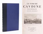
Le Forche Caudine - Illustrate con due Appendici. [Compreso "Prospetto Della Valle Caudina Dalla Parte Della Campania"

14. [Daniele, Francesco / Johann Josef von Wilczek / Thomasius, Christian].

Le Forche Caudine – Illustrate con due Appendici. [Compreso “Prospetto Della Valle Caudina Dalla Parte Della Campania”]. Second edition, augmented and, according to Brunet, preferable to the original first edition, which was printed in Caserta in 1778.

Seconda Edizione. Napoli, Appresso Angelo Trani, 1811. Folio (44.5 cm x29 cm). XIII, (3), 102 pages plus (6) pages advertising and Index (Indice). With 22 (twentytwo) illustrations overall. Including a large fold-out-plan (97 x 43 cm) of the Valle Caudine, several Vignettes, Allegorical/Historical Illustrations and four beautiful landscape engravings of the Valle Caudine by Alessandro d’Anna / XIII, (3), 102 pagine più (6) pagine pubblicitarie e Index (Indice). Con 22 (ventidue) illustrazioni in totale. Tra cui una grande illustrazione (97 x 43 cm) della Valle Caudine, diverse vignette, illustrazioni allegoriche / storiche e quattro bellissime incisioni paesaggistiche della Valle Caudine di Alessandro d’Anna. Hardcover / Fantastic modern, Nigerian goatskin with gilt lettering on spine and fine quality late 19th-century cloth over boards. New endpapers and all bound in style by english master-binders. Excellent condition of the binding. The stunning and most wonderful interior with only very occasional signs of an old dampstain to the outer margins and the beautiful, large fold-out-plan with some mild browning to one part of the center-fold. A typographical masterpiece of italian printmaking.

EUR 1.280,-- 

Show details   Add to cart

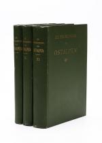
Alpine Chronik des Oesterreichischen Touristen-Club [Angebunden: Heinrich Kempf - Die Flora des Schneeberges in Nieder-Oesterreich (1882)]

29. Graf, Edmund.

Alpine Chronik des Oesterreichischen Touristen-Club [Angebunden: Heinrich Kempf – Die Flora des Schneeberges in Nieder-Oesterreich (1882)].

Erste Ausgabe. Sieben Jahrgaenge in 6 Baenden (Jahrgang 1886 fehlt). Wien, L.C.Zamarski – Verlag des Oesterreichischen Touristen-Club, 1880-1887. Octavo. 1880: IV, 212 Seiten / 1881: (6), 200 Seiten mit Falttafeln und angebunden 66 Seiten (Flora des Schneeberges) / Die Jahrgaenge 1882/1883 zusammen gebunden. Paginierung: Jahrgang 1882: Frontispiz (Chemitypie von Angerer und Goeschl: “Das Spronserthal”) plus 95 Seiten mit einer Falttafel “Meteorologische Beobachtungen” [Die Abbildung “Das Spronserthal” ist der Blick vom Schaermer Kreuz bei Schoena und wurde vom Verfasser mittelst Fridolin Plant’s Zeichenapparat aufgenommen [es fehlt eine Abbildung: “Bergfahrt bei Meran” die dem gleichnamigen Artikel beigebunden sein sollte] / Im Anhang des gleichen Bandes: Jahrgang 1883: Frontispiz (Chemitypie von Angerer und Goeschl: “Alttirolische Wirthschaftsgebaeude im Gebirge” Nach einer Originalzeichnung von Grasmair plus 117 Seiten und eine Tafel “Meteorologische Beobachtungen” / Jahrgang 1884: 101 Seiten plus Tafel “Meteorologische Beobachtungen” / Jahrgang 1885: 100 Seiten plus Tafel “Meteorologische Beobachtungen” / Jahrgang 1887: 136 Seiten plus Tafel “Meteorologische Beobachtungen”. Hardcover [original Verlagsleinenbaende] mit Rueckenvergoldung. Sehr guter Zustand. Alle Exemplare mit Exlibris des “Climbers’ Club” / Kleine Stempel des Central-Ausschuss des Deutschen und Oesterrreichischen Alpen-Vereins. Aus der Bibliothek des “Alpine Club”. / Very good condition with only minor signs of external wear.

EUR 350,-- 

Show details   Add to cart

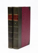
Nathaniel Hooke - The Roman History, From the Building of Rome to the Ruin of the Commonwealth

33. Hooke, Nathaniel.

The Roman History, From the Building of Rome to the Ruin of the Commonwealth [with the printed Dedication to Alexander Pope]. Illustrated with 17 folding Maps, 4 Fontispieces and 11 other Plates [32 copper-engravings in total].

The Fourth Edition. Four Volumes (complete set with all maps and plates). London, Printed for J. and R. Tonson; Hawkins and T.Longman, 1766 – 1771. Quarto (27 cm x 22 cm). Collation: Volume I: Frontispiece, XLVI, XLVI, 634 pages with 10 plates and 3 maps / Volume II: Frontispiece, XXXII, XXXII, 668 pages with 8 maps / Volume III: Frontispiece, VI, 694 pages with 5 maps / Volume IV: Frontispiece, VII, 464 pages plus 76 unnumbered pages of a General Index and 1 plate and 1 map. Hardcover / Original 18th-century leather with gilt lettering and labels on spine. Interior of this set with all maps and illustrations in excellent, very clean condition. The boards of the bindings with abrasions and some bumping but overall very firm. Some stronger peeling of the leather on board of Volume I, Only three pages with minor tears. The large map of Northern Africa (Palestine, Egypt and Libya) with a minor tear. The stunning maps and plates in timeless beauty. Highly underestimated work, in the shadow of Gibbon but with meticulous detail in presenting the geographical impact of the Roman Conquest. From the library of Daniel Conner (Connerville / Manch House), with his Exlibris / Bookplate to pastedown.

EUR 3.500,-- 

Show details   Add to cart

John - An account of the Principal Lazarettos in Europe; with various papers relative to the Plague

34. Howard, John / [Daniel Conner Library]

An account of the Principal Lazarettos in Europe; with various papers relative to the Plague: Together with further Observations on some foreign Prisons and Hospitals; and additional remarks on The Present State of those in Great Britain and Ireland. [Including chapters on English Prisons and Hospitals, Hulks [Prison-Ships] on the Thames, Remarks on the Gaol-Fever, Remarks on Penitentiary Houses, Scottish Prisons and Hospitals, Irish Prisons and Hospitals, Charter Schools in Ireland etc.]

First Edition. Warrington, Printed by William Eyres; And sold by T. Cadell, J. Johnson, C. Dilly, and J. Taylor in London, 1789. Quarto (24,5 cm x 30,5 cm). VIII, 259 pages plus 13 unnumbered pages of Index and 1 page “Directions to the Book-Binder”. Collation complete with 22 plates of which 20 are large fold-out-engravings. Hardcover / Contemporary 18th century calf with gilt lettering on spine. Stunning Volume, recently restored and rebacked by two english master-binders. Very good+ condition with only minor signs of external wear. After the restoration now a highly-desirable collectable. One of the first sociological studies of conditions within the penal system of England and Ireland compared to other 18th-century practices within European Jails / Gaols. The partly romantic engravings seem sinister when one imagines what inmates and children endured within these settings. From the library of Daniel Conner (Connerville / Manch House), with his Exlibris / Bookplate to pastedown.

EUR 2.800,-- 

Show details   Add to cart

Daniel Paterson & Edward Mogg - Paterson's Roads [1831/1832 Edition (18th Edition) with 12 Maps]

42. [Paterson, Daniel] Mogg, Edward.

Paterson’s Roads [1831/1832 Edition (18th Edition)] – Being an entirely original and accurate Description of all the direct and Principal Cross Roads in England and Wales, with part of the roads of Scotland. [Including an “Appendix to the Eighteenth Edition of Paterson’s Roads; being An Accurate Description of the Direct and Principal Cross roads communicating with the Improved Old Passage Ferry, across the River Severn, between Aust and Beachley, near Chepstow. Accompanied by a Map of the Banks of the Wye. To which are added, Course of the Chepstow Steam Packets; and An arranged Tour through Wales, with References to the pages in the Body of the Work, where connection with various lines of Road takes place.”]. The Eighteenth Edition. To which are added Topographical Sketches of the several Cities, Market Towns and remarkable Villages and descriptive accounts of the principal seats of the Nobility and Gentry, the Antiquities, Natural Curiosities and other Remarkable Objects throughout the Kingdom. The whole Remodelled, Augmented and Improved by the Addition of Numerous New Roads and New Admeasurements, and Arranged upon A Plan at once Novel, clear and intelligible, is deduced from the latest and best Authorities: Including a Table of the Heights of Mountains from the Grand Trigonometrical Survey of the Kingdom; Also a Table of the Population, From the Census of 1831; To which is annexed the Arrival and Departure of the Mail, together with the Rates of Postage and An Entirely New Set of Maps.

London, Printed for Longman, Rees, Orme, Brown, Green and Longman, 1831/1832. Octavo (15 cm x 21,5 cm). Fontispiece – Fold-out-Map, 715 pages plus 44 pages of an Appendix. With twelve (12) Maps, including the frontipiece-map and full-page maps throughout the publication. Hardcover / Private half-leather of the early 20th century with gilt lettering on the spine. Some of the maps with visible reapirs but complete. Very good condition with only minor signs of wear. This being the so-called “Best Edition”.

EUR 750,-- 

Show details   Add to cart

Jean-Denis Barbié du Bocage - Tableau de la Grande-Bretagne, De L'Irlande et des Possessions Angloises dans les quatre parties du Monde. [Large Paper Copy / Better Paper Copy / Exemplaire de Luxe]

43. Pugilism (Boxing) – Baert-Duholant, Charles-Alexandre-Balthazar-François de Paule baron de / Jean-Denis Barbié du Bocage.

Tableau de la Grande-Bretagne, De L’Irlande et des Possessions Angloises dans les quatre parties du Monde. [Large Paper Copy / Better Paper Copy / Exemplaire de Luxe] [With five (5) large, folded Maps by Jean-Denis Barbié du Bocage: Large, oblong folded Map/Plan of Gibraltar / England / Scotland / Ireland / India] / [With four (4) stunning copper-engravings: Grotte de Fingal, Chaussée des Géants / Plan et vue de Gibraltar / Combat de Boxe (Pugilists)] / [With two (2) portraits: 1.Portrait of William Pitt (after William Owen) and 2. Portrait of Charles Jacques Fox (after Karl Anton Hickel)].

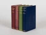
Four Volumes (complete set). Paris, Chez H.J.Jansen, L’An 8me [1800]. Octavo (21.5 cm x 14 cm). Collation: Volume I: (8), 459, (1), 11 pages with Eleven (11) copper-engravings of which are: 5 Maps / Plans and 4 Engravings: The folded view of Fingals Cave (″Grotte de Fingal dans l’Ile de Staffa” – (20.5 cm x 31.5 cm) / “Folded Plate of the Giants Causeway (″Vue occidentale de la Chaussee des Geans et des Caps voisins” (20.5 cm x 39 cm)) / Fantastic, large Map/Plan of Gibraltar by Jean-Denis Barbié du Bocage, with a Birds-Eye-View of the Ville de Gibraltar (20.5 cm x 65.5 cm) [also showing the Ville Irlandaise on Gibraltar] / Scenic View of Gibraltar (″Vue de Gibraltar, prise du cote de l’Espagne” (20.5 cm x 33 cm) / Large Fold-Out-Map of England by Jean-Denis Barbié du Bocage with an Inset-View of Stonehenge (47 cm x 51 cm) / Large Fold-Out-Map of Scotland by Jean-Denis Barbié du Bocage, including the Western Isles and Shetland, with a stunning Inset-View of the irish pilgrimage-mountain Croagh Patrick [Craig-Phadrick] in Westport, Ireland (37 cm x 50 cm)/ Large Fold-Out-Map of Ireland with an Inset-View of the Lakes of Killarney (39 cm x 44.5 cm) / Volume II: 532, (1), 12 pages with Large Fold-Out-Map of India (″Possessions Anglaises”) by Jean-Denis Barbié du Bocage – the large India-Map showing areas as far as Tibet, Siam, Sumatra and the Andaman Islands, Ceylon, Burma (48 cm x 43 cm) / Volume III: 502, 48, (2) pages with two portraits: Guillaume Pitt [William Pitt] & Charles Jacques Fox (each 20.5 cm x 12.5 cm)/ Volume IV: 486, 22, (2) pages with the very famous Fold-out-Illustration of Pugilists / Boxers at Odiham in Hampshire [″Combats de Boxers a Odiham”] showing a boxing-match between Humphrey and Mendoza (32 cm x 20.5 cm). Hardcover / Original, very decorative original half leather bindings with gilt lettering and ornament on spine. Volume One professionally rebacked by an english master bookbinder. All four Volumes in protective Collector’s Mylar. Excellent condition with only minor signs of external wear. From the library of François-Xavier de Valenzi with his bookplate / exlibris to the pastedowns of each Volume. Maps in this de Luxe Edition are all considerably larger than in the normal-paper-edition and all the maps and illustrations are in superb condition. An underestimated collectable.

EUR 2.200,-- 

Show details   Add to cart

Der Tourist, Der Tourist.

46. [Rickmer Rickmers, Willi] Jäger, Gustav (Herausgeber).

Der Tourist – Organ für Natur- und Alpenfreunde [plus einige Jahrgaenge der Beilagen “Das Alpenhorn” und “Bei Nebel und Regen” beigebunden]. 27 Bände in 20 / Es fehlen die No.39 und 40 im Jahrgang 1869 (dies sind die Seiten 609-640 und es fehlen die Jahrgaenge 1893 bis 1896) . Einige Jahrgaenge sind in zwei Baenden erschienen und hier immer in einem Band gebunden. Diese wurden von uns aber bei der Gesamtzahl von 27 Baenden nicht doppelt gezaehlt und immer als “ein Band” gewertet. / 27 volumes of a consecutive run from 1869 bound in 20 volumes with only four annuals (1893-1896) as well as two numbers missing [No.39 and 40 in Volume 1 (year 1869)]. [Als weitere Zugabe: Dublette des Jahrgangsband 1876-1877 vom “Alpine-Club” (London) mit einer beigebundenen Ausgabe: Gustav Jaeger – “Der Fuehrer auf der Kronprinz Rudolfbahn von der Donau bis Laibach enthaltend: Die Beschreibung der Kunstbauten und Eisenbahnfahrten auf der Hauptlinie und den Seitenfluegeln, sowie die Schilderung der Ortschaften und Ausfluege von saemtlichen Bahnstationen in Nieder- und Oberoesterreich, Steiermark, Kaernten und Krain. Wien, 1876. 213 (6) Seiten].

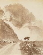
Wien, Carl Finsterbeck, 1869 – 1892 & 1897-1898. 14.5 cm x 21.5 cm / 24.5 cm x 30.5 cm / 25 cm x 32.5 cm. 23.5 cm x 31.5 cm ca. 9800 Seiten (siehe Paginierung im englischen Teil der Beschreibung). [Mit der farbigen Lithographie “Der Sonnblick” im Maltathal in Band 1 (1869 / eingebunden nach Seite 202) sowie der zweiten Lithographie “″Glokner” (eingebunden nach Seite 728)/ Lithographie in Band 2 (1870) fehlt [Allerdings haben wir der Ausgabe den 2. Jahrgangsband 1870 als Dublette beigelegt und die Dublette fuer 1870 enthaelt die seltene Lithographie “Der Blaue Tumpf im Maltathale (Kaernten)” [siehe die Photos]. Die Reihe enthaelt ausserdem das wunderbare, grosse Panorama vom “Hochwechsel” / Circa. 9,200 pages – Vol.I (1869), 768 pages with both Lithographs as called for (pages 609-640 missing) plus “Das Alpenhorn” (Nummern 29 – 48 des 1.Jahrgangs) / Vol.II (1870), 696 pages with the Lithograph missing – Angebunden: “Das Alpenhorn” – Kompletter II.Jahrgang [Als Zugabe: Band 2 liegt hier bei mit der Lithographie] / Vol.III (1871), 726 pages plus “Das Alpenhorn” Teil des III.Jahrgangs / Vol.IV (1872), 552 pages plus der komplette IV. Jahrgang “Das Alpenhorn” / Vol.V (1873), 436 pages plu Jahrgang V of “Das Alpenhorn” / Vol.VI (1874), 442 pages plus Jahrgang VI of “Das Alpenhorn” / VII. (1875), 412 pages mit “Das Alpenhorn” Jahrgang VII. / Vol.VIII (1876) – 2 Volumes in 1: 228 pages & 244 pages plus “Das Alpenhorn” Jahrgang VIII / Vol.IX (1877) – 2 Volumes in 1: 204 & 236 pages plus 48 pages “Bei Nebel und Regen” & “Das Alpenhorn” IX.Jahrgang / Vol.X (1878)-2 Volumes: 234 & 242 pages plus einige Nummern von “Bei Nebel und Regen” & “Das Alpenhorn” / Vol.XI-XII (1879-80) c.416 pages / Vol.XIII-XIV (1881-82), c.384 pages / Vol. XV-XVI (1883-84), c.384 pages / Vol.XVII-XVIII (1885-1886), c.384 pages/ Vol.XIX-XX (1887-88), c.384 pages / Vol.XXI-XXII (1889-90), c.384 pages / Vol.XXIII-XXIV (1891-92), c.384 pages / Vol.14 (1897), 458 pages / Vol.15 (1898), 586 pages / Vol.16 (1899), 668 pages. / In addition the periodical includes a duplicate of Volume II (Annual for 1870) and this Duplicate includes the rare original Lithograph. Originale Halbleinenbaende des 19.Jahrhunderts mit Rueckenvergoldung. / Hardcover. Contemporary cloth with gilt lettering on spine / [2 with marbled boards, the remainder with dark cloth boards]. 3 volumes with navy cloth boards. Zehn Baende in Gross-Quart, die anderen in Oktav-Format. Sehr guter Zustand dieser seltenen, korrespondierenden Reihe mit nur wenigen Gebrauchsspuren an den Bindungen. Very good condition with only minor signs of external wear. Some minor abrasions to cloth for volumes 1872 and 1875. Baende fuer die Jahre 1872 und 1875 mit kleinen Einrissen am Ruecken. Periodikum aus der Bibliothek von Wilhelm Gustav Rickmer Rickmers, mit seinem Exlibris in nahezu allen Baenden / Minor rubbing only to head and heel of spines and board corners. Interiors clean and bright for the most part. Slight tanning throughout. Former copies from the library of Wilhelm Gustav Rickmer Rickmers, with his large, beautiful and artistic bookplate “Bibliotheka Rickmersiana” [designed and monogrammed by Otto Barth] in most of the Volumes. Also Bookplate of Bibliothek Central-Ausschuss Deutscher und Österreichischer Alpenverein. Library stamp on front endpaper / The collection subsequently was part of the library of the Alpine Club in London.

EUR 2.400,-- 

Show details   Add to cart

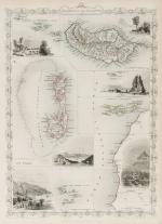
Staunton - An Authentic Account of an Embassy from the King of Great Britain to the Emperor of China

53. Staunton, Sir George / Lord Macartney.

An Authentic Account of an Embassy from the King of Great Britain to the Emperor of China [First Dublin Edition with 34 full-page-plates]; Including Cursory Observations Made, and Information Obtained, in Travelling Through That Ancient Empire, and a Small Part of Chinese Tartary. Together with a Relation of the Voyage undertaken on the Occasion by his Majesty’s Ship ‘The Lion’, and the Ship ‘Hindestan’ in the East India Company’s Service, to the Yellow Sea, and Gulf of Pekin [sic]; as well as of their return to Europe. With Notices of the several places where they stopped in their way out and home: being the Islands of Madeira, Teneriffe and St.Jago, the Port of Rio de Janeiro in South America; the Islands of St.Helena, Tristan da Cunha and Amsterdam, the Coast of Java and Sumatra, the Nanka Isles, Pulo-Condore and Cochin-China. Taken chiefly from the Papers of his Excellency, the Earl of Macartney, Knight of the Bath, his Majesty’s Embassador Extraordinary and Plenipotentiary to the Emperor of China; Sir Erasmus Gower, Commander of the Expedition and other Gentlemen in the several Departments of the Embassy.

Two Volumes (complete set). Dublin, Printed for P.Wogan, R.Cross, P.Byrne and others, 1798. Octavo. Volume I: XV, 449 pages with 8 full-page plates / Volume II: XVIII, 430 pages, with 26 full-page-plates and including an Appendix. Hardcover / Original, early 19th century half leather with original spinelabels. Bindings firm and strong but rather worn. Bookplate of Richard Meade, Ballymartle, to the pastedown of Volume I. Overall in very good condition with some stronger signs of wear but with all the illustrations / engravings, called for in the Dublin Edition.

EUR 1.280,-- 

Show details   Add to cart

Page: 1
: