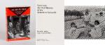
Middle Eastern History – Rare (23 items)

[Middle East with Kuwait] Naylor, Collection of two (2) large boxes of materials regarding Kuwait, Iraq (near Basrah), Lebanon, Jordan (Halat Ammar and Al Mudawwara), Jordan in general, Arava Valley

7. [David Naylor Geology & Petroleum Collection] – [Middle East Collection with Kuwait / Iran (Persia) / Yemen / Jordan] Naylor, David (Dave).

Collection of two (2) large boxes with rare and sometimes inscribed, Printed Materials and very rare Geological Surveys with Maps (for example it includes the very rare Geological Survey of Iran) from the private Reference- library of Geologist Prof. David (Dave) Naylor regarding Kuwait, Iraq (near Basrah), Lebanon, Jordan (Halat Ammar and Al Mudawwara), Jordan in general, Arava Valley (Dead Sea). See a full list of the contents below. These materials are all publications, sometimes official government papers or maps or academic publications from fellow geologists as well as for example official publications of talks given for OAPEC. All publications are revolving around the evaluation of Petroleum Deposits, Petroleum Geology and Stratigraphy or Hydrocarbon in the “Near and Middle East” – Maps and Charts and offprints, all of them rare publications and some only reprinted for private circulation. The focus of the publications ranges from very scientific-geological (″The Fauna of some Recent Marine Deposits near Basrah, Iraq”) to actual problems of prospecting (″Some Problems of Petroleum Geology in Kuwait”). These two boxes are only the Middle East Section of the David Naylor Collection (see all the Materials we own from the David Naylor-Reference library on our website). The collection also includes books related to the region (inquire for separate list).

Amman (Jordan) / Kuwait / Mexico / Potsdam, etc., c.1958 – 2011. Quarto. c. 1200 pages plus maps. Hardcover Boxes / Two bespoke made Boxes for the private reference library of Geologist David (Dave) Naylor. Very good condition with only minor signs of wear.

Show details

Doughty - Travels in Arabia Deserta. [Patrick Leigh Fermor's personal copy with three first editions of Leigh Fermor's Travel Writing]

9. [Fermor, Patrick Leigh] Doughty, Charles M.

Travels in Arabia Deserta. With an Introduction by T. E. Lawrence. [Patrick Leigh Fermor’s personal copy] / [Also including all three Volumes of his autobiographical journey (one of them signed), on foot across Europe from the Hook of Holland to Constantinople in the years 1933 – 1934].

Second Impression of the ‘New and definitive Edition’. Two Volumes (complete set). London, Jonathan Cape, 1943. 20 cm x 26 cm. Volume I: Frontispice- Portrait of Doughty, 674 pages. Volume II: 696 pages. With both Volumes including each the beautiful large colour-fold-out-map in the rear showing “North Western Arabia and Negd”. Hardcover / Publisher’s original buckram with gilt lettering on spine and original dustjackets in protective collector’s Mylar. Deckled fore- and tail-edges. Coloured top edges. Very good condition with only minor signs of external wear. Dustjackets slightly stained and price-clipped. Interior is bright and clean. Patrick Leigh Fermor’s personal copy with his name in ink on the endpaper of Volume II: “Patrick Leigh Fermor. London, July 1945.”. Leigh Fermor obviously rewarded himself with the purchase of Doughty’s masterpiece directly after World War Two. Stunning item, manifesting Doughty’s heavy influence on Patrick Leigh Fermor’s Travel writing. The set includes also three first editions in original dustjackets, of Patrick Leigh Fermor’s famous Travel writings: A Time of Gifts, Between the Woods and the Water [SIGNED], The Broken Road (with the second book, “Between the Woods and the Water” signed by Patrick Leigh Fermor.

EUR 2.400,-- 

Show details   Add to cart

Nathaniel Hooke - The Roman History, From the Building of Rome to the Ruin of the Commonwealth

13. Hooke, Nathaniel.

The Roman History, From the Building of Rome to the Ruin of the Commonwealth [with the printed Dedication to Alexander Pope]. Illustrated with 17 folding Maps, 4 Fontispieces and 11 other Plates [32 copper-engravings in total].

The Fourth Edition. Four Volumes (complete set with all maps and plates). London, Printed for J. and R. Tonson; Hawkins and T.Longman, 1766 – 1771. Quarto (27 cm x 22 cm). Collation: Volume I: Frontispiece, XLVI, XLVI, 634 pages with 10 plates and 3 maps / Volume II: Frontispiece, XXXII, XXXII, 668 pages with 8 maps / Volume III: Frontispiece, VI, 694 pages with 5 maps / Volume IV: Frontispiece, VII, 464 pages plus 76 unnumbered pages of a General Index and 1 plate and 1 map. Hardcover / Original 18th-century leather with gilt lettering and labels on spine. Interior of this set with all maps and illustrations in excellent, very clean condition. The boards of the bindings with abrasions and some bumping but overall very firm. Some stronger peeling of the leather on board of Volume I, Only three pages with minor tears. The large map of Northern Africa (Palestine, Egypt and Libya) with a minor tear. The stunning maps and plates in timeless beauty. Highly underestimated work, in the shadow of Gibbon but with meticulous detail in presenting the geographical impact of the Roman Conquest. From the library of Daniel Conner (Connerville / Manch House), with his Exlibris / Bookplate to pastedown.

EUR 3.500,-- 

Show details   Add to cart

Page: 1 2
: