West Cork Rare BookfairINANNA MODERNWest Cork Reading Holidays
We ship per DHL Express

We ship per DHL Express

Maps (39 items)

Barrow, Voyage dans la partie meridionale de l'Afrique

3. Barrow, John.

Voyage dans la partie meridionale de l’Afrique; fait dans les années 1797 et 1798; par John Barrow, Ex-Secretaire de Lord Macartney…Contenant des observations sur la géologie, la géographie, l’histoire naturelle de ce continent, et une esquisse du caractère physique et moral des diverses races d’habitans qui environnent l’Etablissement du Cap de Bonne-Espérance. / Accompagné: Nouveau Voyage dans la partie méridionale de l’Afrique; Où l’on examine quelle est l’importance du Cap de Bonne-Espérance pour les différentes puissances de l’Europe, considéré comme station militaire et navale; comme boulevart du commerce et de la domination des Anglais dans l’Inde; comme centre des établissemens pour la pêche de la baleine dans les mers Australes; comme acquisition territoriale, et comme entrepôt commercial en tems de paix. Accompagné d’une description statistique de la colonie rédigée sur les documens les plus hautentiques, enrichi de huit belles cartes, contenat celle de la Côte d’Afrique depuis la baie de la Table jusqu’a la baie de Saldanha, des cartes de la baie de Pletenberg, d’Algola, de Mossel et de False bay; du plan militaire de la péninsule du Cap, et de ceux de la baie de la Table et du Knisna. (2 Volumes).

First French Edition. 4 Volumes [complete set of two works with 2 Volumes each]. Paris, Dentu, 1801-1806. 35.5 cm x 55.8 cm. Collation: complete. Pagination: Volume I: XVI, 403, (1) pages / Volume II: 326, (2) pages including Errata-leaf / Volume III: X, 310 pages / Volume IV: 312 pages. Original contemporary red calf with gilt lettering and ornament to lacquer-polished-spine. The Volumes are numbered consecutively, even though these are two separate works. Excellent condition of the binding and interior of this important publication with very minor signs of foxing only ! All the maps in wonderful condition ! First french edition of “Travels into the Interior of Southern Africa” (Barrow’s journey with Lord Macartney in 1797 to the Cape of Good Hope) plus two further Volumes which describe the second journey in 1801 / 1802 to Saldanha Bay [Saldanhabaai] with an early image of Robben Island. The survey of the Dutch colonies was not only a seminal work on South Africa but the beautifully engraved, large folding map of South Africa was a turning point of african cartography and geographical illustration.

EUR 1.800,-- 

Show details   Add to cart

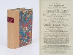
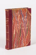
Cary's New Itinerary: Or an Accurate Delineation of the Great Roads, Both Direct and Cross throughout England and Wales: With Many of the Principal Roads in Scotland.

5. Cary, John.

Cary’s New Itinerary: Or an Accurate Delineation of the Great Roads, Both Direct and Cross throughout England and Wales: With Many of the Principal Roads in Scotland. From an Actual Admeasurement by John Cary: Made by Command of his Majesty’s Postmaster General for official purposes: Under the Direction and Inspection of Thomas Hasker Esq., Surveyor and Superintendant of the Mail Coaches. [Including an advertising for Cary’s New Celestial and Terrestrial Globes (with Illustrations of Globes)]. [Subtitle:] This work shows the immediate Route from the Metropolis [London] to all parts of England and Wales: And from Town to Town in every direction, distinguishing also the Cities, Market, Borough and Corporate Towns: And those at which the Assizes are held and gives the time of the Mails, Arrival and Departure from each, Describes the Line of the Navigable Canals and the Course of the Rivers passed over, The Number of Houses and Inhabitants contained in each Town, And those Inns which supply Post Horses and Carriages. Also The Inn’s throughout the Metropolis [London] from which the Mail and Stagecoaches go, their time of departure & the Route they seveerally take. The Noblemen and Gentlemen’s Seats situate near the Roads, A List of the Packet Boats and their time of sailing. Copious Indexes. Maps of the Lot Wight Environs of London, Bath, Brighton, Margate & Cheltenham & a Large Map of England and Wales peculiarly adapted to the Work. – [An Advertisement juxtaposed to the titlepage reads: “This Edition contains the Routes to upwards of Nine Thousand Places, which have never been given in any work of a similar Description; being a complete Directory to every Parish situate out of the Line of the Direct and Cross Roads throughout England and Wales”].

Seventh Edition, with Improvements [complete with all maps as called for]. London, Printed for J. Cary, 1817. Octavo. Pagination: [1], 647 pages plus 7 maps / Detailed pagination see here: [1], Title, Large Folding Map, [121], 6 folded Maps, [526] pages. Modern, recent Hardcover / Very decorative half-leather with marbled-paper-covered boards. Gilt lettering on new sppine-label. New endpapers. Protective Mylar. Only the large folding map with a inor tear (one part of the map deliberately bound separate (geniously folding out to meet th erest of the map). Interior text and maps all in excellent, unusually clean condition !!

EUR 780,-- 

Show details   Add to cart

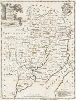
Gilpin / Castle Freke Library - Observations Relative Chiefly to Picturesque Beauty, Made in the Year 1776

11. Gilpin, William. [Castle-Freke Library Bookplates]

Collection of four Volumes (bound in two) by Gilpin – All from the historical library at Castle Freke (Castlefreke, West Cork / Ireland). The Volumes include: I. & II. Observations Relative Chiefly to Picturesque Beauty, Made in the Year 1776, on Several Parts of Great Britain; particularly the High-Lands of Scotland. [Second Edition, with an “Account of the Prints” bound to the rear] / III. Observations on the River Wye and several Parts of South Wales &c. relative chiefly to Picturesque Beauty; Made in the summer of the Year 1770 (Third Edition). / IV. An Essay on Prints – [″The chief intention of the following work was to put the elegant amusement of collecting prints, on a more rational footing; by giving the unexperienced collector a few principles and cautions to assist him”] (Fourth Edition with the printed dedication “To the Honorable Horace Walpole in Deference to his Taste in the Polite Arts; and the Valuable Researches he has made to improve them; the following work is inscribed by his most obedient and very humble servant, William Gilpin”). [Volumes I & II with 40 original illustrations and vintage 18th century maps [correctly 39 illustrations and one table], for example of Loch Lomond and the Firth of Forth/ all illustrations are vintage mezzotint-plates].

Mixed Editions. Four Volumes (bound in two). London, Printed for R. Blamire, Strand, 1792. Octavo. Pagination: Volume I: XI, [1], 221 pages with 24 mezzotints / Volume II: 195, XVI pages with 16 mezzotints and an “Account of the Prints” as well as “Translations of Latin Passages” / [Volume III]: [River Wye]: XVI, 152 pages with 16 (of 17) full – page mezzotints / [Volume IV]: [An Essay on Prints]: XIII, [3], 174 pages plus XI pages Index and 1 page Errata. Hardcover / Early 19th century quarter – morocco with gilt lettering and ornament on spine. Both volumes bound in unison. Very good + condition with only minor signs of external wear. Pages 185 – 191 of Volume I with some stronger browning. Otherwise the interior very clean. All mezzotints in very good or even better condition. This is the original copy from the historical Castle-Freke Library in West Cork (Ireland), with two armorial bookplates to front and rear pastedown with the family’s motto ‘Pro Patria’. With two pages of manuscript annotations by a contemporary hand with a reference between the common name “Tarbet” in Scotland and a place-name in County Kerry in Ireland” (pages 13 of Volume II) / another entry is on page 12 of Volume II regarding the name-sake “Loch-Loung” for a Lake of ships in Scotland and Ireland.

Show details

Nathaniel Hooke - The Roman History, From the Building of Rome to the Ruin of the Commonwealth

12. Hooke, Nathaniel.

The Roman History, From the Building of Rome to the Ruin of the Commonwealth [with the printed Dedication to Alexander Pope]. Illustrated with 17 folding Maps, 4 Fontispieces and 11 other Plates [32 copper-engravings in total].

The Fourth Edition. Four Volumes (complete set with all maps and plates). London, Printed for J. and R. Tonson; Hawkins and T.Longman, 1766 – 1771. Quarto (27 cm x 22 cm). Collation: Volume I: Frontispiece, XLVI, XLVI, 634 pages with 10 plates and 3 maps / Volume II: Frontispiece, XXXII, XXXII, 668 pages with 8 maps / Volume III: Frontispiece, VI, 694 pages with 5 maps / Volume IV: Frontispiece, VII, 464 pages plus 76 unnumbered pages of a General Index and 1 plate and 1 map. Hardcover / Original 18th-century leather with gilt lettering and labels on spine. Interior of this set with all maps and illustrations in excellent, very clean condition. The boards of the bindings with abrasions and some bumping but overall very firm. Some stronger peeling of the leather on board of Volume I, Only three pages with minor tears. The large map of Northern Africa (Palestine, Egypt and Libya) with a minor tear. The stunning maps and plates in timeless beauty. Highly underestimated work, in the shadow of Gibbon but with meticulous detail in presenting the geographical impact of the Roman Conquest. From the library of Daniel Conner (Connerville / Manch House), with his Exlibris / Bookplate to pastedown.

EUR 3.500,-- 

Show details   Add to cart

Jäger, Der Tourist - Organ für Natur- und Alpenfreunde.

13. Jäger, Gustav (Herausgeber) / Rabl, Josef / Matzak, Franz Johann.

Der Tourist – Organ für Natur- und Alpenfreunde.

9 Baende. Wien, Verlag des Redakteurs Carl Finsterbeck, 1869 – 1877. 14.5 cm x 21.5 cm. Siehe Paginierung im englischen Teil der Beschreibung / Mit der farbigen Lithographie “Der Sonnblick” im Maltathal in Band 1 (1869) und ausserdem in Band 1 die Lithographie: “Glokner [sic] – Front gegen Sued-West” (Glockner) eingebunden vor Seite 190. Vorhanden in Band 2 ist ausserdem die seltene und oft fehlende Lithographie “Der Blaue Tumpf im Maltathale (Kaernten)”. Die Reihe enthaelt ausserdem in Band 5 (Jahrgang 1873) das wunderbare, grossformatige Falt-Panorama vom “Hochwechsel” und eine darauffolgende Faltkarte./ Vol.I (1869), 768 pages with both Lithographs / Vol.II (1870), 696 pages with the Lithograph / Vol.III (1871), 726 pages with bookplate: “The Property of the Climbers’ Club” / Vol.IV (1872), 552 pages mit Faltkarte des Kanalthales / Vol.V (1873), 436 pages . Mit einer Karte des Wechsel-Gebietes und einem Panorama vom Hochwechsel / Vol.VI (1874), 442 pages plus No.1 – 24 (kompletter Jahrgang 1874) of “Das Alpenhorn” als Beilage des Tourist mit eingebunden / Vol.VII (1875), 412 pages plus No.1-18 plus No.21 of “Das Alpenhorn” for the year 1875 – [This Volume also includes the announcement of the editors Gustav Jaeger’s death] / Vol.VIII (1876): 2 volumes in 1: Volume 1 counts 228 pages plus 52 pages “Das Alpenhorn” and Volume 2 counts 244 pages plus 54 pages “Das Alpenhorn” [VIII.Jahrgang for 1876] / Vol.IX (1877) – Redigiert von J.Karl Beer in zwei Baenden. Volume 1: 204 pages / Volume 2: 236 pages plus 48 pages “Bei Nebel und Regen” – Blaetter belletristischen Inhaltes mit Beruecksichtigung der engeren Heimatskunde mit Original-Beitraegen. Redigiert von Franz Johann Matzak // Originale Halbleinenbaende des 19.Jahrhunderts mit Rueckenvergoldung. / Hardcover. Contemporary cloth with gilt lettering on spine / [2 with marbled boards, the remainder with dark cloth boards]. 3 volumes with navy cloth boards. Zehn Baende in Gross-Quart, die anderen in Oktav-Format. Sehr guter Zustand dieser seltenen, korrespondierenden Reihe mit nur wenigen Gebrauchsspuren an den Bindungen. Very good condition with only minor signs of external wear. Some minor abrasions to cloth for volumes 1872 and 1875. Baende fuer die Jahre 1872 und 1875 mit kleinen Einrissen am Ruecken. Periodikum aus der Bibliothek von Wilhelm Gustav Rickmer Rickmers, mit seinem Exlibris in nahezu allen Baenden / Minor rubbing only to head and heel of spines and board corners. Interiors clean and bright for the most part. Slight tanning throughout. Former copies from the library of Wilhelm Gustav Rickmer Rickmers, with his large, beautiful and artistic bookplate “Bibliotheka Rickmersiana” [designed and monogrammed by Otto Barth] in most of the Volumes. Also Bookplate of Bibliothek Central-Ausschuss Deutscher und Österreichischer Alpenverein. Library stamp on front endpaper / The collection subsequently was part of the library of the Alpine Club in London.

EUR 980,-- 

Show details   Add to cart

Philip Luckombe, The Compleat Irish Traveller [Luxury Reprint with all of Charles Smith's Illustrations of 18th century Ireland (Munster / Kerry / Waterford) in separate Folder for Framing]

20. [Luckombe, Philip / Smith, Charles].

Luxury Reprint of “The Compleat Irish Traveller” [With high quality Reproductions of the 31 original Plates of detailed Maps of County Cork in the 18th century, County Kerry in the 18th century and Waterford in the 18th century, as well as some of the earliest engravings of Irish Towns here for the first time reproduced as beautiful Artworks for framing and housed in a special, handmade Folder. The publication was just recently enlarged with a detailed, Topographical Index (July 2023)]. Complete Title: “The Compleat Irish Traveller, containing A general Description of the most Noted Cities, Towns, Seats, Buildings, Loughs &c. in the Kingdom of Ireland, Interspersed with Observations on the Manners, Customs, Antiquities, Curiosities and Natural History of that Country. With Elegant Copper Plates”. [With 31 original Plates after Charles Smith, including Frontispiece, this Reprint / Facsimile is the result of 10 years of research and purchase of three (3) original versions of the First Edition from the year 1788. The first Editions known to Inanna Rare Books all had different quantities of Plates and Maps included. This Reprint by Inanna Rare Books has been produced from an extremely clean version of the original and shows the most complete set of illustrations and XL-Size Maps and Artworks we could find in any of the original editions. The publication shows not only Maps of County Cork, County Kerry and County Waterford but also Views of Irish Cities and Towns in these Counties of the Province of Munster and besides the wonderful Historical Plan of Cork City this set also includes the very rare Plan of the “Grand Canal from Dublin to the River Shannon” (see detailed list of all the illustrations present at the end of this description)].

Luxury Limited-Edition-Reprint of the First Edition by Luckombe in 1788. Two Volumes plus extra Folder with 31 Plates reprinted as Artworks for framing. Skibbereen (County Cork), Inanna Rare Books Publishing, 1788. Octavo (13.5 cm x 21 cm). Pagination: Volume I: Frontispiece, engraved Titlepage, XXX, 189 pages plus recently published Index (July, 2023) / Volume II: Engraved Titlepage, 263 pages plus recently published Index (July, 2023). Plus large, bespoke made Folder with thirtyone (31) Reproductions of the Maps, Plans and Illustrations which usually were folded inside this publication and now for the first time have been liberated from the book and were published as the beautiful works of art they are. Textvolume: Volume I and II of the text bound in one beautiful half-leather-volume with gilt lettering on spine, bound in the style of the 18th century / Illustrations-Folder with 31 reprinted illustrations of Towns and Maps of Ireland but mainly of Munster, bound in bespoke made half-cloth with paper-covered boards and pasted Reprint of the original titlepage. Excellent, new condition. One of only 300 printed. [Inanna Rare Books – Reprint & Facsimile – Series].

EUR 2.480,-- 

Show details   Add to cart

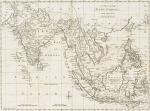
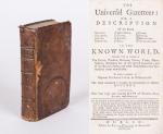
[Wilson, The Universal Gazetteer: or a Description of the several Empires,

38. [Wilson, Peter / Martin, Benjamin].

The Universal Gazetteer [Very Rare Dublin Edition] : or a Description of the several Empires, Kingdoms, States, Provinces, Countries, Cities, Towns, Seas, Lakes, Rivers, Mountains, Volcanos &c. in the Known World. Together with an Account of The Extent, produce, Revenue, Forces, Trade, Manufacturer, Religions &c. of the several Countries and of the Battles, Sieges and other Transactions that have sendered them remarkable. To which is prefixed a copious Introduction to Geography. The whole calculated to explain the Occurences in Modern History. Illustrated with four large and accurate Maps of Europe, Asia, Africa and America (only the Map of Asia is present: “New & Correct Map of Asia – Drawn from the latest and best Authorities by J. Gibson”). The Second Edition, in which several necessary Corrections and Material Additions have been made; the Geography of Ireland has been revised and enlarged; about four hundred entire new Articles have been added, chiefly relative to North America and Ireland, none of which are contained in the London Impression, and comprising in the whole, many thousand Places more than any other Gazzetteer; Whereby it is rendered the largest, cheapest, and most compleat Work of the Kind extant.

Dublin, Printed for Peter Wilson in Dame-Street, 1759. Small Octavo. XXXVIII, (1), 512 unnumbered pages (collation complete) with only the folded Map on Asia present and the other three maps missing. Including 6 pages of “Books, printed for and sold by Peter Wilson, in Dame-Street”. Original Hardcover (full calf on five raised bands with original spinelabel intact). Half a page in chapter “M” torn out. Faint dampstain throughout. Otherwise in very good condition. Binding rubbed and bumped on the corners but absolutely firm and tight. Minor traces of foxing and staining only. Name of preowner in 17th or 18th century ink on endpaper: “Daniel Eugene MacNamara”. Very rare Dublin Edition of this publication with a full-page recommendation of the famous Lexicographer Benjamin Martin.

EUR 1.200,-- 

Show details   Add to cart

Page: 1
: