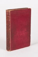
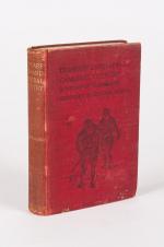
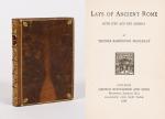
West Cork Rare BookfairINANNA MODERNWest Cork Reading Holidays
We ship per DHL Express

We ship per DHL Express

19th Century (320 items)

Ireland (Carrick-A-Rede / Giant's Causeway

1. 19th century European Travel – Ireland (Carrick-A-Rede / Giant’s Causeway / Bideford (Devon) / Torrington (Devon) / Lynton (Devon) / Lynmouth (Devon) / Watersmeet (Devon) / Ilfracombe (Devon) / Carnarvon Castle (Wales) / Forth Bridge – (Wales)/

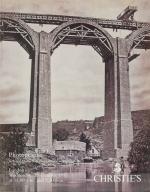
Original Photoalbum from ca. 1870 / 1880 with 37 original Albumen Print / Albumen Silver Print – Photographs of a Tour through Europe. With very interesting photographs of Ireland’s favourite attractions in County Antrim , a large section of the Devon Region in England (The DEVON – Section includes 15 photographs alone), and some beautiful and rare early colour photographs of Luzern in Switzerland: Examples of images: 8. Bideford in Devon (Promenade with ships and people) / 9. Torrington – Devon (Town Mill Bridge) / 10. Torrington – Devon (Northern Bridge) / Two smaller photographs on one board: 11. Torrington – Devon (Castle Ruins) / 12. Torrington – Devon – (Near Railway Station) / Two smaller photographs on board: 13. Torrington – Devon – (The Avenue) / 14. Torrington – Devon (Valley of Rocks / Castle Rock) / 15. Lynton – North Devon / 16. Lynton – North Devon (Castle Rock) / 17. Lynmouth – Watersmeet / 18. Lynmouth (Bridge /Watersmeet near Lynmouth) / 19. Lynmouth (Picturesque Harbourscene with old fisherhuts on left) / 20. Ilfracombe – North Devon (from the Tours Walk – Top of the Hill) / 21. Ilfracombe – Tour Walk / 22. Ilfracombe – View from Capstone Hill /

Devon, ca.1870/1880/1890. Oblong – Quarto. 37 plates. Hardcover. Recently, professionally rebound in half leather with gilt lettering on spine. The large photographs in very good condition.

EUR 580,-- 

Show details   Add to cart

Barrow, Voyage dans la partie meridionale de l'Afrique

34. Barrow, John.

Voyage dans la partie meridionale de l’Afrique; fait dans les années 1797 et 1798; par John Barrow, Ex-Secretaire de Lord Macartney…Contenant des observations sur la géologie, la géographie, l’histoire naturelle de ce continent, et une esquisse du caractère physique et moral des diverses races d’habitans qui environnent l’Etablissement du Cap de Bonne-Espérance. / Accompagné: Nouveau Voyage dans la partie méridionale de l’Afrique; Où l’on examine quelle est l’importance du Cap de Bonne-Espérance pour les différentes puissances de l’Europe, considéré comme station militaire et navale; comme boulevart du commerce et de la domination des Anglais dans l’Inde; comme centre des établissemens pour la pêche de la baleine dans les mers Australes; comme acquisition territoriale, et comme entrepôt commercial en tems de paix. Accompagné d’une description statistique de la colonie rédigée sur les documens les plus hautentiques, enrichi de huit belles cartes, contenat celle de la Côte d’Afrique depuis la baie de la Table jusqu’a la baie de Saldanha, des cartes de la baie de Pletenberg, d’Algola, de Mossel et de False bay; du plan militaire de la péninsule du Cap, et de ceux de la baie de la Table et du Knisna. (2 Volumes).

First French Edition. 4 Volumes [complete set of two works with 2 Volumes each]. Paris, Dentu, 1801-1806. 35.5 cm x 55.8 cm. Collation: complete. Pagination: Volume I: XVI, 403, (1) pages / Volume II: 326, (2) pages including Errata-leaf / Volume III: X, 310 pages / Volume IV: 312 pages. Original contemporary red calf with gilt lettering and ornament to lacquer-polished-spine. The Volumes are numbered consecutively, even though these are two separate works. Excellent condition of the binding and interior of this important publication with very minor signs of foxing only ! All the maps in wonderful condition ! First french edition of “Travels into the Interior of Southern Africa” (Barrow’s journey with Lord Macartney in 1797 to the Cape of Good Hope) plus two further Volumes which describe the second journey in 1801 / 1802 to Saldanha Bay [Saldanhabaai] with an early image of Robben Island. The survey of the Dutch colonies was not only a seminal work on South Africa but the beautifully engraved, large folding map of South Africa was a turning point of african cartography and geographical illustration.
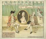
EUR 1.800,-- 

Show details   Add to cart

Manuscript Autobiography, Diary and vintage photo album of the Chapman - Barwise

38. Barwise, Lucy Weston / [Lucy Chapman, George Chapman, Henry Chapman]

Manuscript Autobiography, Diary and vintage photo album of the Chapman – Barwise Family. A cultured London woman’s autobiography and diary including a first hand account of ‘Fiesche’s attempt to assassinate Louis Phillippe’ which she observed while at school in Paris as a child. The manuscript has a mournful postscript by the man she left behind, her husband: ‘Alas! that I George Chapman should have to finish the record of so dear a Life…’ by Lucy Weston Barwise (1822-1876) wrote in a lockable, lined octavo notebook, crushed morocco, marbled endpapers and edges. Her autobiography was begun in January 1872 at one end of the book (16 pages); her diary appears at the other end of the book from October 22 1871-April 1874 with her husband’s postscript dating from June 1880. There is a second volume of family accounts in a lockable octavo sized ledger and a folio sized volume of family photographs, most unlabelled. Barwise’s autobiography recounts her education in Paris in the Rue Taitbout where she witnessed ‘Fiesche’s attempt to assassinate Louis Phillippe’ while watching from her music master’s house opposite the Porte St Martin, noting ‘the Duc D’Orleans [who] looked very handsome’ but shortly afterwards ‘heard a loud report and then a shout… general commotion but the crowd was so thick and immoveable’ and then ‘the King and stiff rode slowly back along the line but looking very white.’ It was only later that she discovered the casualties of ‘Fieschi’s infernal machine… It was a row of gun barrels arranged along a window so as to be discharged all at once.’ Barwise also watched the subsequent funeral from her attic window, the ‘open hearse with its draperies of black and silver’. The highlight of Chapman’s diary is a detailed account of the deaths she witnessed during the ‘Thanksgiving Day for the recovery of the Prince of Wales’ on February 27th, 1872, as seen from her husband George Chapman’s ‘office windows in Cockspur St’ behind Trafalgar Square which overlooked the procession. There she witnessed the lack of barriers and observes with horror the police charging into the surging crowd ‘The big policemen threw themselves against the men; the horses even made to dance and back heel it was a fearful struggle’with a baby almost crushed to death in front of her. There is an interesting secondhand account of Paris under the Commune via one of her daughters and frequent visits to London art exhibitions as on July 8 1871 where she saw an ‘exhibition of old masters at the Royal Academy… Crome, Ruysdael, heads by Moroni, of Titian’s Schoolmaster, Burgomaster by Rembrandt… the two heads.. by Giorgine belonging to Lord Ashburton, such colour and such expression. There are trips to Ascot and the Boat Race, a curry with friends in Wandsworth and a recitation by ‘Mr Bradman [of] the Merchant of Venice for the benefit of the Workman’s Club. It was very clever… Shylock was good but my recollection of actors, Charles Kemble, C.Kean &c made this more familiar and perhaps a little more like ranting’.

[London], c. 1871 – 1872. Octavo. Diary I: 44 pages / Diary II: 24 pages / Photoalbum: 48 pages with 120 original cabinet photographs (including a photograph of a british Forest School). Hardcover / Original full leather. All three Volumes slightly rubbed but all in very good condition. The cabinet photographs all in excellent condition and from dozens of different victorian photographers in Bath (Friese Greene), Bonn (Emil Koch), Astley (Photograpic Landscape Artist in Astley, Essex), and many others. The one diary is really a cash ledger of George Chapman where he kept track for the Chapman family with listings of expenses for Hampstead House, Henry Chapman, Edward Chapman, Oswald D. Chapman, Mrs. Barrett Chapman, Edith Louisa Chapman.

EUR 950,-- 

Show details   Add to cart

Cary's New Itinerary: Or an Accurate Delineation of the Great Roads, Both Direct and Cross throughout England and Wales: With Many of the Principal Roads in Scotland.

65. Cary, John.

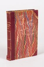
Cary’s New Itinerary: Or an Accurate Delineation of the Great Roads, Both Direct and Cross throughout England and Wales: With Many of the Principal Roads in Scotland. From an Actual Admeasurement by John Cary: Made by Command of his Majesty’s Postmaster General for official purposes: Under the Direction and Inspection of Thomas Hasker Esq., Surveyor and Superintendant of the Mail Coaches. [Including an advertising for Cary’s New Celestial and Terrestrial Globes (with Illustrations of Globes)]. [Subtitle:] This work shows the immediate Route from the Metropolis [London] to all parts of England and Wales: And from Town to Town in every direction, distinguishing also the Cities, Market, Borough and Corporate Towns: And those at which the Assizes are held and gives the time of the Mails, Arrival and Departure from each, Describes the Line of the Navigable Canals and the Course of the Rivers passed over, The Number of Houses and Inhabitants contained in each Town, And those Inns which supply Post Horses and Carriages. Also The Inn’s throughout the Metropolis [London] from which the Mail and Stagecoaches go, their time of departure & the Route they seveerally take. The Noblemen and Gentlemen’s Seats situate near the Roads, A List of the Packet Boats and their time of sailing. Copious Indexes. Maps of the Lot Wight Environs of London, Bath, Brighton, Margate & Cheltenham & a Large Map of England and Wales peculiarly adapted to the Work. – [An Advertisement juxtaposed to the titlepage reads: “This Edition contains the Routes to upwards of Nine Thousand Places, which have never been given in any work of a similar Description; being a complete Directory to every Parish situate out of the Line of the Direct and Cross Roads throughout England and Wales”].

Seventh Edition, with Improvements [complete with all maps as called for]. London, Printed for J. Cary, 1817. Octavo. Pagination: [1], 647 pages plus 7 maps / Detailed pagination see here: [1], Title, Large Folding Map, [121], 6 folded Maps, [526] pages. Modern, recent Hardcover / Very decorative half-leather with marbled-paper-covered boards. Gilt lettering on new sppine-label. New endpapers. Protective Mylar. Only the large folding map with a inor tear (one part of the map deliberately bound separate (geniously folding out to meet th erest of the map). Interior text and maps all in excellent, unusually clean condition !!
EUR 780,-- 

Show details   Add to cart

Page: 1 2 3 4
: