West Cork Rare BookfairINANNA MODERNWest Cork Reading Holidays
We ship per DHL Express

We ship per DHL Express

18th Century (120 items)

[Chiari, Giovanni] Vascellini, Gaetano - Statute di Firenze [Richard Meade - Ballymartle]

6. [Chiari, Giovanni] Vascellini, Gaetano.

Statue di Firenze [incluso: “Catalogo delle Statue del R. Giardino di Boboli colla Notizia dei Loro Autori”, “Catalogo delle Statue nel R. Palazzo de Pitti”, Catalogo delle Statue colla Notizia dei Loro Autori ec.” ec.]

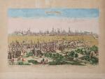
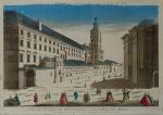
Tres Parti (complete) [Tutto dichiarato come prima parte]. Firenze, Presso Giuseppe Volpini Cartolaro, no year [c. 1765]. Octavo. Collation complete. Pagination: Part I (Primo): Frontispiece copper-engraving with Florence in the background, 8 pages of text with introduction by Giovanni Chiari and the catalogue of statues in Boboli Garden, 25 plates each with 4 copper-engravings of Statues in Boboli Garden. Part II (Seconda): Frontispiece copper-engraving with Florence in the background, 8 pages of text with catalogue of Statues in Palazzo Pitti, 41 plates each with 4 copper-engravings of Statues in Pitti Palace. Part III (Terza): Frontispiece copper-engraving with Florence in the background, 8 pages of text with catalogue of Statues [″Catalogo delle Statue colla Notizia del Loro Autori ec. (incl. Michelangelo Buonarotti, Donatello etc.). Hardcover / Original bookblock rebound by Bayntun in Bath in a subtle and charming modern cloth with gilt lettering on new spine-label. Original endpapers preserved. Exceptional condition of this rare 18th century publication with only very faint signs of foxing. Provenance: Richard Meade, Ballymartle (with the Meade Family – crest as library stamp).

EUR 880,-- 

Show details   Add to cart

Derham, Astro-Theology: or, a Demonstration of the Being and Attributes of God,

13. Derham, William [Philosopher and Scientist] / [John Senex (Cartographer)].

Astro-Theology: or, a Demonstration of the Being and Attributes of God, From a Survey of the Heavens [Including a Chapter on the “Attraction of Gravity”].

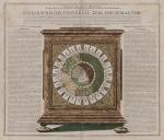
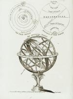
Sixth Edition. London, W. Innys, 1731. Octavo. [16], LVI, [8], 246 pages,[10 pages of Index], [with 3 astronomical foldout engravings by english Cartographer and Explorer John Senex / The Engravings show the Ptolemaic Geocentric System with the Earth as centre of the Universe and discuss other models as well by pointing to pages within the text that reflect on the illustrations / Two of the Engravings are showing the Stars and Constellations over Europe, the Mediterranean, Asia Minor, Asia etc.]. ]. Original Hardcover / bound in contemporary panelled calf. The book has been sympathetically rebacked to style. Besides a spot of hard green adhesive to the front board in very good condition. The armorial 18th century bookplate of one Dr. Blackett appears on the first pastedown [″A coat of arms divided into three portions, with three stars and three scallop shells throughout. At the helm is the head of an eagle, and elaborate mantling, flowers, and leaves surround the crest. Below is the motto ‘Nous Travailler ons dans L’Esperance’”] / The text of this rare and notoriously underrated book is complete and clean with the three foldout engravings of the cosmos to the rear with only a small archival paper restoration to one of the engravings.

EUR 680,-- 

Show details   Add to cart

Gilpin / Castle Freke Library - Observations Relative Chiefly to Picturesque Beauty, Made in the Year 1776

31. Gilpin, William. [Castle-Freke Library Bookplates]

Collection of four Volumes (bound in two) by Gilpin – All from the historical library at Castle Freke (Castlefreke, West Cork / Ireland). The Volumes include: I. & II. Observations Relative Chiefly to Picturesque Beauty, Made in the Year 1776, on Several Parts of Great Britain; particularly the High-Lands of Scotland. [Second Edition, with an “Account of the Prints” bound to the rear] / III. Observations on the River Wye and several Parts of South Wales &c. relative chiefly to Picturesque Beauty; Made in the summer of the Year 1770 (Third Edition). / IV. An Essay on Prints – [″The chief intention of the following work was to put the elegant amusement of collecting prints, on a more rational footing; by giving the unexperienced collector a few principles and cautions to assist him”] (Fourth Edition with the printed dedication “To the Honorable Horace Walpole in Deference to his Taste in the Polite Arts; and the Valuable Researches he has made to improve them; the following work is inscribed by his most obedient and very humble servant, William Gilpin”). [Volumes I & II with 40 original illustrations and vintage 18th century maps [correctly 39 illustrations and one table], for example of Loch Lomond and the Firth of Forth/ all illustrations are vintage mezzotint-plates].

Mixed Editions. Four Volumes (bound in two). London, Printed for R. Blamire, Strand, 1792. Octavo. Pagination: Volume I: XI, [1], 221 pages with 24 mezzotints / Volume II: 195, XVI pages with 16 mezzotints and an “Account of the Prints” as well as “Translations of Latin Passages” / [Volume III]: [River Wye]: XVI, 152 pages with 16 (of 17) full – page mezzotints / [Volume IV]: [An Essay on Prints]: XIII, [3], 174 pages plus XI pages Index and 1 page Errata. Hardcover / Early 19th century quarter – morocco with gilt lettering and ornament on spine. Both volumes bound in unison. Very good + condition with only minor signs of external wear. Pages 185 – 191 of Volume I with some stronger browning. Otherwise the interior very clean. All mezzotints in very good or even better condition. This is the original copy from the historical Castle-Freke Library in West Cork (Ireland), with two armorial bookplates to front and rear pastedown with the family’s motto ‘Pro Patria’. With two pages of manuscript annotations by a contemporary hand with a reference between the common name “Tarbet” in Scotland and a place-name in County Kerry in Ireland” (pages 13 of Volume II) / another entry is on page 12 of Volume II regarding the name-sake “Loch-Loung” for a Lake of ships in Scotland and Ireland.

Show details

John - An account of the Principal Lazarettos in Europe; with various papers relative to the Plague

42. Howard, John / [Daniel Conner Library]

An account of the Principal Lazarettos in Europe; with various papers relative to the Plague: Together with further Observations on some foreign Prisons and Hospitals; and additional remarks on The Present State of those in Great Britain and Ireland. [Including chapters on English Prisons and Hospitals, Hulks [Prison-Ships] on the Thames, Remarks on the Gaol-Fever, Remarks on Penitentiary Houses, Scottish Prisons and Hospitals, Irish Prisons and Hospitals, Charter Schools in Ireland etc.]

First Edition. Warrington, Printed by William Eyres; And sold by T. Cadell, J. Johnson, C. Dilly, and J. Taylor in London, 1789. Quarto (24,5 cm x 30,5 cm). VIII, 259 pages plus 13 unnumbered pages of Index and 1 page “Directions to the Book-Binder”. Collation complete with 22 plates of which 20 are large fold-out-engravings. Hardcover / Contemporary 18th century calf with gilt lettering on spine. Stunning Volume, recently restored and rebacked by two english master-binders. Very good+ condition with only minor signs of external wear. After the restoration now a highly-desirable collectable. One of the first sociological studies of conditions within the penal system of England and Ireland compared to other 18th-century practices within European Jails / Gaols. The partly romantic engravings seem sinister when one imagines what inmates and children endured within these settings. From the library of Daniel Conner (Connerville / Manch House), with his Exlibris / Bookplate to pastedown.

EUR 2.800,-- 

Show details   Add to cart

Lindsay - A New and Correct Chart of Cork Harbour with the Old Head of Kinsale

50. Lindsay, The Rev. John.

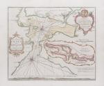
[A New and Correct Chart of Cork Harbour (This is the rare 18th century Map of Cork Harbour which also shows Haulbowline Island, which is the original location of “The Royal Cork Yacht Club”, later “The Water Club of the Harbour of Cork”, the Map shows also the Old Head of Kinsale, Crosshaven Harbour, Haulbowline Island, Curraghbinny, Spike Island, Ringaskiddy etc.)] – Correct Title of the Map: “A New and Correct Chart of the Harbour of Corke by the Revd. J. Lindsay, Late of His Majesty’s Ship Fougueux”. There is an inset Map showing “A Continuation of Corke Harbour from a smaller Scale”. The scale of this reads “A Scale of three English”. Below the chart is a coastal profile entitled “A View of the Land from the Old Head of Kinsale to Hawks Rock, the Old Head W b S 7 Miles. Cork Harbour mark’d *. ″

Original, hand-coloured copper engraving on extra thick paper / Better paper – edition [differing from all other versions of this map we ever handled, this is only the second version of this high-quality version of this Map we encountered], possibly an admiralty issue since it was dedicated to the Office of the Lord High Admiral of Great Britain. London, Sold by W. & I. Mount, T. & T. Page on Tower Hill, [c. 1759]. Beautifully mounted and framed. Size of the actual map: c. 62 cm wide x 52 cm high. Spectacular, unusually excellent condition of this rare, hand-coloured seachart of Cork Harbour with the Old Head and clear geography of Little Island, Poor Head, Ringaskiddy, Cork’s Natural Harbour, Crosshaven, Haulbowline, Spike Island, Cloyne, etc. / Price includes worldwide free shipping per UPS Courier !

EUR 2.800,-- 

Show details   Add to cart

Philip Luckombe, The Compleat Irish Traveller [Luxury Reprint with all of Charles Smith's Illustrations of 18th century Ireland (Munster / Kerry / Waterford) in separate Folder for Framing]

67. [Luckombe, Philip / Smith, Charles].

Luxury Reprint of “The Compleat Irish Traveller” [With high quality Reproductions of the 31 original Plates of detailed Maps of County Cork in the 18th century, County Kerry in the 18th century and Waterford in the 18th century, as well as some of the earliest engravings of Irish Towns here for the first time reproduced as beautiful Artworks for framing and housed in a special, handmade Folder. The publication was just recently enlarged with a detailed, Topographical Index (July 2023)]. Complete Title: “The Compleat Irish Traveller, containing A general Description of the most Noted Cities, Towns, Seats, Buildings, Loughs &c. in the Kingdom of Ireland, Interspersed with Observations on the Manners, Customs, Antiquities, Curiosities and Natural History of that Country. With Elegant Copper Plates”. [With 31 original Plates after Charles Smith, including Frontispiece, this Reprint / Facsimile is the result of 10 years of research and purchase of three (3) original versions of the First Edition from the year 1788. The first Editions known to Inanna Rare Books all had different quantities of Plates and Maps included. This Reprint by Inanna Rare Books has been produced from an extremely clean version of the original and shows the most complete set of illustrations and XL-Size Maps and Artworks we could find in any of the original editions. The publication shows not only Maps of County Cork, County Kerry and County Waterford but also Views of Irish Cities and Towns in these Counties of the Province of Munster and besides the wonderful Historical Plan of Cork City this set also includes the very rare Plan of the “Grand Canal from Dublin to the River Shannon” (see detailed list of all the illustrations present at the end of this description)].

Luxury Limited-Edition-Reprint of the First Edition by Luckombe in 1788. Two Volumes plus extra Folder with 31 Plates reprinted as Artworks for framing. Skibbereen (County Cork), Inanna Rare Books Publishing, 1788. Octavo (13.5 cm x 21 cm). Pagination: Volume I: Frontispiece, engraved Titlepage, XXX, 189 pages plus recently published Index (July, 2023) / Volume II: Engraved Titlepage, 263 pages plus recently published Index (July, 2023). Plus large, bespoke made Folder with thirtyone (31) Reproductions of the Maps, Plans and Illustrations which usually were folded inside this publication and now for the first time have been liberated from the book and were published as the beautiful works of art they are. Textvolume: Volume I and II of the text bound in one beautiful half-leather-volume with gilt lettering on spine, bound in the style of the 18th century / Illustrations-Folder with 31 reprinted illustrations of Towns and Maps of Ireland but mainly of Munster, bound in bespoke made half-cloth with paper-covered boards and pasted Reprint of the original titlepage. Excellent, new condition. One of only 300 printed. [Inanna Rare Books – Reprint & Facsimile – Series].

EUR 2.480,-- 

Show details   Add to cart

Payne, Universal Geography formed into a new and entire system

99. Payne, John.

Volume I (of III) of the “Universal Geography” [Including Asia, Africa and Voyages of English Navigators] – formed into a new and entire system; describing Asia, Africa, Europe, and America; with their subdivisions of Empires, Kingdoms, States, and Republics: the extent, boundaries, and remarkable appearances of each country; cities, towns, and curiosities of Nature and Art. Also giving a general account of the fossil and vegetable productions of the Earth, and of every species of animal: The History of Man, in all Climates, Regions and Conditions; Customs, Manners, Laws, Governments and Religions: The State of Arts, Sciences, Commerce, Manufactures and Knowledge. Sketches of the Ancient and Modern History of each Nation and People to which is added, A Short View of Astronomy, as connected with Geography; of the Planetary System to which the Earth belongs; and of the Universe in General. With a set of Maps, drawn from the best Materials, every one of which is very neatly coloured; and a great Variety of Copper-Plates; descriptive of the most remarkable curiosities in the world. With an Appendix in two Parts, containing I. The History of the Voyages round the World, and toward the North and South Pole, which have been made since the year 1764 by English Navigators and II. A Digested and Geographical Account of the most considerable Islands and Countries which have been either discovered or explored during those Voyages, collected from every writer upon those subjects. Part I on the Appendix includes: 1. The First Voyage round the world, performed by Commodore Byron, in the Dolphin, accompanied by the Tamar Sloop / 2. Captain Wallis’s Voyage round the World, being the Second performed in the Dolphin / 3. Continuation of Captain Carteret’s Voyage round the World in the Swallow / 4. Lieutenant Cook’s Voyage round the World, in the Endeavour Bark (First Voyage, Second Voyage and Third Voyage including a stunning engraving of Cook, together with Portraits of inhabitants of the Sandwich Islands, Mangea and Ulietea) / The Appendix Part II contain a Geographical Account and Description of the Islands which have been lately discovered or visited in the South-Sea, proceeding from East to West (Easter Island / The Society Islands / The FRiendly Islands / The New Hebrides, Mallicolo and New Caledonia / New Zealand / New Holland / The Sandwich Islands //

First Edition. Dublin, Printed by Zachariah Jackson (Great Ship-Street), 1792. Quarto. XV, 894 pages with a list of subscribers and eight fantastic full-page copper engravings (NO MAPS in this Volume) / Frontispiece (The beautiful Frontispiece-plate is cleanly detached and now comes with this beautifully restored book framed): Plates included are: 1. Frontispiece: Vegetable Productions constituting important Articles of Commerce: Nutmeg Tree / Bohea Tea Plant or Thea Bohea / The Cotton Shrub / The Nutmeg enclosed in the Mace and Nutmeg Kernel / Flower of Tea / The Cotton Shrub – This plate is hand-coloured ! / 2. The Artificial Sphere (Globe) with the Solar System and Divisions of the Earth / 3. [Kamtschatka] – A Kamtscadale Travelling in Winter / An inside View of a Winter-Hut of the Kamtschadales / 4. Animals in the Southern Parts of Africa (The Rhinoceros Bicornis / The Buffalo / The Hippopotamus, called by the Hottentots the Seacow) / 5. The Country contiguous to the Cape of Good Hope – Hottentots and their Huts &c. &c. / 6. Portrait – Collection on one plate of Captain James Cook – Killed on the Island of Owhyhee – 14th of February 1779 (From a painting by Dance in the possession of Sir Joshua Banks) – other portraits on that page include A woman and a man of the Sandwich Islands / A Man of the Magea – Omai or Omia , a Native of Ulietea / 7. Portrait – Collection on one plate of: Poulaho – King of the Friendly Islands / A Man of van Diemen’s Land / A Woman from van Diemen’s Land / A Woman of Prince William’s Sound / A Man of Prince William’s Sound / 8. Portrait-Collection on one plate of: A woman of Otaheite Island (Tahiti) bringing a present / A Woman of Otaheite (Tahiti) dancing / An Otahetian (Tahiti) in the Dress of his Country / A New Zealand Warrior completely armed (Maori) // Hardcover / Professionally restored original 18th-century leather with original gilt ornament and new labels on spine. Binding rubbed but after the masterful restoration in very good condition. Some of the plates slightly loose but not detached. Very few minor wormhole damage to the last 250 pages. Rare with the plates ! From the library of Richard Meade, Ballymartle, with his original bookplate to the pastedown. One of the early accounts of english Navigation and Discovery.

EUR 1.200,-- 

Show details   Add to cart

Page: 1 2
: