West Cork Rare BookfairINANNA MODERNWest Cork Reading Holidays
We ship per DHL Express

We ship per DHL Express

Cartography (156 items)

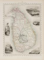
Tallis, Ceylon (British Ceylon) - with Vignettes and illustrations

129. Tallis, John / Rapkin, John. (1817 – 1876)

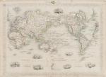
Ceylon (British Ceylon) – with Vignettes and illustrations of the Lake of Kandy, Adam’s Peak from the Lake of Colombo, a beautiful scenery of Colombo, Temple of Buddha , Kalany, Ruins of A Dagora at Toophamaraya. The map is divided in the old regions of British Ceylon: The Eastern Provinces (Kattoe, Colompattoo, Tamblegam, Kottiar, Tambankadewa, Koorle, Eraquer, Mamoene, Karrewitte, Chiam Pature, Erwiel, Nadene, Akkrepattoo, Ghiam Pature, Veddag, Ratte, Nadekadoe, Panowa / The Western Provinces (Anewoelandan, Rajawania, Seram, Sevien Korles, Rajawanny) / Northern Provincec (Wademo Ratchi, Welligammo, Jafnapatam, Leyden, Ponoryn, Manaar, Mantotte, Pomparipo, Moessellie, Neurawanny, Meel-Pattoo, Poedoe, Koe-Dirpo, Moeliawalle, Karie-Kattoe-Molle, Tinne-Mar, Re-waddie, Patchilapelle, Negammo / Central Provinces – Matelle, Doombera, Toompane, Erris Pattoo, Yattenoowere, Dollos Bage, Lower Ouna, Hewahetta, Wellassee / Western Provinces – Hapeti Gam, Pasdum, Caltura, Three Korles, Hewagam Korle, Hina Korle, Saffragam etc. / South Provinces – Wallawitte, Gangebodde, Gangedode, Mahagam, Pattoo, Morva, Talpe, Belligam, Wellerode etc.

Original steel engraving / Vintage map. Drawn and engraved by John Rapkin. Partly hand-coloured. London & New York, J & F. Tallis, 1851. Beautifully Framed. Size of frame with map: 40.5 cm x 50.5 cm. Size of the actual map: 27 cm x 37 cm. Excellent condition.

EUR 350,-- 

Show details   Add to cart

[Wilson, The Universal Gazetteer: or a Description of the several Empires,

153. [Wilson, Peter / Martin, Benjamin].

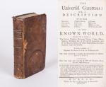
The Universal Gazetteer [Very Rare Dublin Edition] : or a Description of the several Empires, Kingdoms, States, Provinces, Countries, Cities, Towns, Seas, Lakes, Rivers, Mountains, Volcanos &c. in the Known World. Together with an Account of The Extent, produce, Revenue, Forces, Trade, Manufacturer, Religions &c. of the several Countries and of the Battles, Sieges and other Transactions that have sendered them remarkable. To which is prefixed a copious Introduction to Geography. The whole calculated to explain the Occurences in Modern History. Illustrated with four large and accurate Maps of Europe, Asia, Africa and America (only the Map of Asia is present: “New & Correct Map of Asia – Drawn from the latest and best Authorities by J. Gibson”). The Second Edition, in which several necessary Corrections and Material Additions have been made; the Geography of Ireland has been revised and enlarged; about four hundred entire new Articles have been added, chiefly relative to North America and Ireland, none of which are contained in the London Impression, and comprising in the whole, many thousand Places more than any other Gazzetteer; Whereby it is rendered the largest, cheapest, and most compleat Work of the Kind extant.

Dublin, Printed for Peter Wilson in Dame-Street, 1759. Small Octavo. XXXVIII, (1), 512 unnumbered pages (collation complete) with only the folded Map on Asia present and the other three maps missing. Including 6 pages of “Books, printed for and sold by Peter Wilson, in Dame-Street”. Original Hardcover (full calf on five raised bands with original spinelabel intact). Half a page in chapter “M” torn out. Faint dampstain throughout. Otherwise in very good condition. Binding rubbed and bumped on the corners but absolutely firm and tight. Minor traces of foxing and staining only. Name of preowner in 17th or 18th century ink on endpaper: “Daniel Eugene MacNamara”. Very rare Dublin Edition of this publication with a full-page recommendation of the famous Lexicographer Benjamin Martin.

EUR 1.200,-- 

Show details   Add to cart

Page: 1 2
: