19th Century (310 items)

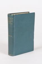
36. [Rickmer Rickmers, Willi] Jäger, Gustav (Herausgeber).

Der Tourist – Organ für Natur- und Alpenfreunde [plus einige Jahrgaenge der Beilagen “Das Alpenhorn” und “Bei Nebel und Regen” beigebunden]. 27 Bände in 20 / Es fehlen die No.39 und 40 im Jahrgang 1869 (dies sind die Seiten 609-640 und es fehlen die Jahrgaenge 1893 bis 1896) . Einige Jahrgaenge sind in zwei Baenden erschienen und hier immer in einem Band gebunden. Diese wurden von uns aber bei der Gesamtzahl von 27 Baenden nicht doppelt gezaehlt und immer als “ein Band” gewertet. / 27 volumes of a consecutive run from 1869 bound in 20 volumes with only four annuals (1893-1896) as well as two numbers missing [No.39 and 40 in Volume 1 (year 1869)]. [Als weitere Zugabe: Dublette des Jahrgangsband 1876-1877 vom “Alpine-Club” (London) mit einer beigebundenen Ausgabe: Gustav Jaeger – “Der Fuehrer auf der Kronprinz Rudolfbahn von der Donau bis Laibach enthaltend: Die Beschreibung der Kunstbauten und Eisenbahnfahrten auf der Hauptlinie und den Seitenfluegeln, sowie die Schilderung der Ortschaften und Ausfluege von saemtlichen Bahnstationen in Nieder- und Oberoesterreich, Steiermark, Kaernten und Krain. Wien, 1876. 213 (6) Seiten].

Wien, Carl Finsterbeck, 1869 – 1892 & 1897-1898. 14.5 cm x 21.5 cm / 24.5 cm x 30.5 cm / 25 cm x 32.5 cm. 23.5 cm x 31.5 cm ca. 9800 Seiten (siehe Paginierung im englischen Teil der Beschreibung). [Mit der farbigen Lithographie “Der Sonnblick” im Maltathal in Band 1 (1869 / eingebunden nach Seite 202) sowie der zweiten Lithographie “″Glokner” (eingebunden nach Seite 728)/ Lithographie in Band 2 (1870) fehlt [Allerdings haben wir der Ausgabe den 2. Jahrgangsband 1870 als Dublette beigelegt und die Dublette fuer 1870 enthaelt die seltene Lithographie “Der Blaue Tumpf im Maltathale (Kaernten)” [siehe die Photos]. Die Reihe enthaelt ausserdem das wunderbare, grosse Panorama vom “Hochwechsel” / Circa. 9,200 pages – Vol.I (1869), 768 pages with both Lithographs as called for (pages 609-640 missing) plus “Das Alpenhorn” (Nummern 29 – 48 des 1.Jahrgangs) / Vol.II (1870), 696 pages with the Lithograph missing – Angebunden: “Das Alpenhorn” – Kompletter II.Jahrgang [Als Zugabe: Band 2 liegt hier bei mit der Lithographie] / Vol.III (1871), 726 pages plus “Das Alpenhorn” Teil des III.Jahrgangs / Vol.IV (1872), 552 pages plus der komplette IV. Jahrgang “Das Alpenhorn” / Vol.V (1873), 436 pages plu Jahrgang V of “Das Alpenhorn” / Vol.VI (1874), 442 pages plus Jahrgang VI of “Das Alpenhorn” / VII. (1875), 412 pages mit “Das Alpenhorn” Jahrgang VII. / Vol.VIII (1876) – 2 Volumes in 1: 228 pages & 244 pages plus “Das Alpenhorn” Jahrgang VIII / Vol.IX (1877) – 2 Volumes in 1: 204 & 236 pages plus 48 pages “Bei Nebel und Regen” & “Das Alpenhorn” IX.Jahrgang / Vol.X (1878)-2 Volumes: 234 & 242 pages plus einige Nummern von “Bei Nebel und Regen” & “Das Alpenhorn” / Vol.XI-XII (1879-80) c.416 pages / Vol.XIII-XIV (1881-82), c.384 pages / Vol. XV-XVI (1883-84), c.384 pages / Vol.XVII-XVIII (1885-1886), c.384 pages/ Vol.XIX-XX (1887-88), c.384 pages / Vol.XXI-XXII (1889-90), c.384 pages / Vol.XXIII-XXIV (1891-92), c.384 pages / Vol.14 (1897), 458 pages / Vol.15 (1898), 586 pages / Vol.16 (1899), 668 pages. / In addition the periodical includes a duplicate of Volume II (Annual for 1870) and this Duplicate includes the rare original Lithograph. Originale Halbleinenbaende des 19.Jahrhunderts mit Rueckenvergoldung. / Hardcover. Contemporary cloth with gilt lettering on spine / [2 with marbled boards, the remainder with dark cloth boards]. 3 volumes with navy cloth boards. Zehn Baende in Gross-Quart, die anderen in Oktav-Format. Sehr guter Zustand dieser seltenen, korrespondierenden Reihe mit nur wenigen Gebrauchsspuren an den Bindungen. Very good condition with only minor signs of external wear. Some minor abrasions to cloth for volumes 1872 and 1875. Baende fuer die Jahre 1872 und 1875 mit kleinen Einrissen am Ruecken. Periodikum aus der Bibliothek von Wilhelm Gustav Rickmer Rickmers, mit seinem Exlibris in nahezu allen Baenden / Minor rubbing only to head and heel of spines and board corners. Interiors clean and bright for the most part. Slight tanning throughout. Former copies from the library of Wilhelm Gustav Rickmer Rickmers, with his large, beautiful and artistic bookplate “Bibliotheka Rickmersiana” [designed and monogrammed by Otto Barth] in most of the Volumes. Also Bookplate of Bibliothek Central-Ausschuss Deutscher und Österreichischer Alpenverein. Library stamp on front endpaper / The collection subsequently was part of the library of the Alpine Club in London.

EUR 2.400,-- 

Show details   Add to cart

45. [Strong, George Crockett] The Secretary of War.

U.S. Infantry Tactics, for the Instruction, Exercise and Manoeuvres of the United States Infantry, Including Infantry of the Line, Light Infantry, and Riflemen. [with vintage cabinet photograph / Carte de visite of Union Brigadier General George Crockett Strong, loosely inserted and his name signed and dated to endpaper on April 28, 1863 (3 months prior to his death after being wounded during his assault on Fort Wagner on Morris Island, South Carolina)]. Prepared under the direction of the War Department, and Authorized and Adopted by the Secretary of War, May 1, 1861. Containing The School of the Soldier; The School of the Company; Instruction for Skirmishers; the General Calls, the Calls for Skirmishers, and the School of the Battalion; Including the Articles of War and a Dictionary of Military Terms.

Philadelphia, J.B. Lippincott & Co, 1861. 9.3 cm x 13.5 cm. Fold-out Frontispiece, 450 pages. 77 plates with illustrations of various stances and manoeuvres. 12 additional fold-out diagrams. Hardcover / publisher’s original blue pebbled cloth with gilt lettering and stamp on spine. Blind triple ruling and stamp on both boards. Very good condition with only minor signs of external wear. Corners slightly bumped. Very minor abrasion to cloth at bottom front corner. Very minor closed tear to page 25. Minor foxing occasionally throughout. Signs of dampstaining evident throughout otherwise clean and bright volume. Binding good and firm and tight bookblock. Inked annotation to title page. Ownership annotation to front pastedown. Embossed stamp of Wm B Sprague Jr, 51 State St, Albany on front endpaper. Endpaper also carries pencilled signature of George C Strong dated April 28 1862. Carte de visite of General Strong also loosely inserted.

EUR 1.500,-- 

Show details   Add to cart

Baert-Duholant, Tableau de la Grande-Bretagne, De L'Irlande et des Possessions Angloises dans les quatre parties du Monde.

62. Baert-Duholant, Charles-Alexandre-Balthazar-François de Paule baron de / Jean-Denis Barbié du Bocage.

Tableau de la Grande-Bretagne, De L’Irlande et des Possessions Angloises dans les quatre parties du Monde. [With five (5) large, folded Maps by Jean-Denis Barbié du Bocage: Large, oblong folded Map/Plan of Gibraltar / England / Scotland / Ireland / India] / [With four (4) stunning copper-engravings: Grotte de Fingal, Chaussée des Géants / Plan et vue de Gibraltar / Combat de Boxe (Pugilists)] / [With two (2) portraits: 1.Portrait of William Pitt (after William Owen) and 2. Portrait of Charles Jacques Fox (after Karl Anton Hickel)].

Four Volumes (complete set). Paris, Chez H.J.Jansen, L’An 8me [1800]. Octavo (20 cm x 13.5 cm). Collation: Volume I: (8), 459, (1), 11 pages with Eleven (11) copper-engravings of which are: 5 Maps / Plans and 4 Engravings: The folded view of Fingals Cave (″Grotte de Fingal dans l’Ile de Staffa” – (19.5 cm x 31 cm) / “Folded Plate of the Giants Causeway (″Vue occidentale de la Chaussee des Geans et des Caps voisins” (19.5 cm x 31 cm)) / Fantastic, large Map/Plan of Gibraltar by Jean-Denis Barbié du Bocage, with a Birds-Eye-View of the Ville de Gibraltar (19.5 cm x 63.5 cm) [also showing the Ville Irlandaise on Gibraltar] / Scenic View of Gibraltar (″Vue de Gibraltar, prise du cote de l’Espagne” (19.5 cm x 32 cm) / Large Fold-Out-Map of England by Jean-Denis Barbié du Bocage with an Inset-View of Stonehenge (43 cm x 48.5 cm) / Large Fold-Out-Map of Scotland by Jean-Denis Barbié du Bocage, including the Western Isles and Shetland, with a stunning Inset-View of the irish pilgrimage-mountain Croagh Patrick [Craig-Phadrick] in Westport, Ireland (33 cm x 39 cm)/ Large Fold-Out-Map of Ireland with an Inset-View of the Lakes of Killarney (36 cm x 40.5 cm) / Volume II: 532, (1), 12 pages with Large Fold-Out-Map of India (″Possessions Anglaises”) by Jean-Denis Barbié du Bocage – the large India-Map showing areas as far as Tibet, Siam, Sumatra and the Andaman Islands, Ceylon, Burma (53.5 cm x 40.5 cm) / Volume III: 502, 48, (2) pages with two portraits: Guillaume Pitt [William Pitt] & Charles Jacques Fox (each 19.5 cm x 12 cm)/ Volume IV: 486, 22, (2) pages with the very famous Fold-out-Illustration of Pugilists / Boxers at Odiham in Hampshire [″Combats de Boxers a Odiham”] showing a boxing-match between Humphrey and Mendoza (29.5 cm x 19.5 cm). Hardcover / Original, very decorative original half leather bindings with gilt lettering and ornament on spine. All four Volumes in protective Collector’s Mylar. Very good condition with only minor signs of external wear. Very minor wormhole-damage to a few pages.

EUR 2.200,-- 

Show details   Add to cart

63. Pugilism (Boxing) – Baert-Duholant, Charles-Alexandre-Balthazar-François de Paule baron de / Jean-Denis Barbié du Bocage.
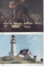
Tableau de la Grande-Bretagne, De L’Irlande et des Possessions Angloises dans les quatre parties du Monde. [Large Paper Copy / Better Paper Copy / Exemplaire de Luxe] [With five (5) large, folded Maps by Jean-Denis Barbié du Bocage: Large, oblong folded Map/Plan of Gibraltar / England / Scotland / Ireland / India] / [With four (4) stunning copper-engravings: Grotte de Fingal, Chaussée des Géants / Plan et vue de Gibraltar / Combat de Boxe (Pugilists)] / [With two (2) portraits: 1.Portrait of William Pitt (after William Owen) and 2. Portrait of Charles Jacques Fox (after Karl Anton Hickel)].

Four Volumes (complete set). Paris, Chez H.J.Jansen, L’An 8me [1800]. Octavo (21.5 cm x 14 cm). Collation: Volume I: (8), 459, (1), 11 pages with Eleven (11) copper-engravings of which are: 5 Maps / Plans and 4 Engravings: The folded view of Fingals Cave (″Grotte de Fingal dans l’Ile de Staffa” – (20.5 cm x 31.5 cm) / “Folded Plate of the Giants Causeway (″Vue occidentale de la Chaussee des Geans et des Caps voisins” (20.5 cm x 39 cm)) / Fantastic, large Map/Plan of Gibraltar by Jean-Denis Barbié du Bocage, with a Birds-Eye-View of the Ville de Gibraltar (20.5 cm x 65.5 cm) [also showing the Ville Irlandaise on Gibraltar] / Scenic View of Gibraltar (″Vue de Gibraltar, prise du cote de l’Espagne” (20.5 cm x 33 cm) / Large Fold-Out-Map of England by Jean-Denis Barbié du Bocage with an Inset-View of Stonehenge (47 cm x 51 cm) / Large Fold-Out-Map of Scotland by Jean-Denis Barbié du Bocage, including the Western Isles and Shetland, with a stunning Inset-View of the irish pilgrimage-mountain Croagh Patrick [Craig-Phadrick] in Westport, Ireland (37 cm x 50 cm)/ Large Fold-Out-Map of Ireland with an Inset-View of the Lakes of Killarney (39 cm x 44.5 cm) / Volume II: 532, (1), 12 pages with Large Fold-Out-Map of India (″Possessions Anglaises”) by Jean-Denis Barbié du Bocage – the large India-Map showing areas as far as Tibet, Siam, Sumatra and the Andaman Islands, Ceylon, Burma (48 cm x 43 cm) / Volume III: 502, 48, (2) pages with two portraits: Guillaume Pitt [William Pitt] & Charles Jacques Fox (each 20.5 cm x 12.5 cm)/ Volume IV: 486, 22, (2) pages with the very famous Fold-out-Illustration of Pugilists / Boxers at Odiham in Hampshire [″Combats de Boxers a Odiham”] showing a boxing-match between Humphrey and Mendoza (32 cm x 20.5 cm). Hardcover / Original, very decorative original half leather bindings with gilt lettering and ornament on spine. Volume One professionally rebacked by an english master bookbinder. All four Volumes in protective Collector’s Mylar. Excellent condition with only minor signs of external wear. From the library of François-Xavier de Valenzi with his bookplate / exlibris to the pastedowns of each Volume. Maps in this de Luxe Edition are all considerably larger than in the normal-paper-edition and all the maps and illustrations are in superb condition. An underestimated collectable.

EUR 1.200,-- 

Show details   Add to cart

Barrow, Voyage dans la partie meridionale de l'Afrique

65. Barrow, John.

Voyage dans la partie meridionale de l’Afrique; fait dans les années 1797 et 1798; par John Barrow, Ex-Secretaire de Lord Macartney…Contenant des observations sur la géologie, la géographie, l’histoire naturelle de ce continent, et une esquisse du caractère physique et moral des diverses races d’habitans qui environnent l’Etablissement du Cap de Bonne-Espérance. / Accompagné: Nouveau Voyage dans la partie méridionale de l’Afrique; Où l’on examine quelle est l’importance du Cap de Bonne-Espérance pour les différentes puissances de l’Europe, considéré comme station militaire et navale; comme boulevart du commerce et de la domination des Anglais dans l’Inde; comme centre des établissemens pour la pêche de la baleine dans les mers Australes; comme acquisition territoriale, et comme entrepôt commercial en tems de paix. Accompagné d’une description statistique de la colonie rédigée sur les documens les plus hautentiques, enrichi de huit belles cartes, contenat celle de la Côte d’Afrique depuis la baie de la Table jusqu’a la baie de Saldanha, des cartes de la baie de Pletenberg, d’Algola, de Mossel et de False bay; du plan militaire de la péninsule du Cap, et de ceux de la baie de la Table et du Knisna. (2 Volumes).

First French Edition. 4 Volumes [complete set of two works with 2 Volumes each]. Paris, Dentu, 1801-1806. 35.5 cm x 55.8 cm. Collation: complete. Pagination: Volume I: XVI, 403, (1) pages / Volume II: 326, (2) pages including Errata-leaf / Volume III: X, 310 pages / Volume IV: 312 pages. Original contemporary red calf with gilt lettering and ornament to lacquer-polished-spine. The Volumes are numbered consecutively, even though these are two separate works. Excellent condition of the binding and interior of this important publication with very minor signs of foxing only ! All the maps in wonderful condition ! First french edition of “Travels into the Interior of Southern Africa” (Barrow’s journey with Lord Macartney in 1797 to the Cape of Good Hope) plus two further Volumes which describe the second journey in 1801 / 1802 to Saldanha Bay [Saldanhabaai] with an early image of Robben Island. The survey of the Dutch colonies was not only a seminal work on South Africa but the beautifully engraved, large folding map of South Africa was a turning point of african cartography and geographical illustration.

EUR 1.480,-- 

Show details   Add to cart

Cary's New Itinerary: Or an Accurate Delineation of the Great Roads, Both Direct and Cross throughout England and Wales: With Many of the Principal Roads in Scotland.

83. Cary, John.

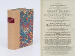
Cary’s New Itinerary: Or an Accurate Delineation of the Great Roads, Both Direct and Cross throughout England and Wales: With Many of the Principal Roads in Scotland. From an Actual Admeasurement by John Cary: Made by Command of his Majesty’s Postmaster General for official purposes: Under the Direction and Inspection of Thomas Hasker Esq., Surveyor and Superintendant of the Mail Coaches. [Including an advertising for Cary’s New Celestial and Terrestrial Globes (with Illustrations of Globes)]. [Subtitle:] This work shows the immediate Route from the Metropolis [London] to all parts of England and Wales: And from Town to Town in every direction, distinguishing also the Cities, Market, Borough and Corporate Towns: And those at which the Assizes are held and gives the time of the Mails, Arrival and Departure from each, Describes the Line of the Navigable Canals and the Course of the Rivers passed over, The Number of Houses and Inhabitants contained in each Town, And those Inns which supply Post Horses and Carriages. Also The Inn’s throughout the Metropolis [London] from which the Mail and Stagecoaches go, their time of departure & the Route they seveerally take. The Noblemen and Gentlemen’s Seats situate near the Roads, A List of the Packet Boats and their time of sailing. Copious Indexes. Maps of the Lot Wight Environs of London, Bath, Brighton, Margate & Cheltenham & a Large Map of England and Wales peculiarly adapted to the Work. – [An Advertisement juxtaposed to the titlepage reads: “This Edition contains the Routes to upwards of Nine Thousand Places, which have never been given in any work of a similar Description; being a complete Directory to every Parish situate out of the Line of the Direct and Cross Roads throughout England and Wales”].

Seventh Edition, with Improvements [complete with all maps as called for]. London, Printed for J. Cary, 1817. Octavo. Pagination: [1], 647 pages plus 7 maps / Detailed pagination see here: [1], Title, Large Folding Map, [121], 6 folded Maps, [526] pages. Modern, recent Hardcover / Very decorative half-leather with marbled-paper-covered boards. Gilt lettering on new sppine-label. New endpapers. Protective Mylar. Only the large folding map with a inor tear (one part of the map deliberately bound separate (geniously folding out to meet th erest of the map). Interior text and maps all in excellent, unusually clean condition !!

EUR 780,-- 

Show details   Add to cart

Page: 1 2 3 4
: