Travel & Expedition – Rare (123 items)

Richard Ligon, A True and Exact History of the Island of Barbadoes [sic].

3. Ligon, Richard.

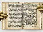
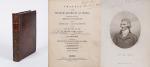
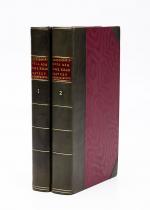
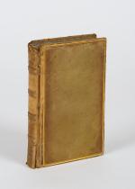
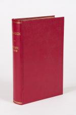
A True and Exact History of the Island of Barbadoes [sic] / [Barbados]. Illustrated with a Map of the Island [missing], as also the Principal Trees and Plants there, set forth in their due Proportions and Shapes, drawn out by their several and respective Scales. Together with the Ingenio that makes the Sugar, with the Plots of the several Houses, Rooms, and other places, that are used in the whole process of Sugar-making; viz. the Grinding-house, Still-house, and Furnaces; All cut in Copper.

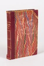
[Second Edition]. London, Printed, and are to be sold by Peter Parker, at his Shop at the Leg and Star over against the Royal Exchange, and Thomas Guy at the corner Shop of Little Lumbard-street and Cornhill, 1673. Small-Folio (19 cm x 29 cm). [II], 122 pages plus an unnumbered Index-page (bound, according to instructions for the bookbinder after page 84), lacking the Fold-out-Map of Barbados but including all six illustrations of Plants, as well as the three diagrams of Houses and Production-Rooms for Sugar. 19th-century Hardcover (half-leather with gilt lettering on spine). Condition of Binding: Very good condition with only minor signs of wear to the binding / Condition of bookblock: Original, front free endpaper was preserved and bound in. Rear endpaper missing. The original endpaper includes two historical ownership-signatures in ink (c.17th or early 18th century) as well as several annotations in ink and pencil. The previous owners seem to have been one Richard Gardner and there is an additional notation verso which reads: “E[x] Libris Richmondi Garnays [or Garneys]”. Some ink-annotations or corrections throughout the book. Signs of old bookworm – damage and very few abrasions due to fire-sparks (few pages effected only). Some plates with professional repairs, some tears. Some professional paper-repairs and re-enforcements to title-page and Content-Page. All the described flaws sound worse than they really appear. All plant-plates in strong impresion. A scarce publication ! From the library of Rev. William Andrew Lamb, Kilcoleman Park, County Cork.

EUR 1.480,-- 

Show details   Add to cart

Payne, Universal Geography formed into a new and entire system

6. Payne, John.

Volume I (of III) of the “Universal Geography” [Including Asia, Africa and Voyages of English Navigators] – formed into a new and entire system; describing Asia, Africa, Europe, and America; with their subdivisions of Empires, Kingdoms, States, and Republics: the extent, boundaries, and remarkable appearances of each country; cities, towns, and curiosities of Nature and Art. Also giving a general account of the fossil and vegetable productions of the Earth, and of every species of animal: The History of Man, in all Climates, Regions and Conditions; Customs, Manners, Laws, Governments and Religions: The State of Arts, Sciences, Commerce, Manufactures and Knowledge. Sketches of the Ancient and Modern History of each Nation and People to which is added, A Short View of Astronomy, as connected with Geography; of the Planetary System to which the Earth belongs; and of the Universe in General. With a set of Maps, drawn from the best Materials, every one of which is very neatly coloured; and a great Variety of Copper-Plates; descriptive of the most remarkable curiosities in the world. With an Appendix in two Parts, containing I. The History of the Voyages round the World, and toward the North and South Pole, which have been made since the year 1764 by English Navigators and II. A Digested and Geographical Account of the most considerable Islands and Countries which have been either discovered or explored during those Voyages, collected from every writer upon those subjects. Part I on the Appendix includes: 1. The First Voyage round the world, performed by Commodore Byron, in the Dolphin, accompanied by the Tamar Sloop / 2. Captain Wallis’s Voyage round the World, being the Second performed in the Dolphin / 3. Continuation of Captain Carteret’s Voyage round the World in the Swallow / 4. Lieutenant Cook’s Voyage round the World, in the Endeavour Bark (First Voyage, Second Voyage and Third Voyage including a stunning engraving of Cook, together with Portraits of inhabitants of the Sandwich Islands, Mangea and Ulietea) / The Appendix Part II contain a Geographical Account and Description of the Islands which have been lately discovered or visited in the South-Sea, proceeding from East to West (Easter Island / The Society Islands / The FRiendly Islands / The New Hebrides, Mallicolo and New Caledonia / New Zealand / New Holland / The Sandwich Islands //

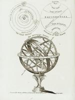
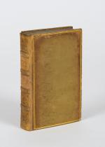
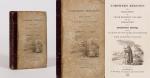
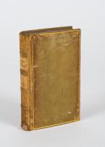
First Edition. Dublin, Printed by Zachariah Jackson (Great Ship-Street), 1792. Quarto. XV, 894 pages with a list of subscribers and eight fantastic full-page copper engravings (NO MAPS in this Volume) / Frontispiece (The beautiful Frontispiece-plate is cleanly detached and now comes with this beautifully restored book framed): Plates included are: 1. Frontispiece: Vegetable Productions constituting important Articles of Commerce: Nutmeg Tree / Bohea Tea Plant or Thea Bohea / The Cotton Shrub / The Nutmeg enclosed in the Mace and Nutmeg Kernel / Flower of Tea / The Cotton Shrub – This plate is hand-coloured ! / 2. The Artificial Sphere (Globe) with the Solar System and Divisions of the Earth / 3. [Kamtschatka] – A Kamtscadale Travelling in Winter / An inside View of a Winter-Hut of the Kamtschadales / 4. Animals in the Southern Parts of Africa (The Rhinoceros Bicornis / The Buffalo / The Hippopotamus, called by the Hottentots the Seacow) / 5. The Country contiguous to the Cape of Good Hope – Hottentots and their Huts &c. &c. / 6. Portrait – Collection on one plate of Captain James Cook – Killed on the Island of Owhyhee – 14th of February 1779 (From a painting by Dance in the possession of Sir Joshua Banks) – other portraits on that page include A woman and a man of the Sandwich Islands / A Man of the Magea – Omai or Omia , a Native of Ulietea / 7. Portrait – Collection on one plate of: Poulaho – King of the Friendly Islands / A Man of van Diemen’s Land / A Woman from van Diemen’s Land / A Woman of Prince William’s Sound / A Man of Prince William’s Sound / 8. Portrait-Collection on one plate of: A woman of Otaheite Island (Tahiti) bringing a present / A Woman of Otaheite (Tahiti) dancing / An Otahetian (Tahiti) in the Dress of his Country / A New Zealand Warrior completely armed (Maori) // Hardcover / Professionally restored original 18th-century leather with original gilt ornament and new labels on spine. Binding rubbed but after the masterful restoration in very good condition. Some of the plates slightly loose but not detached. Very few minor wormhole damage to the last 250 pages. Rare with the plates ! From the library of Richard Meade, Ballymartle, with his original bookplate to the pastedown. One of the early accounts of english Navigation and Discovery.


EUR 780,-- 

Show details   Add to cart

John Payne - Universal Geography - Formed Into A New And Entire System; Describing Asia, Africa, Europe And America

7. Payne, John / Zachariah Jackson [Dublin Printer].

Universal Geography – Formed Into A New And Entire System; Describing Asia, Africa, Europe And America ; With Their Subdivision Of Empires, Kingdoms, States And Republics : The Extend, Boundaries, and remarkable Appearances of each Country ; Cities, Towns, and Curiosities of Nature and Art. Also giving A general Account of the Fossil and Vegetable Production of the Earth, and of every Species of Animal : The History of Man, In all Climates, Regions, And Conditions ; Customs, Manners, Laws, Governments, And Religions : The State of Arts, Sciences, Commerce, Manufactures, And Knowledge : Sketches of the Ancient and Modern History of each Nation and People. To which is added, A Short View of Astronomy, As Connected With Geography ; Of The Planetary System to which the Earth belongs ; And of the Universe in General. With a Set of Maps, drawn from the best Materials, every one of which is very neatly coloured ; And a great Variety of Copper-Plates ; Descriptive of the most Remarkable Curiosities in the World. [This Edition with all three Volumes but only with 14 Maps, 3 Colour-Engravings and 5 Black-and-White Engravings (see detailed listing of these Maps and Engravings at the end of this Bibliography)].

Two Volumes in Three Parts (bound in Two Volumes). Dublin, Printed by Zachariah Jackson, 1793 – 1794 Quarto (23 cm wide x 28 cm high). Pagination: Volume I: Hand-coloured Frontispiece, VI [Subscribers], XIII, 894 pages [page 555 misprinted as 454] [Stating “The End” at the end of the Volume] with Four Maps and Three engravings (including Frontispiece) / Volume II: Hand-coloured Frontispiece, 792 pages [Stating “End Of The Second Volume” at the end of Volume II] with Ten Maps and One Engraving (Frontispiece) / [Volume III] is Bound to the rear of Volume II and is falsely ending with “End of The Second Volume” even though it is the “Continuation of Book IV” and in all other listings of this book internationally is accepted to be Volume III. Pagination of [Volume III]: Hand-coloured Frontispiece, [No separate titlepage], 416 pages, XXXIII pages of an Index, 1 page “Directions to the Binder”, 10 pages “A Chronological Table of Remarkable Events, Discoveries and Inventions”, with Four Engravings (including Frontispiece). Hardcover / Modern Binding in the style of the 18th century. Full leather with gilt lettering on spine. Very minor signs of neglectable, minimal wormhole-damage. Obviously this work was robbed of many of the maps but those which remain have the original hand-colouring in stunning condition (see description). Overall near Fine condiiton of this extremely rare set, with only minor signs of wear. Page 199/200 of Volume II with longer cut (Text not effected). All the engravings and maps without defects.

EUR 2.800,-- 

Show details   Add to cart

Barrow, Voyage dans la partie meridionale de l'Afrique

10. Barrow, John.

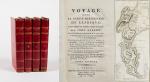
Voyage dans la partie meridionale de l’Afrique; fait dans les années 1797 et 1798; par John Barrow, Ex-Secretaire de Lord Macartney…Contenant des observations sur la géologie, la géographie, l’histoire naturelle de ce continent, et une esquisse du caractère physique et moral des diverses races d’habitans qui environnent l’Etablissement du Cap de Bonne-Espérance. / Accompagné: Nouveau Voyage dans la partie méridionale de l’Afrique; Où l’on examine quelle est l’importance du Cap de Bonne-Espérance pour les différentes puissances de l’Europe, considéré comme station militaire et navale; comme boulevart du commerce et de la domination des Anglais dans l’Inde; comme centre des établissemens pour la pêche de la baleine dans les mers Australes; comme acquisition territoriale, et comme entrepôt commercial en tems de paix. Accompagné d’une description statistique de la colonie rédigée sur les documens les plus hautentiques, enrichi de huit belles cartes, contenat celle de la Côte d’Afrique depuis la baie de la Table jusqu’a la baie de Saldanha, des cartes de la baie de Pletenberg, d’Algola, de Mossel et de False bay; du plan militaire de la péninsule du Cap, et de ceux de la baie de la Table et du Knisna. (2 Volumes).

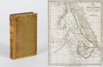
First French Edition. 4 Volumes [complete set of two works with 2 Volumes each]. Paris, Dentu, 1801-1806. 35.5 cm x 55.8 cm. Collation: complete. Pagination: Volume I: XVI, 403, (1) pages / Volume II: 326, (2) pages including Errata-leaf / Volume III: X, 310 pages / Volume IV: 312 pages. Original contemporary red calf with gilt lettering and ornament to lacquer-polished-spine. The Volumes are numbered consecutively, even though these are two separate works. Excellent condition of the binding and interior of this important publication with very minor signs of foxing only ! All the maps in wonderful condition ! First french edition of “Travels into the Interior of Southern Africa” (Barrow’s journey with Lord Macartney in 1797 to the Cape of Good Hope) plus two further Volumes which describe the second journey in 1801 / 1802 to Saldanha Bay [Saldanhabaai] with an early image of Robben Island. The survey of the Dutch colonies was not only a seminal work on South Africa but the beautifully engraved, large folding map of South Africa was a turning point of african cartography and geographical illustration.

EUR 1.200,-- 

Show details   Add to cart

Le Forche Caudine - Illustrate con due Appendici. [Compreso "Prospetto Della Valle Caudina Dalla Parte Della Campania"

13. [Daniele, Francesco / Johann Josef von Wilczek / Thomasius, Christian].

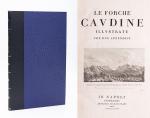
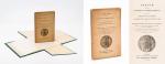
Le Forche Caudine – Illustrate con due Appendici. [Compreso “Prospetto Della Valle Caudina Dalla Parte Della Campania”]. Second edition, augmented and, according to Brunet, preferable to the original first edition, which was printed in Caserta in 1778.

Seconda Edizione. Napoli, Appresso Angelo Trani, 1811. Folio (44.5 cm x29 cm). XIII, (3), 102 pages plus (6) pages advertising and Index (Indice). With 22 (twentytwo) illustrations overall. Including a large fold-out-plan (97 x 43 cm) of the Valle Caudine, several Vignettes, Allegorical/Historical Illustrations and four beautiful landscape engravings of the Valle Caudine by Alessandro d’Anna / XIII, (3), 102 pagine più (6) pagine pubblicitarie e Index (Indice). Con 22 (ventidue) illustrazioni in totale. Tra cui una grande illustrazione (97 x 43 cm) della Valle Caudine, diverse vignette, illustrazioni allegoriche / storiche e quattro bellissime incisioni paesaggistiche della Valle Caudine di Alessandro d’Anna. Hardcover / Fantastic modern, Nigerian goatskin with gilt lettering on spine and fine quality late 19th-century cloth over boards. New endpapers and all bound in style by english master-binders. Excellent condition of the binding. The stunning and most wonderful interior with only very occasional signs of an old dampstain to the outer margins and the beautiful, large fold-out-plan with some mild browning to one part of the center-fold. A typographical masterpiece of italian printmaking.

EUR 980,-- 

Show details   Add to cart

Cary's New Itinerary: Or an Accurate Delineation of the Great Roads, Both Direct and Cross throughout England and Wales: With Many of the Principal Roads in Scotland.

14. Cary, John.

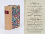
Cary’s New Itinerary: Or an Accurate Delineation of the Great Roads, Both Direct and Cross throughout England and Wales: With Many of the Principal Roads in Scotland. From an Actual Admeasurement by John Cary: Made by Command of his Majesty’s Postmaster General for official purposes: Under the Direction and Inspection of Thomas Hasker Esq., Surveyor and Superintendant of the Mail Coaches. [Including an advertising for Cary’s New Celestial and Terrestrial Globes (with Illustrations of Globes)]. [Subtitle:] This work shows the immediate Route from the Metropolis [London] to all parts of England and Wales: And from Town to Town in every direction, distinguishing also the Cities, Market, Borough and Corporate Towns: And those at which the Assizes are held and gives the time of the Mails, Arrival and Departure from each, Describes the Line of the Navigable Canals and the Course of the Rivers passed over, The Number of Houses and Inhabitants contained in each Town, And those Inns which supply Post Horses and Carriages. Also The Inn’s throughout the Metropolis [London] from which the Mail and Stagecoaches go, their time of departure & the Route they seveerally take. The Noblemen and Gentlemen’s Seats situate near the Roads, A List of the Packet Boats and their time of sailing. Copious Indexes. Maps of the Lot Wight Environs of London, Bath, Brighton, Margate & Cheltenham & a Large Map of England and Wales peculiarly adapted to the Work. – [An Advertisement juxtaposed to the titlepage reads: “This Edition contains the Routes to upwards of Nine Thousand Places, which have never been given in any work of a similar Description; being a complete Directory to every Parish situate out of the Line of the Direct and Cross Roads throughout England and Wales”].

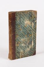
Seventh Edition, with Improvements [complete with all maps as called for]. London, Printed for J. Cary, 1817. Octavo. Pagination: [1], 647 pages plus 7 maps / Detailed pagination see here: [1], Title, Large Folding Map, [121], 6 folded Maps, [526] pages. Modern, recent Hardcover / Very decorative half-leather with marbled-paper-covered boards. Gilt lettering on new sppine-label. New endpapers. Protective Mylar. Only the large folding map with a inor tear (one part of the map deliberately bound separate (geniously folding out to meet th erest of the map). Interior text and maps all in excellent, unusually clean condition !!

EUR 480,-- 

Show details   Add to cart

Stuart de Rothesay, Charles Stuart, Baron (1779-1845) / Hay, Robert William (1786–1861) /

23. Stuart de Rothesay, Charles Stuart, Baron (1779-1845) / Hay, Robert William (1786-1861) / Jean-Baptiste Rousseau (1780 – 1831) [Baron de Rousseau – French Orientalist and French Consul at Tripoli] / Alexander Gordon Laing (1794 – 1826) [Scottish explorer and the first European to reach Timbuktu] / Hanmer Warrington / Foreign Secretary for Prime Minister Wellington, George Hamilton-Gordon, 4th Earl of Aberdeen [Lord Aberdeen].

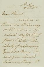
Original, unpublished and meaningful letter by British official and Permanent Under-Secretary of State for the Colonies, Sir Robert William Hay, addressed with urgency to former secret agent in Spain and Portugal, Sir Charles Stuart de Rothesay, Scottish nobleman, and English ambassador to France (1815-1830); alerting Ambassador Charles Stuart of Hay’s arrival in Paris and his wish to ask him if he has “anything to communicate to me in regard to that Royal [Baron] Rousseau, The Barbary Consul”. Hay is in this letter preparing Stuart in order to investigate the situation around the death of explorer Alexander Gordon Laing in Africa. Under-Secretary for the Colonies, Sir R[obert] W.Hay, who had been informed about the situation around Laing’s missing Journals per private letter from the British Consul in Tripoli, Hanmer Warrington, announces his arrival in Paris to protest to the French government and advices ambassador Stuart:″I conclude that he [Baron Jean-Baptiste Rousseau] is by this time out of guarantiae, but I hope that by ensuing at Paris he will only get out of the frying Pan with the fire”. Hay continues: “I hope you will go with me (in case it be necessary) to the Minister, whoever he may be, in [?] Departement this ….were incredibly false for it. The French Govt. are really disposed & prosecute the Enquiry bon a fide. I think that same may acq…[….]…..on the other hand, if the French Govt. do not enter into y. enquiry with a good spirit, it will be in Rousseau’s …..to baffle me with the utmost facility in all our attempts to get at the truth. I spoke to Lord Aberdeen [George Hamilton-Gordon, 4th Earl of Aberdeen, Foreign Secretary for Prime Minister Wellington] on the day I left London, & he gave me full permission to conduct measures with you for the …of this affair. Yours very truly R.W.Hay”.

[London], [1829]. 5 octavo – pages on 2 sheets, folded. Excellent condition. Signed by Hay and dated probably “Monday, 19 Oct. [1829]”.

EUR 3.500,-- 

Show details   Add to cart

Johannes Justus Rein, Japan nach Reisen und Studien im Auftrage der Königlich Preussischen Regierung dargestellt

50. Rein, J.J. [Johannes Justus] / [Provenienz / Provenance: Max von Baden / Bibliothek Schloss Salem].

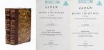
Japan nach Reisen und Studien im Auftrage der Königlich Preussischen Regierung dargestellt von J.J. Rein [Johannes Justus Rein], Professor der Geographie in Marburg [an der Lahn]. Erster Band: Natur und Volk des Mikadoreiches. Mit 5 Lichtdruckbildern [Photographien], 12 Holzschnitten, 3 Lithographischen Tafeln und 2 Karten. / Zweiter Band: Land- und Forstwirthschaft, Industrie und Handel. Mit zum Theil farbigen Tafeln, 20 Holzschnitten im Text und 3 Kaertchen.

Erste Ausgabe [First Edition]. Two Volumes. Leipzig, Verlag von Wilhelm Engelmann, 1881 – 1886. Gross-Oktav. Band I: XII, [1], 630 Seiten mit allen Abbildungen und insbesondere der Original-Photographie von Nagasaki aber ohne die “Orographish-hydrographische Karte [Japans]” am Schluss des Bandes. / Band II: XII, 678 Seiten mit den drei Falt-Karten von Japan am Schluss des Bandes . Hardcover / Original 19th century half-leather with gilt lettering and ornament to spine. / Originale Verlags-Leinenbaende. Ehemalige Exemplare der “Bibliothek Salem” und ehemaliges “Eigenthum des Prinzen Wilhelm”, mit zwei dezenten Bibliotheksschildchen der Bibliothek Salem im Innendeckel und dem Stempel des Prinzen Max von Baden [″MB” mit Krone] auf den Titelseiten. Very good condition with only minor signs of wear and only the two folded Maps missing / Sehr guter Zustand des seltenen Werks und mit nur wenigen Stockfleckchen, wie ueblich auf den Rueckseiten des Photo-papiers und Abklatsch auf den Seiten verso. Aus dem Vorwort: “Saemtliche Illustrationen dieses Buchs sind Originale – Bonn, im September 1886 – Der Verfasser”.

EUR 1.000,-- 

Show details   Add to cart

Wohlgemuth - Die österreichische Polarstation Jan Mayen - Ausgerüstet durch seine Excellenz Graf Hanns Wilczek

52. First International Polar Year (1882-1883) – Wohlgemuth, Emil von.

Die österreichische Polarstation Jan Mayen – Ausgerüstet durch seine Excellenz Graf Hanns Wilczek. Geleitet von K.K. Corvetten-Capitän Emil Edlen von Wohlgemuth. Beobachtungs-Ergebnisse Herausgegeben von der Kaiserlichen Akademie der Wissenschaften. [Inklusive Ephemera] Band I – III (Komplett in vier Bänden mit dem eingebundenen Vorbericht zur Publikation welcher manchmal auch separat gebunden wurde: I. Band / II.Band 1. und 2. Abtheilung / III.Band).

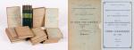
Erste und einzige Ausgabe. Wien, K. und K. Hof-und Staatsdruckerei in Commission bei Karl Gerold’s Sohn, 1886. Quarto (24.5 cm x 31.5 cm). Collation: Band I: 118 Seiten mit vier Falttafeln (Beobachtungsstation im Wilczeck-Thale / Sternwarte / Helligkeitsgrad der Polarnacht / Kreuzung / [Route] des S.M.Dampfer “Pola” laengs der Eiskante bei der Insel Jan Mayen (farbig) / ), 26, 50, 202, 76, 16,18 Seiten / Band II,1: 232 Seiten / Band II,2: 175 Seiten / Band III: X, 132, 24, 20 Seiten [The set includes 85 text-illustrations, 61 plates (some folded) and four maps (original lithographs of which one is in colour)]. Original publisher’s Hardcover-Boards, now in protective collector’s Mylar. [Inclusive grossformatiger Werbung zu den Druckschriften der kaiserlichen Akademie der Wissenschaften in Wien vom Jahre 1885] The boards of the thicker Volume One, as often, cleanly detached. All other Volumes in very good condition with only minor signs of external wear. Minor signs of foxing only. Unopened, unread version of this rare publication !

EUR 280,-- 

Show details   Add to cart

Vintage Photo Album of "Cruise No. 2 to 'The Norwegian Fjords'  in June 1913 on the R.M.S.P. Arcadian"

76. [Davey & Hackney] / R.M.S.P. Arcadian.

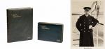
Two Vintage Photo Albums / Portfolios of “Cruise No. 2 to ‘The Norwegian Fjords’ in June 1913 on the R.M.S.P. Arcadian”. Fantastic combination of two photo logbooks of one of the last trips for this beautiful passenger liner before she served with the Royal Navy and was sunk by a U-boat, the German submarine SM UC-74, in 1917. These luxury photographic records were created by Davey & Hackney, Alexandra Palace, London. I. Album One: On 24 pages (12 stiff cardboards with photographs on both sides) with 44 vintage high-quality photographs, the cruise was documented by not only focusing on the natural beauty of Norway but also by documenting the captain (Captain Custance) and crew of the Arcadian, one large photograph shows the captain and all his officers. Some striking images of the ship itself are showing this liner in all its glory. The ship was built in 1899 by Vickers, Sons & Maxim Ltd. for the Pacific Steam Navigation Company as SS Ortona. This unusually luxury Album also documents in an appendix with a small map of Norway the Itinerary of the cruise. All mileage covered and dates the cruise would reach the scheduled destinations in Norway are mentioned (Grimsby, Wed. 18 June / Leith, 235 miles, Thursday 19 June / Aalesund 493 Miles Sat. 21 June / and so on and so on). The cruise would stop at Molde (Moldefjord), Aandalsnaes (Romsdalfjord) / Oie (Jorundfjord) / Hellesylt (Sunelvsfjord) / Merok (Geirangerfjord) / Olden (Invikfjord) / Loen (Nordfjord) / Mundal (Fjaerlandsfjord) / Balholmen (Sognefjord) / Gudvangen (Naerofjord) / Sundal (Maurangerfjord) / Norheimsund (Hardangerfjord) / Bergen / back to Grimsby on July 2nd, 1913 with a total of 2127 miles covered in 14 days. The photographs of the “Arcadian” are differing in size from a beautiful full ship image in 17.5 cm x 28.7 cm to detailed photographs of the deck in 11.5 cm x 16.4 cm; a nice photo of the “Arcadian’s” Launch (with small steem funnel), interior of the ship (Dining Salon), a photograph of a visiting steam Tender (″The Grimsby Tender”), Deck tennis – scenes, Playing Bull Board, Letting go the Anchor with two crew members. / II. Album Two: This additional, smaller Album, on an additional 24 pages (12 stiff cardboards with photographs on both sides) shows a further 24 vintage, high-quality photographs. These additional photographs show The Hardangerfjord / Folgefond Glacier / An Arcade in the Dining Salon / Photograph of Captain Custance / Sundal / The Landing Stage in Norheimsund / Fysse / The Landing Stage in Trondheim with many locals waiting / The Landing Stage in Forhatten / Digermulen / The Raftsund Fjord / Lyngenfjord / A boat full of Lapps in traditional clothing, showing and offering livestock and handmade dolls for tourists on board the “Arcadian” / Hammerfest / North Cape & Midnight Sun from the “Arcadian” / Tromso, with a large gathering of schoolchildren / A Boxing Match on the “Arcadian”, showing two pugilists fighting it out to the bemusement of bystanders / Pillow Fighting as Pastime for Tourists on the “Arcadian” / Molde from the Hill, showing the “Arcadian” in the Fjord / Aandalsnes / View from Aandalsnes / Bergen and Bergen Harbour with a few nice local Yachts in the foreground // The quality of the photography in both of these Album is excellent.

London / Norway, Davey & Hackney Photo (Alexandra Palace), 1913. Sizes: Vol. I: Folio (25.5 cm x 32 cm) / Vol.II: Oblong Octavo (25 cm x 17 cm). Volume I: 12 cardboard sheets with 24 pages (of which 24 are with photographs) with foldable appendix / Volume II: 12 cardboard sheets with 24 pages (of which 24 are with photographs) Hardcover / Green soft morocco with gilt lettering on cover and ornament around the pastedowns of the inner boards. Some minor rubbing to the binding but overall in excellent, near Fine condition with only minor signs of external wear.

EUR 1.280,-- 

Show details   Add to cart

Sikes, Personal Papers and Archival Material Related to the Life and Career of S

100. Sikes, Sylvia / [Natural History of the African Elephant]

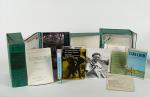
Personal Papers / Archive of Material Related to the Life and Career of Zoologist Sylvia Sikes, the Foremost African Elephant Specialist of her time. All materials from her personal collection / working copies and manuscript material. Including her extensive, two-volume-thesis: “Cardiovascular Disease in Freeliving Wild Animals with particular Reference to the African Elephant (Loxodonta africana)”. A collection of professional and academic papers, copies of Sikes’ monographs, zoological manuscripts and a plethora of photographs and personal newsletters, letters, pamphlets and manuscripts spanning seven decades of Sikes’ personal and professional life in Africa and the UK. The collection is composed of 92 specific pieces (some of which are comprised of one or more items). A detailed bibliography of the collection has been outlined in a Word Document (please request). The collection also includes personal copies of three monographs Sylvia Sikes has published, an original copy of her two-volume doctoral thesis, 37 academic articles and 5 unpublished draft manuscripts. There are also 7 booklets and a book by a third author among the collection. The collection is rounded off by a large number of vintage colour and monochrome photographs, letters, single-sheet newsletters, newspaper and magazine cuttings.

Africa and the UK, Various, 1937 – 2012. 21 cm x 26 cm – 24.5 cm x 31 cm. Circa 2,500+ pages. Numerous monochrome and colour photographs throughout the collection. Includes Hardcover book with dustjacket, softcover book, reprints of academic journal articles in paper wrappers and a variety of loose material in cellophane files. The archive, running from 1937 to 2012, is contained in two green (24.5 cm x 31 cm x 10.5 cm) boxes, four additional folders (32 cm x 24 cm) and two hardcover volumes (21.5 cm x 26cm). Very good condition.

EUR 2.800,-- 

Show details   Add to cart

Page: 1 2
: