Complete Catalog (8231 items)

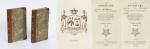
Goldschmid - Entwicklung und Bibliographie der Pathologisch-Anatomischen Abbildung.

6626. Medical Illustration in Dermatology – Goldschmid, Edgar / [Georges Sarton].

Entwicklung und Bibliographie der Pathologisch-Anatomischen Abbildung. [Mit Autograph: TLS – Mit einem zweiseitigen Brief an Dr.Krieg in Wien, der von Goldschmid den Entwurf eines Nekrologs zu Georges Sarton erhofft hatte und diesen in Form dieses Briefs bekommt (von Goldschmid voll signiert) / Typed Letter (two pages, signed) by Edgar Goldschmid; the letter being a draft of an obituary on Georges Sarton (in german)].

Leipzig, Karl W. Hiersemann, 1925. Quarto (25 cm x 31 cm). 301 Seiten text plus 44 fantastisch-farbige Tafeln in Lichtdruck mit den original-bedruckten Schutzfolien / 301 pages plus 44 fantastic colour-plates with their original tissue-guards. Originales Ganzleinen des Hiersemann-Verlags / Original publisher’s cloth. Sehr guter Zustand mit nur geringen Gebrauchsspuren. Offensichtlich Handexemplar von Dr.Krieg (Wien) mit Anmerkungen in Bleistift auf dem Vorsatz (″Bei G[oldschmid] zufragen”) und gelegentlich im Text mit Korrekturen und Anmerkungen neben den von Goldschmid verfassten Bibliographien, moeglicherweise fuer eine nie erschienene zweite Auflage. / Very good condition with only minor signs of external wear. Extremely important landmark-publication in medicine, focusing on the importance of colour-illustration in dermatological diagnostics. This being the personal copy of Dr.Krieg (Vienna), with some annotations in pencil, reflecting questions and additional suggestions to some of the bibliographical entries, possibly for a second edition of the work.

EUR 580,-- 

Show details   Add to cart

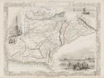
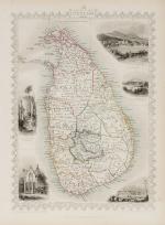
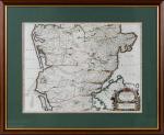
Tallis, Ceylon (British Ceylon) - with Vignettes and illustrations

6663. Tallis, John / Rapkin, John. (1817 – 1876)

Ceylon (British Ceylon) – with Vignettes and illustrations of the Lake of Kandy, Adam’s Peak from the Lake of Colombo, a beautiful scenery of Colombo, Temple of Buddha , Kalany, Ruins of A Dagora at Toophamaraya. The map is divided in the old regions of British Ceylon: The Eastern Provinces (Kattoe, Colompattoo, Tamblegam, Kottiar, Tambankadewa, Koorle, Eraquer, Mamoene, Karrewitte, Chiam Pature, Erwiel, Nadene, Akkrepattoo, Ghiam Pature, Veddag, Ratte, Nadekadoe, Panowa / The Western Provinces (Anewoelandan, Rajawania, Seram, Sevien Korles, Rajawanny) / Northern Provincec (Wademo Ratchi, Welligammo, Jafnapatam, Leyden, Ponoryn, Manaar, Mantotte, Pomparipo, Moessellie, Neurawanny, Meel-Pattoo, Poedoe, Koe-Dirpo, Moeliawalle, Karie-Kattoe-Molle, Tinne-Mar, Re-waddie, Patchilapelle, Negammo / Central Provinces – Matelle, Doombera, Toompane, Erris Pattoo, Yattenoowere, Dollos Bage, Lower Ouna, Hewahetta, Wellassee / Western Provinces – Hapeti Gam, Pasdum, Caltura, Three Korles, Hewagam Korle, Hina Korle, Saffragam etc. / South Provinces – Wallawitte, Gangebodde, Gangedode, Mahagam, Pattoo, Morva, Talpe, Belligam, Wellerode etc.

Original steel engraving / Vintage map. Drawn and engraved by John Rapkin. Partly hand-coloured. London & New York, J & F. Tallis, 1851. Beautifully Framed. Size of frame with map: 40.5 cm x 50.5 cm. Size of the actual map: 27 cm x 37 cm. Excellent condition.


EUR 225,-- 

Show details   Add to cart

Page: 1 2 ... 64 65 66 67 68 69 70 ... 82 83
: